Charlotte-Mecklenburg Historic Landmarks Commission

Author: Mary Dominick

This report was written on September 1, 1976

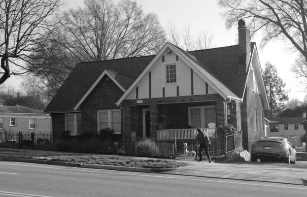
1. Name and location of the property: The property known as the Sugaw Creek School House is located on the grounds of the Sugaw Creek Presbyterian Church at 101 Sugar Creek Rd. W., Charlotte, N.C. 28213.

2. Name, addresses, and telephone numbers of the present owners and occupants of the property: The present owner and occupant of the property:
Sugaw Creek Presbyterian Church
101 Sugar Creek Rd., W.
Charlotte, N.C. 28213

Telephone: 596-4487

3. Representative photographs of the property: Representative photographs of the property are included in this report.

4. A map depicting the location of the property: This report contains a map which depicts the location of the property.

5. Current Deed Book Reference to the property: The most recent reference to this property is found in Mecklenburg County Deed Book 1 (New) at Page 174. The Parcel Number of the property is 08701115.

6. A brief historical sketch of the property:

The Sugaw Creek School House was built in 1837 by Mr. Gillett, a Frenchman, who was assisted by several young men of the congregation. The structure, erected during the pastorate of Rev. John Madison McKnitt Caldwell, replaced a log school house which had become too small to accommodate an expanding enrollment. In this building many boys acquired the academic preparation necessary for entry into Davidson College, the newly-established Presbyterian college in the northern section of Mecklenburg County. The school maintained high standards. The first full-time teacher was Robert I. McDowell, an honor graduate of Hampton-Sydney College. The school continued to operate until the early years of this century, when the public schools began to assume the responsibilities associated with educating the youth of the Sugaw Creek community. In 1960 the women of Sugar Creek Presbyterian Church converted the building into the Sugaw Creek Historical Museum. It is still used for that purpose today.

7. A brief architectural description of the Property: This report contains an architectural description prepared by Jack O. Boyte, A.I.A.

8. Documentation of why and in what ways the property meets the criteria set forth in NCGS 160A-399.4:


a. Historical and cultural significance: The historical and cultural significance of the property known as the Sugaw Creek School House rests upon its association with the early educational efforts of one of the oldest Presbyterian congregations in Mecklenburg County.

b. Suitability for reservation and restoration: The Sugaw Creek School House retains much of its exterior integrity and is therefore suitable for preservation and restoration.

c. Educational value: The Sugaw Creek School House has educational value as the oldest surviving instructional facility in Mecklenburg County. It now houses materials of educational value.

d. Cost of acquisition, restoration, and maintenance or repair: The Commission has no intention of purchasing this property, nor is it aware of any intention or the owner to sell. The Commission assumes that all costs associated with renovating and maintaining the property will be paid by the owner or subsequent owner of the property.

e. Possibilities for adaptive or alternative use of the property: The Commission concurs with the present owner’s adaptive use of the structure as a museum.

f. Appraised value: The current tax appraisal value of the structure is $3550. The Commission is aware that designation of the property would allow the owner to apply for a special classification for purposes of Ad Valorem Taxation.

g. The administrative and financial responsibility of any person or organization willing to underwrite all or a portion of such costs: As indicated earlier,the Commission has no intention of purchasing this property. Furthermore, the Commission area that all costs associated with the property will be paid by whatever party now owns or will subsequently own the property. Clearly, the present owner has demonstrated the capacity to pay the expenses associated with maintaining the structure.

9. Documentation of why and in what ways the property meets the criteria established for inclusion on the National Resister of Historic Places: The Commission judges that the property known as the Sugaw Creek School House does meet the criteria of the National Register of Historic Places. Basic to the Commission’s judgment is its knowledge of the fact that the National Register of Historic Places functions to identify properties of local and State historic significance. The Commission believes that the property known as the Sugaw Creek School House is of local historic significance and thereby meets the criteria of the National Registor of Historic Places.

10. Documentation of why and in what ways the property is of historical importance: As noted earlier, the property known as the Sugaw Creek School House is of local historical significance because of its association with the early educational efforts of one of the oldest Presbyterian congregations in Mecklenburg County. Moreover, it is the oldest surviving instructional facility in Mecklenburg County.


Bibliography

An Inventory Of Older Buildings in Mecklenburg County and Charlotte for the Historic Properties Commission .

Charlotte Observer (July 16, 1933).

Charlotte Observer (April 29, 1960).

Neill Roderick McGeachy, A History of the Sugaw Creek Presbyterian Church.

Records of the Mecklenburg County Register of Deeds Office.

Records of the Mecklenburg County Tax Office.

Date of Preparation of this report: September 1, 1976

Prepared by: Dr. Dan L. Morrill, Director
Charlotte-Mecklenburg Historic Landmarks Commission
139 Middleton Dr.
Charlotte, N.C. 28207

Telephone: 332-2726:


Architectural Description
 

School House

The history of European emigration into the Piedmont Carolinas, and more particularly Mecklenburg County, is the story of the first Presbyterian Scotch-Irish pioneers. These staunch farmers were united not only by the challenge of this wilderness, but by their fiercely independent spirit and strong religious beliefs. They worshipped together from the first, and from their churches the county inherited a rich cultural and architectural heritage.

The first church in the county was Sugaw Creek Presbyterian, established in 1755 on land assigned by the crown to colonial land agent John Selwyn. Since the Presbyterian Church traditionally laid great emphasis on education, one wonders why the early church waited until 1806 to establish a classical school at Sugaw Creek. Be that as it may, the church fathers did start teaching at the church in that year. This Sugaw Creek school was the only one available for children of the settlers, so it was soon necessary to build a separate log school house on the church grounds. After a scant few years the growing enrollment and increasing affluence of local planters gave rise to plans for a fine new brick school house. So in the early 1820s the church hired a skilled French builder named Gillet to design and build this new school. And today, after a century and a half, the old school house rests on its original site on the front lawn of the church, viewed by hundreds of passing motorists each day.

A large class in 1820 would have been fifteen students, so the structure is small by today’s standards, measuring about 20 feet by 30 feet on the ground. A simple rectangle with plain gabled ends, the building exhibits no ornamentation or elaboration. Builder Gillet created a functional school house done strictly in the understated manner of the Federal style.

From a low field stone foundation, the solid brick exterior walls rise in typical Flemish bond coursing to the roof eaves set out with two courses of corbeled headers. At the corners are smaller brick called queen closures, also typical of the period. Above the eaves a small molded strip supports the end of slightly cantilevered wood shingles. The present roof surface is sawn cedar shingles, though originally the roof was likely hand riven cypress shingles.

The long axis of the building runs generally north-south and at the north gabled end a large fireplace is centered in a solid brick wall built integrally with a small chimney. On the long west wall is at entrance door centered between single six light over six light windows. Neither the door nor windows are original. However, one could assume that these units were typical of the period and could be accurately restored.

On the opposite long east wall are two additional windows similar to those on the west. In the center of this wall is evidence that there was an additional exterior entrance door on the east side at one time. This could possibly indicate that the interior of the school house, which is now one large room, was originally divided by an off-set partition into several chambers.

The south gabled end of the building exhibits evidence of severe past damage and has been essentially replaced with more recent brick. It is said that the building suffered heavy damage during the earthquake which struck the county in the 1880s. This possibly explains the damage in the south wall and the several other wall cracks in the exterior. There are cast iron plates high in the corners of outside walls connected to earthquake rods, which were probably added at that time.

The interior of the building has been extensively remodeled and shows little of the original materials — other than some wide pine floor boards. There are no exposed framing members in the floor, ceiling or roof at present. If these elements in the building retain original characteristics, the historic nature of the structure would be better understood and appreciated if certain portions of this work and material were put on display.

This small Federal structure is no doubt unique in the county and possibly in the state. While there is much in the school house now which does not accurately reflect the original building, the essential characteristic can be determined from that which has been preserved. And with sensitive restoration an historic architectural treasure would be created.

SUGAW CREEK PRESBYTERIAN CHURCH CEMETERY #1
West Craighead Road
Tax parcel #08511506

There are three close but separated graveyards associated with this church, their locations reflecting successive changes in the church building’s site over the centuries. This cemetery is the first known cemetery for Sugaw Creek Presbyterian, established in 1755. Sugaw Creek is the oldest church in Mecklenburg County, the mother church for the seven original Presbyterian congregations in Mecklenburg County established before the Revolutionary War.

Burials on the church grounds date from the time of the Reverend Alexander Craighead, Sugaw Creek’s first settled pastor and the fiery minister who preached freedom from England to the settlers. Indeed, the first known grave at cemetery #1 is that of Reverend Alexander Craighead who died in 1766. The grave, according to tradition, was marked by two sassafras trees that grew from the poles used to carry his coffin from the church to the graveyard and were then thrust into the ground to mark the spot. The poles took root and grew to be large trees. A storm about one hundred and twenty-five years later uprooted one and the other was broken off about twenty feet above the ground. One piece of the wood was used to make the top of the pulpit used in the church until recently. It is now in the Sugaw Creek Museum. Today there is a granite marker over the grave and it is enclosed in a small iron fence.

Jean Wallis, mother of Reverend James Wallis of Providence Presbyterian Church, is buried here (1792-1819). David Robinson, father of Reverend John Robinson of Poplar Tent Presbyterian Church, is buried here (1724-1808).

The tombstone listing by Ralph Kiser made in 1937 has been compared with the record of Mrs. J. S. Welborn, “North Carolina Tombstone Records” made in 1935 and W. Michael Biggers’ “Cemetery Inscriptions, 1750-1850” made in approximately 1966. This listing is now used as the only existing list of tombstones in cemetery #1. It shows forty-eight tombstones dated from 1766 to 1836, thirty-four of which are from the 18th century.

A stone wall encloses the cemetery and it has become necessary in recent times to install a chain link fence around the cemetery for protection of the property.


SUGAW CREEK PRESBYTERIAN CHURCH CEMETERY #2
4130 North Tryon Street
Tax parcel #09108109

Sometime after the death of Alexander Craighead in 1766, the Sugar Creek Church building was changed from near the first graveyard to a site nearer the creek and east of the Salisbury Road (North Tryon Street). This building stood north of what is now designated as cemetery #2. J. B. Alexander in his History of Mecklenburg County, from 1740 to 1900 says, “The building which occupied a part of the graveyard,… was the second house built by the congregation.”

Two signers of the Mecklenburg Declaration of Independence, Hezekiah Alexander (1728-1801) and Abraham Alexander (1717-1786) are buried in cemetery #2. The Reverend Samuel C. Caldwell (1768-1826) is also buried here.

With a substantial number of burials from the era of the American Revolution, both cemetery #1 and #2 preserve the funerary record of many prominent Scots-lrish settlers.

The tombstone listing by Ralph Kiser made in 1937 has been compared with the record of Mrs. J. S. Welborn, “North Carolina Tombstone Records” made in 1935 and W. Michael Biggers. “Cemetery Inscriptions, 1750-1850” made in approximately 1966. This listing is now used as the only existing list of tombstones in cemetery #2. It shows two hundred ninety-seven listings dating from 1786 to 1888.

The cemetery is surrounded by the original “Scottish” piled stone wall approximately four feet wide by two feet high. In recent years it became necessary to enclose the cemetery with a chain link fence located immediately inside the stone wall. There are also hand hewn stone steps leading to the north cemetery entrance.


SUGAW CREEK PRESBYTERIAN CHURCH CEMETERY #3
100 Sugar Creek Road West
Tax parcel #08901204

The third Sugaw Creek cemetery covers 3.395 acres and is located directly across Sugar Creek Road from the present church building at the corner of Sugar Creek Road West and North Tryon Street.

The tombstone listing by Ralph Kiser made in 1937 has been compared with the record of Mrs. J. S. Welborn, “North Carolina Tombstone Records” made in 1935. This listing is now used as the only existing list of tombstones in cemetery #3. It lists several hundred tombstones dated from the mid 1800’s to the present. This is the cemetery still in use today for church burials.

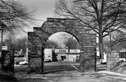
The cemetery is surrounded by the original wrought iron fence with mortared stone entrances. There is a stone historic marker in front of the cemetery commemorating a Revolutionary War skirmish.


  1. Name and location of the property: The property known as the Standard Oil Company of New Jersey Filling Station 1010 North Tryon Street, Charlotte, North Carolina.
  2. Name and address of the present owner of the property:

John and Louise McDow

1018 La Salle St. Monroe, NC 28110

  1. Representative photographs of the property: This report contains representative photographs of the property.
  2. Maps depicting the location of the property: This report contains a map depicting the location of the property.


  1. UTM coordinate: 17 514258E 3898018N
  2. Current deed book and tax parcel information for the property:08102413
  3. A brief historical sketch of the property: This report contains a brief historical sketch of the property.
  4. A brief architectural description of the property: This report contains a brief architectural description of the property.
  5. Documentation of why and in what ways the property meets criteria for designation set forth in N. C. G. S. 160A-400.5:
  6. Special significance in terms of its history, architecture, and/or cultural importance: The Commission judges that the property known as the Standard Oil Company of New Jersey Filling Station does possess special significance in terms of Charlotte-Mecklenburg. The Commission bases its judgment on the following considerations:

1)    Standard Oil Company of New Jersey Filling Station is the sole surviving pre- World War Two automobile filling station surviving in Center City Charlotte.

2)  The Standard Oil Station is a reflection of the growing importance of the automobile in Charlotte’s transportation mix.

3)  The Standard Oil Station possesses architectural significance as an example of Craftsman style design.

  1. Integrity of design, setting, workmanship, materials, feeling and/or association: The Commission contends that the physical and architectural description which is included in this report demonstrates that the Standard Oil Company Of New Jersey Filling Station meets this criterion.
  2. Ad Valorem tax appraisal: The Commission is aware that designation would allow the owner to apply for an automatic deferral of 50% of the Ad Valorem taxes on all or any portion of the property which becomes a designated “historic landmark.” The current total appraised value of the building and property $52,700.
  3. Portion of property recommended for designation: The exterior of the building and the property associated with the tax parcel are recommended for historic designation.

Date of preparation of this report: January, 2005

Prepared by: Stewart Gray and Dr. Dan L. Morrill

The Standard Oil Company Of New Jersey Filling Station

Standing along North Tryon Street immediately north of the CSX Railroad tracks in the City of Charlotte, is the Standard Oil Company of New Jersey Filling Station.  The distinctive building with a tiled, hipped roof supported by a single column, was constructed sometime before 1926.  The construction of this type of building signaled the rise of the automobile as a major mode of transportation into and out of Center City Charlotte.
Historical Overview
Charlotte began to become a significant regional retail and wholesale mercantile center with the arrival of the first railroad in October 1852.  In anticipation of that event several local businessmen purchased what was known as the “Davidson Corner” on the southwestern corner of the intersection of Trade Street and Tryon Street, locally known as the “Square,” and divided the land into five separate store lots on which they erected a series of brick mercantile buildings, probably Charlotte’s first, collectively called “Granite Range” or “Granite Row.”[1] William Treloar, an Englishman who moved to Charlotte in the 1850s, purchased the structures soon after they were built and named them “Treloar’s Hall.”[2]

The 1850s also witnessed the arrival in Charlotte of several enterprising Jews who drew upon their experience in the mercantile trade and established retail and wholesale outlets here.  Among them were Samuel Wittkowsky and Jacob Rintels.  In 1862, these two men joined forces to establish Wittkowsky and Rintels, a wholesale mercantile firm on South Mint Street that would eventually become one of the leading businesses of its type in the two Carolinas.  By the 1870s, Rintels and Wittkowsky were among the wealthiest men in town; and in 1874 they expanded into the retail trade in a building they leased on West Trade Street.  The local newspaper began publishing advertisements that described the “new and desirable goods” that the firm received by railroad from New York City.   Rintels died at the age of 40 on June 20, 1876; but Wittkowsky, who lived until February 13, 1911, remained an important civic figure for many years.[3]  In 1883, no doubt spurred by the increasing need for housing, Wittkowsky and other local investors established the Mechanics Perpetual Building and Loan Association, later the Home Federal Savings and Loan Association.[4]   Wittkowsky also headed the Masonic Temple Association in Charlotte  in the late 1860s and early 1870s and led the successful fundraising campaign to establish a local lodge.[5]

Many small shopkeepers operated in Charlotte in the late nineteenth and early twentieth centuries; and they too took advantage of the substantial growth that was occurring here due mainly to the emergence of Charlotte and its environs as a major  textile industrial area in the Piedmont.  As with William Treloar, Jacob Rintels, and Samuel Wittkowsky, many moved here from the North.  John W. Sheppard arrived in 1896 from New Jersey and established a drugstore on the “Osborne Corner” or the northwestern corner of the Square.[6]  Annie Augusta “Gussie” Newcomb and her sister-law, Susie A. Newcomb, who had come with their husbands to Charlotte from White Plains, N.Y. in 1879, purchased Miss Gray’s Millinery Store at 24 W. Trade St. Gussie and Susie catered to the wealthier ladies of the community. Gussie would travel to New York City to acquire the finest material and ribbons. The making of the elaborate hats of that era, resplendent with ornamental trimming, was done in the store by several milliners. To say that your hat came from Newcomb’s was “enough said.” The store was a resounding success.[7]

Grocery stores occupied an important place in Charlotte’s retail trade.  The oldest commercial building surviving in Center City Charlotte is the Crowell-Berryhill Store at 401 West Ninth Street.  A designated historic landmark, the store opened in 1897.  The owner of longest duration was Earnest Wiley Berryhill (1865-1931) who was known as a gracious and considerate man, who ran a charge and delivery store.  Berryhill sometimes gave free baskets of food to customers who could not pay. Working with him in the store for many years was Berryhill’s longtime black employee, Amzie Roseman, who was a familiar figure to those who traded at the store and lived in Fourth Ward.[8]

There were also restaurants and saloons in Center City Charlotte in the late 1800s and early 1900s.  In April 1902,  J. Luther Snyder, a Virginia native, arrived from Atlanta, where he had worked for the Coca-Cola Company for two years. He settled here to establish the first Coca-Cola bottling plant in the Carolinas. “When I came to Charlotte, the city had 17,000 people, eighteen saloons, two breweries . . . and I had a terrible time selling soft drinks with that kind of competition,” Snyder remembered.[9]  According to some residents, Charlotte was “awash in booze.”   A.M.E. Zion Bishop Henry Lomax  insisted in 1881 that “Charlotte was haunted with more drunken men, in proportion of the population, than he had ever seen and he had traveled in every State of the Union except three.”[10]  On Christmas Day 1880 groups of young men roamed through town like participants in a “carnival of intemperance,” commented another observer.[11] Retailer David Ovens, who arrived in 1903, noted that the only decent restaurant in town was “The Gem” on South Tryon Street. No restaurants  or saloons of that era survive.[12]

Charlotte’s retail business expanded significantly between 1890 and 1910 to keep pace with the burgeoning population of Charlotte and the surrounding countryside. The population of the town increased from 18,091 in 1900 to 34,010 in 1910, partly due to annexation.  William Henry Belk (1862-1952) opened a dry goods store in Monroe, N.C. in 1888 and persuaded his brother, Dr. John M. Belk, to join him in the business.  The Belk Brothers successful formula was to sell clearly marked, quality merchandise at reasonable prices, for cash only, treat all customers with respect irrespective of their financial status, and to institute a “no-questions-asked” return policy.  Belk Brothers established their first store in Charlotte on September 25, 1895.  On October 6, 1910, the  Belks opened a new three-story store on East Trade Street. It had an impressive, highly ornamental front façade.  Live music was provided by Richardson’s Orchestra for the gala occasion, which was held from eight to eleven in the evening.[13]  The building was demolished in the 1990s to make way for the present headquarters of Bank of America.

The second major dry goods store to open in the early 1900s in Center City Charlotte was Efird’s Department Store.  Beginning operations as the  “Racket Store” and soon thereafter as the “Bee Hive” on the corner of East Trade Street and North College Street, the store was bought by Anson County native Hugh Efird and two of his brothers, Joseph and Edmund, in 1907; and the name was changed to Efird’s Department Store.  Joseph Efird took charge of the Charlotte store after Hugh died in 1909 and oversaw the creation of a chain of stores that eventually included over 50 retail establishments across the Carolinas and Virginia, all directed from Charlotte.

Plans were announced in 1922 plans  for constructing a brand new half million dollar Efird’s Department Store on the much-sought-after 100 block of North Tryon Street. The site gave Efird’s an advantage over its main rival, Belk Department Stores. A bronze plaque was placed on the front of the building in memory of Hugh Efird. The new flagship store was designed by locally renowned architect Louis Asbury and was built on the site of the old Charlotte Hotel next to City Hall. It was a state of the art store, five stories high with over 100,000 square feet of floor space including a bargain basement and a spacious dining room on the top floor. Perhaps the most impressive feature of the building for its time, however, were the escalators which made Efird’s the only store south of Philadelphia which could boast of such a convenience, and gave this Charlotte department store temporary bragging rights over even the renowned Macy’s of New York. The building too was sacrificed in the 1990s so the present headquarters of Bank of America could be erected.[14]

The third major department store that appeared in Center City Charlotte in the early 1900s was Ivey’s.  Joseph Benjamin Ivey, the son of a Methodist preacher, opened a small store room in rented space near the Square on February 18, 1900. He, like William Henry Belk and Hugh and Joseph Efird, came to Charlotte at the turn of the century to take advantage of the local booming cotton mill economy. Ivey’s first day’s sales totaled $33.18. “We had to study carefully and push the lines that the other merchants did not make a specialty,” the enterprising merchant explained many years later. “For instance, at one time brass buttons were quite the rage. I was careful to keep in a supply all of the time while the other merchants were not noticing and allowed their stock to get low.” Among Ivey’s early employees was David Ovens, a Canadian who joined J. B. Ivey & Company in 1904. “I would probably have been satisfied with a moderate business that would make something over a living,” said Ivey, “but Mr. Ovens was ambitious to make J. B. Ivey & Company a big store and the business grew rapidly under our combined efforts.” A devout Methodist, Ivey insisted that the curtains be drawn in his store windows on Sundays, so that the pedestrians would not be tempted to consider matters of this world on the Lord’s day.    Happily, the Ivey’s Department Building survives. This elegant structure at Fifth and North Tryon Streets was designed by architect William H. Peeps and opened as the new home of J. B. Ivey & Company in 1924. A native of London, England, Peeps came to Charlotte in 1905 from Grand Rapids, Michigan, where he had been a furniture designer. Peeps lived here and thrived as an architect until his death in 1950. Peeps would serve as president of the North Carolina Chapter of the American Institute of Architects.[15]  Ivey’s was renovated and enlarged in 1939. On May 4, 1990, the company was purchased by Dillard’s, another department store chain. The Ivey’s Department Store Building has  since been converted into condominiums.[16]

Peeps was also the architect of the Latta Arcade and the Ratcliffe Florist Shop on South Tryon Street and the Hovis Funeral Home on North Tryon Street – all constructed in the first three decades of the twentieth century.  Opening in 1914 and inspired by the Grand Central Palace Exhibition Building in London, the two-story  Latta Arcade  housed the offices of the Charlotte Consolidated Construction Company, the developers of Dilworth, plus a range of other offices and retail outlets.[17]

In 1917, Louis G. Ratcliffe, a native of Henrico County, Virginia, opened a florist shop next to the Latta Arcade. After military service during World War I, he returned to Charlotte and was a civic leader in this community for more than 50 years. He died in 1961. So successful was Ratcliffe at supplying flowers for weddings, funerals and other special occasions that he decided to erect his own building in 1929.  The Ratcliffe Florist Shop, which has recently been moved a short distance and incorporated into  a large mixed use project, is an almost whimsical expression of Mediterranean motifs.[18]

Another pre-World War Two commercial building designed by Peeps that survives on Tryon Street is the Hovis Funeral Home Building.  Erected in the 1920s, this eclectic Classical style building served for many years as the site of the Z. A. Hovis & Sons Funeral Home.   As with Peeps’s other buildings in Center City Charlotte, the Hovis Funeral Home draws upon traditional patters of design, including arches and quoining.  Also, the building underscores the role of Tryon St. as the principal upscale commercial street in Charlotte in the first half of the twentieth century.[19]

Peeps was not the only notable local architect who fashioned commercial buildings in Center City Charlotte in the first half of the twentieth century. Louis H. Asbury (1877-1975) was the son of S. J. and Martha Moody Asbury of Charlotte. In addition to being one of the first carriers of the Charlotte Observer, the young Asbury assisted his father, who was a builder of houses in Charlotte in the 1890s.  He subsequently matriculated at Trinity College, now Duke University, and graduated from that institution in 1900. Having acquired his professional training at the Massachusetts Institute of Technology, Asbury returned to Charlotte and established his architectural practice in 1908.  In the succeeding decades, Louis H. Asbury assumed a position of prominence and leadership in the architectural profession. He was the first North Carolina member of the American Institute of Architects and played a leading role in organizing the North Carolina Chapter of the A.I.A.[20]

Louis Asbury was responsible for two noteworthy commercial structures that still stand on North Tryon Street. Montaldo’s, a retail outlet for expensive women’s attire and accessories, opened in the 1920s and was expanded in 1950s.  Asbury designed the original or northern part of the building; and his son, Louis Asbury, Jr., was the architect for the southern half of the store.[21]  Louis Asbury was the architect of the Oscar J. Thies Automotive Sales and Service Building at 500 North Tryon Street.  By the 1920s, automobiles were becoming increasingly available for purchase by the middle class; and businessmen such as Thies sought to take advantage of this expanding market. The Thies Building was completed in 1922 and was occupied by the Roamer (automobile) Sales Agency. Hipp Chevrolet rented the building in 1923, and in 1925, Carolina Oldsmobile occupied the building and remained there through 1930.[22]

The demands of the automobile increasingly shaped the built environment of Center City Charlotte as the twentieth century progressed.  Additional automotive dealerships appeared, including the Thomas Cadillac Company and the  Frye Chevrolet Company (1934) at 416 West Fifth Street.[23]  Of New Jersey Filling Stations also came into existence.  The only pre-World War Two example that survives in Center City Charlotte is the former Standard Oil Company Of New Jersey Filling Station at 1010 North Tryon Street.[24]  Even more profoundly, the automobile forced retailers to provide ample parking.  The most graphic example of the transformation that began to occur in Uptown retailing in the decade immediately following World War Two  was the decision of Sears Roebuck and Company to erect a complex of buildings and a large parking lot on North Tryon Street and North College Street.  On May 5, 1949, Mayor Herbert H. Baxter joined civic leaders, including Charlotte Chamber of Commerce president  J. Norman Pease, and Sears officials at opening day, ribbon-cutting ceremonies for a large Sears Roebuck and Co. retail store and parking lot on North Tryon St.[25]

South Tryon Street was also dramatically impacted by the advent of the automobile.  Charlotte architect J. Norman Pease, Jr. , who had been educated in the Modernist tradition at North Carolina State and Auburn University, designed an award-winning building for the Home Finance Company in 1958.  The structure exhibits many of the best characteristics of Modernism.  Devoid of applied ornamentation and exploiting contemporary materials, the Home Finance Building has expansive windows to allow large amounts of light to enter the second floor offices.  The stairway and hallway are on the outside of the building, thereby allowing a more efficient use of interior space.  Originally, the lower floor was used for customer parking.  The concept was that customers could park on the lower level rather than needing a large area paved outside the building.  Unfortunately, the bottom floor has since been enclosed for additional office space and a parking lot has been built, thereby depriving the Home Finance Company Building of some of its integrity.26

In summary, the retail stores of Center City Charlotte have continuously evolved in response to changes in the marketplace.  New forms of transportation have been especially significant in this regard.  Before 1852 customers had to walk or ride in buggies or wagons to get from one place to another.  The coming of the railroad in 1852, horse-drawn streetcars in 1888, and the opening of electric streetcar or trolley service in 1891, gradually transformed Charlotte’s built environment and gradually gave rise to the appearance of suburbs.  The arrival of the automobile in the first decade of the twentieth century and the enormous expansion of their numbers following World War One gave even greater momentum to this process. Although totally understandable, these powerful inducements for change have meant that very few retail buildings endure in Center City Charlotte.  Indeed, the Center City is now entering a new era as more residential units are being built, thereby giving rise to more pedestrian traffic.  In some sense history does repeat itself.

[1] Dr. William H. Huffman, “Survey and Research Report on the Garibaldi and Bruns Building,”  June 5, 1985.

[2] Dr. Dan L. Morrill, “Survey and Research Report on the William Treloar House,” July 3, 1984.

[3] Dr. Dan L. Morrill, “Survey and Research Report on the McManaway House,” June 1, 1977.  Jacob Rintels House stood on West Trade St. but was moved to Queens Road in Myers Park in 1916 by its new owner, Dr. Charles McManaway.  The house still stands at 1700 Queens Road.

[4] Dr. Richard L. Mattson, “Survey and Research Report on the Home Federal Savings and Loan Buildng,” November 25, 2001.

[5] Dr. Dan L. Morrill and Jack O. Boyte, “Survey and Research Report on the Masonic Temple,” n.d.

[6] Dr. Dan L. Morrill and Nora M. Black, “Survey and Research Report on the John W. Sheppard House,” January 29, 1992.  The John W. Sheppard House still stands at 601 North Poplar Street.

[7] Dr. Dan L. Morrill, “Survey and Research Report on the Berryhill House,” n.d.   Gussie Newcomb’s House still stands at 324 West Ninth Street.

[8] Dr. Dan L. Morrill, “Survey and Research Report on the Crowell-Berryhill Store,” July 7, 1982.

[9] http://www.cmhpf.org/essays/cocacola.html

[10] http://danandmary.com/hisofcharlottechap8new.htm

[11] http://danandmary.com/hisofcharlottechap8new.htm

[12] http://landmarkscommission.org/educationovens.htm

[13] Dr. Dan L. Morrill, “Survey and Research Report on the Belk Façade,” April 3, 1985.

[14] Christina A. Wright, “Survey and Research Report on the Withers Efird House,” June 30, 2000.

[15] Frances P. Alexander and Dr. Richard L. Mattson, “Survey and Research Report on the Latta Arcade,” July 20, 1994. Hereinafter cited as Latta Arcade.

[16] Dr. Dan L. Morrill, “Route VII.  Uptown Walking Tour Part 2” (landmarkscommission.org), n.d.

[17] Latta Arcade.

[18] Dr. Dan L. Morrill, “Route VII.  Uptown Walking Tour Part 2” (landmarkscommission.org), n.d.

[19] Dr. Dan L. Morrill and Stewart Gray, “Survey of Historic Buildings in Center City Charlotte,” November 2004.

[20] Dr. Dan L. Morrill, “Survey and Research Report on the Advent Christian Church,” November 2, 1987.

[21] Ibid.  Mecklenburg Iron Works Drawings, 1945-1968 (UNCC Manuscript Collection 190 in the J. Murray Atkins Library).

[22] Dr. Dan L. Morrill and Nora M. Black, “Survey and Research Report on the Oscar J. Thies Automotive Sales and Service Building,” July 24, 1992.

[23] http://cmhpf.org/Frye%20Chevrolet.htm.

[24] http://cmhpf.org/uptownsurveystandardoil.htm.

[25] http://cmhpf.org/uptownsurveyhistorysears.htm

  1. http://landmarkscommission.org/uptownsurveyhomefinance.htm


Architectural Description


The Standard Oil Company of New Jersey Filling Station faces west, adjacent to North Tryon Street, just north of the CSX Railroad tracks that define the northern edge of the Uptown area.  The neighborhood is now distinctly commercial and industrial in nature, with small warehouses and business in one-story buildings separated by overgrown lots.  When it was built however, the station was surrounded by blocks of small mill houses and duplexes, and busy railroad sidings and spurs. But it was not the immediate neighborhood that attracted the filling station. The Standard Oil Station occupied a prominent position along what was then one of the state’s busiest roads.  Not only was Tryon Street one of the city’s original defining roads, but it was also part of the first system of paved highways that connected the cities of North Carolina.


The one-story, frame and masonry station consists of a retail office and a deep two-bay wide garage attached to the north side elevation of the office.  The station is covered with stucco, and its most distinctive feature is a single square concrete post, centered in front of the retail office.  The post flares into a concrete beam and supports a hipped-roof, half of which acts as a canopy that once afforded protection to customers and their cars, with the other half protecting the principal section, the station’s retail office.  The hipped roof is covered with pressed metal shingles, formed to resemble clay tiles.


While difficult to categorize, the ca. 1927 building is definitely reflective of the popular styles of the early twentieth century, and shows that influence of the eclectic nature of the Craftsman Style bungalows being built throughout the city.  The tile roofing itself, commonly employed in exotic revivals such as Mediterranean, Italian, and Mission, is one such eclectic element.  The form of the building, with its prominent but low-pitched roof, echoes the engaged front porch of a bungalow.  The flaring of the center post recalls the form of Craftsman Brackets.   The retail office sits on a concrete slab.  The base of the retail office is formed by a low brick wall, upon which the wall framing rests.  A replacement door is topped with an original four-light transom, and the store-front windows appear to be original.


The concrete block flat-roofed garage is set back slightly from the retail office.  A shallow pent roof shelters a pair of 24-light overhead doors.  The garage extends from the rear of the building and is accessed by a recently added or replacement overhead door on the north elevation.  The south elevation features a pair of 20-light metal frame windows.


Stone Entry Gates (JCSU)

This report was written on September 5, 1984

1. Name and location of the property: The property known as the Stone Entry Gates of Johnson C. Smith University is located on the campus of Johnson C. Smith University, 100 Beatties Ford Rd., Charlotte, North Carolina.

2. Name, address and telephone number of the present owner of the property:
Johnson C. Smith University
100 Beatties Ford Rd.
Charlotte, N.C. 28216

Telephone: (704) 378-1000

3. Representative photographs of the property: This report contains representative photographs of the property.

4. A map depicting the location of the property: This report contains a map which depicts the location of the property.


5. Current Deed Book Reference to the property: There is no individual deed to this property listed in the Deed Books of Mecklenburg County. The Tax Parcel Number of this property is 078-201-06.

6. A brief historical sketch of the property: This report contains a brief historical sketch of the property prepared by Dr. William H. Huffman, Ph.D.

7. A brief architectural description of the property: This report contains a brief architectural description of the property prepared by Lisa A. Stamper.

8. Documentation of why and in what ways the property meets the criteria set forth in N.C.G.S. 160A-399.4:

a. Special significance in terms of its history architecture and/or cultural importance: The Commission judges that the property known as the Stone Entry Gates of Johnson C. Smith University does possess special significance in terms of Charlotte-Mecklenburg. The Commission bases its judgment on the following considerations: l) the stone entry gates symbolize the revitalization of an important black institution of higher education through the generous gift of funds by Mrs. Johnson C. Smith in 1921-22; and 2) the stone entry gates, designed by New York architect A. G. Lamont, occupy a strategically important site, at the intersection of Beatties Ford Rd. and W. Fifth St., and are a unique element in the built environment of Charlotte-Mecklenburg.b. Integrity of design, setting, workmanship, materials, feeling, and/or association: The Commission contends that the attached architectural description by Miss Lisa A. Stamper demonstrates that the Stone Entry Gates of Johnson C. Smith University meet this criterion.

9. Ad Valorem Tax Appraisal: The Commission is aware that designation would allow the owner to apply for an automatic deferral of 50% of the Ad Valorem taxes on all or any portion of the property which becomes “historic property.” The Stone Entry Gates possess no individual Ad Valorem Tax Assessment. However, the entire 44.24 acre campus has an appraised value of $575,120 for the land and $11,607,330 for the improvements, or a total appraised value of $12,182,450.

Date of Preparation of this Report: September 5, 1984

Prepared by: Dr. Dan L. Morrill, Director
Charlotte-Mecklenburg Historic Properties Commission
1225 S. Caldwell St.
Charlotte, N.C. 28203

Telephone: (704) 376-9115

Historical Overview

Dr. William H. Huffman

The stone gates guarding the old entrances to Johnson C. Smith University are fitting monuments to mark both the revitalization of that institution through the benefaction of Mrs. Johnson C. Smith and the changing of its name to honor the memory of her husband. Built in 1923 as part of a rigorous construction program funded by Mrs. Smith, the gates stand as a symbol of the commitment to the school to be one of the best black colleges in the country by Mrs. Smith, the Presbyterian church, and local leaders.

Johnson C. Smith University was started in 1867 by the Committee of Freedmen of the Presbyterian Church, USA as a school to train young black men to become teachers and preachers in the South. Through the gifts of Mrs. Mary D. Biddle of Philadelphia, the school was able to move to eight acres of land donated by William R. Myers, and in 1869, Biddle Memorial Institute opened just north of the city. It was named in honor of Mrs. Biddle’s husband, Major Henry J. Biddle, who had fallen in the recent war. Under the direction of Dr. Stephen Mattoon, (1815-1886), who began his tenure in 1870, Biddle was solidly established as one of the leading black colleges in the nation, and it also became an influential part of the City of Charlotte. The school has not only provided the education for many black professionals, but the institutions administrators and staff have played a significant role in the community and the community of Biddleville, which became connected to the city center by streetcar in 1903, grew up around it.1

Despite a disastrous fire in 1878, the school prospered. In 1912, a fine new library building was dedicated which was built from a grant by Andrew Carnegie, the philanthropist.2 Another fire of 1921 which destroyed the theologies dormitory, kitchen and dining room put the continued existence of Biddle (chartered by the state as a university in 1876) very much in doubt because of the great amount of money needed to rebuild.3 Through the Presbyterian Board of Missions, Mrs. Mary Jane Smith of Pittsburgh, PA, learned of the schools plight, and during the academic year 1921-1922 pledged about $200,000 to build a new theological dormitory, a science building, a teacher’s cottage, a dining hall, and a memorial gate to honor the memory of her late husband, Johnson C. Smith. Because of her gift, the Board of Missions of the Presbyterian Church changed the name of the institution to Johnson C. Smith University in 1922, a change which was legalized by an amendment to its state charter by the legislature on March 1, 1923.4 In all, Mrs. Smith’s gifts eventually totaled about $700,000, which built another dormitory and teacher’s cottage, a new heating plant, a printing shop, and a church, as well as added to the endowment.5

At ceremonies on the campus on October 27, 1922, which were attended by local civic and religious leaders as well as Mrs. Smith and Presbyterian officials, the dormitory, teacher’s cottage (Berry Cottage, after Mrs. Smith’s parents) and refectory (dining hall) were dedicated. As part of the proceedings, the cornerstone for the new stone science hall was laid.6 By the following year, the science building and the stone gateway were completed, and on October 25, 1923, a second dedication was held on the campus led by JCSU President B. L. McCrory, at which Harry Harding, Charlotte Schools Superintendent, Dr. James Dudley, President of the Agricultural and Technical College of Greensboro, and others spoke. The high point of the ceremonies came when Mrs. Smith was presented with an oil painting of the arched entry gate that had been painted by the professor of French at the University.7

All of the buildings and the gate arch on the campus built with Mrs. Smith’s funds (except for the church) were designed by the superintendent of architecture for the Presbyterian Board of Missions, A. G. Lamont. Lamont’s office was on Fifth Avenue in New York, and the Missions Board kept him busy designing many buildings for black colleges in the South which were funded by donors such as Mrs. Smith, although some designs were repeated in various locations. All of the structures were also built by the same Charlotte contractor, the Southeastern Construction Company. Southeastern built similar buildings for the Board of Missions from Lamont designs in Hot Springs, NC, Keysville, GA, and Cordele, GA, in 1924 as well.8

There is no question that Mrs. Smith, the Presbyterian Board of Missions, and local leaders were proud of the revitalization of the school made possible by the generous Smith gifts and that the arched gateway to the renewed campus was an appropriate landmark to symbolize its rejuvenation and the commitment of those involved to make the school a strong and viable one.


NOTES

1 Arthur A. George, 100 Years, 1867-1967: Salient Factors in the Growth and Development of Johnson C. Smith University (Charlotte: Johnson C. Smith University, 1968).

2 Charlotte Evening Chronicle, May 30, 1912, p. 1.

3 George, pp. 30-34.

4 Fifty-eighth Annual Report of the Board of Missions for Freedmen of the Presbyterian Church, Pittsburgh, PA, May, 1923, p. 40; Fifty-fourth Annual Catalogue, Johnson C. Smith University, 1921-22, p. 3 et passim; Fifty-fifth Annual Catalogue, Johnson C. Smith University, 1922-23, p. 9.

5 Inez Parker and Helen Callison, The Biddle-Johnson C. Smith University Story (Charlotte: Observer Craftsman Co., l975), pp. 19-21.

6 Charlotte Observer, Oct. 27, 1922, p. 4; Charlotte News, Oct. 28, 1922, p. 7.

7 Charlotte News Oct. 26, 1923, p. 12.

8 City of Charlotte Building Permits No. 3540, 3836, 5345, 5366, 5368, and 8454; Southeastern Construction Company files, 1924.

Architectural Description

Lisa A. Stamper

The arched stone gate near the five-point intersection of Biddleville, Charlotte’s first black suburb, marks the name change of Biddle University to Johnson C. Smith University. It also serves a more utilitarian function by designating the old entrance to the institution, and has done so since 1923. According to Dr. William Huffman, Mrs. Mary Jane Smith donated a total of $700,000 in memory of her husband, to struggling Biddle University. This money was used not only to build the stone gate, but also several buildings on the campus, with funds left over to add to the endowment. The stone gate was designed by A. G. Lamont, superintendent of architecture for the Presbyterian Board of Missions, and the contractor was the Southeastern Construction Company of Charlotte.

The stone gateway is composed of a horseshoe shaped arch over a driveway, and two flanking pillars. Sidewalks begin between each pillar and the arch, and a driveway begins underneath the arch. This rusticated gateway is made primarily of granite. The stones are cut into irregular size pieces which, except for the voussoirs, are all basically rectangular in shape. Although not apparent at first glance, the voussoirs are not all of the same length. They too are irregularly cut, with the smaller ones being near the top.

The string course of the stone gate arch is of concrete. In this case, it is not a continuous horizontal band, but allows the stone to be molded to form a polished looking, stepped outline. This outline consists or a straight, horizontal line at the very top; a step down from that are elongated S-curves which complement the round arched opening; yet another step down are short straight string courses permitting the squaring off of the sides of the structure so that they appear to be piers rather than part of an arch.

To emphasize the “piers” formed at the sides of the arch, wide pilasters with concrete string courses are located on troth sides of the stone gate. The height or these pilasters does not extend above the spring line of the arch. Another concrete string course appears to run behind the pilasters at approximately the same height as the pillars. This helps to make the pillars look more like part of the total gateway. The pillars are square and also capped with concrete string courses. A simple iron gate inside the arched opening prevents usage of the driveway.

On the side of the stone gate which faces Beatties Ford Road, a rectangular polished stone is set underneath the topmost string course. It is not surprising that this stone is engraved with the name of the university. However, there is a period placed after “Johnson”, and a comma placed after the initial “C.”

Two large trees flank the stone gateway, and several others randomly follow the driveway and sidewalks. It is difficult to determine when and/or if they were planted there, but it is obvious that many of the trees and shrubs in this area have been there for quite a while. The 1929 Sanborn map shows that the semi-circular driveway was present six years after the stone gate was built. Today the main entrance is located at the opposite end of this drive.

The stone gate has been a strong symbol of the university’s achievements since the early 1920’s. The gateway is in good condition, and students still pass through it often. This landmark deserves recognition as a monument to Charlotte’s support of Johnson C. Smith University.


Stephens House

This report was written on Apr 30, 1984

1. Name and location of the property: The property known as the George Stephens House is located at 821 Harvard Place, in Charlotte, North Carolina.

2. Name, address and telephone number of the present owner of the property: The present owner of the property is:

Mr. James P. Pressly and wife Susan T.
821 Harvard Place
Charlotte, N.C. 28207

3. Representative photographs of the property: This report contains representative photographs of the property.

4. A map depicting the location of the property: This report contains a map which depicts the location of the property.

5. Current Deed Book Reference to the property: The most recent deed to this property is listed in Mecklenburg County Deed Book 4750 at page 367. The Tax Parcel Number of the property is: 155-053-10.

6. A brief historical sketch of the property: This report contains a brief historical sketch of the property prepared by Dr. William H. Huffman.

7. A brief architectural description of the property: This report contains an architectural description of the property prepared by Miss Lisa A. Stamper.

8. Documentation of why and in what ways the property meets the criteria set forth in N.C.G.S. 160A-399.4:


a. Special significance in terms of its history, architecture, and/or cultural importance: The Commission judges that the property known as the George Stephens House does possess special significance in terms of Charlotte-Mecklenburg. The Commission bases its judgment on the following considerations: 1) the initial owner of the house, George Stephens (1873-1946), was a seminal figure in the development of Charlotte in the early 20th Century, being a co-founder of the Piedmont Realty Company, a founder of the Southern States Trust Company, later the American Trust Company, and founder and president of the Stephens Company, developers of Myers Park; 2) the probable architect of the George Stephens House was L. L. Hunter (1882-1925), who designed such important local landmarks as the F. O. Hawley House (923 Elizabeth Avenue) and the Carnegie Library on the campus of Johnson C. Smith University; 3) the George Stephens House, erected c. 1915-16, occupies a pivotal place in terms of the Myers Park townscape and is one of the older houses in the suburb; and 4) the George Stephens House is an interesting local example of a sophisticated blending of Bungalow and Colonial Revival motifs.

b. Integrity of design, setting, workmanship, materials, feeling and/or association: The Commission contends that the attached architectural description by Mr. Thomas W. Hanchett demonstrates that the George Stephens House meets this criterion.

9. Ad Valorem Tax Appraisal: The Commission is aware that designation would allow the owner to apply for an automatic deferral of 50% of the Ad Valorem taxes on all or any portion of the property which becomes “historic property.” The current appraised value of the 1.125 acres of land is $299,009. The current appraised value of the improvements is $59,242. The total current appraised value is $358,251. The property is zoned R12.

Date of Preparation of this Report: April 30, 1984

Prepared by: Dr. Dan L. Morrill, Director
Charlotte-Mecklenburg Historic Properties Commission
1225 S. Caldwell Street/Box D
Charlotte, North Carolina 28203

Telephone: 704/376-9115


Historical Overview
 

Dr. William H. Huffman
November, 1983

The interestingly varied bungalow-style frame house with a lively charm at 821 Harvard Place in Myers Park was built about 1915-16 by George Stephens (1873-1946), the energetic developer of Myers Park, and his wife, Sophie Myers Stephens (1875-1958).

Christened George Erwin Cullet Stephens as the only child of Addison and Lydia Pierson Lambeth Stephens, he was born in Guilford County, near Summerfield. After his father’s death when he was about nine years old, he and his mother moved to Greensboro, where the boy attended the school of Lina Porter (an aunt of author O. Henry). At his next school, the Oak Ridge Institute, he became interested in physical education and showed great promise as a left-handed baseball pitcher. In 1892, Stephens entered the university at Chapel Hill, and earned his way through college with an appointment as an instructor in physical education.


George Stephens
His claim to fame from his college years, however, comes from his prowess as a varsity football and baseball player. As the former, he is credited with having caught the first forward pass thrown in football in a game between UNC and Georgia in 1895, when the Carolina quarterback threw it to left halfback Stephens, who proceeded to make the only score of the game against the astonished opponents. In baseball, Stephens was called “the best pitcher Carolina ever had,” and received offers to play professionally from four of the eight National League teams of the day. John McGraw (1873-1934), the legendary New York Giants manager who led his team to ten pennants and 3 championships, called Stephens “One of the best college pitchers I have ever seen.” 1

It was not athletics that led George Stephens to Charlotte after college, however, but his college roommate and the county’s part in the good roads movement. To help earn his way through college, he had learned stenography and worked as a secretary to J. A. Holmes, the state geologist, who was making a study of good roads and road materials. This prompted Stephens to write his graduation thesis on road materials and learn in the process that Mecklenburg County was number one in good roads in the state, a fact which influenced his decision to locate here in 1896. His career was launched in Charlotte in the insurance business with his college roommate, Walter Brem, Jr., and the senior Mr. Brem. 2

It was an excellent time to be in business in Charlotte, because of the rapid growth and prosperity brought about by the booming textile industry: the city was strategically located on the main rail lines in the heart of the rapidly industrializing New South Piedmont area. That combined with George Stephens’s personality, drive and good business sense assured success, which indeed came in rapid steps. After only three years in the city, in 1899, he formed a partnership with Frederick C. Abbott, a Charlotte real estate man, and the following year the two of them organized the Piedmont Realty Company with B. D. Heath, a merchant, banker and textile manufacturer, and William Coleman. This company bought some rural acreage from Col. William R. Myers located about a mile to the northeast of the Square, and began to develop the suburb of Piedmont Park, now part of the Elizabeth neighborhood. 3

In 1901, a year after starting the real estate development, the energetic Stephens organized a new bank, the Southern States Trust Co., with his childhood friend, Word H. Wood, a Winston-Salem banker, and F. C. Abbott. Abbott began as president, Stephens as vice-president, and Wood as secretary-treasurer, but Stephens soon bought out Abbott and became president. Hardly content, the following year the Piedmont Realty built the city’s first skyscraper, the seven-story Trust Building (on the site of the present Johnston Building), which housed the bank, the growing Southern Power Co. (forerunner of Duke Power) and others. The bank’s name was changed to the American Trust Co. (1957, merged into American Commercial Bank, 1960 merged into NCNB [in 1999, the Bank of America]), and it prospered greatly during the years of rapid growth in the early twentieth century. 4


American Trust Company Building, 1924
To Charlotteans, however, George Stephens is best known as the developer of Myers Park. In 1902, after his successful career as a banker and developer was already launched, he married Sophie Converse Myers, the daughter of John Springs Myers (1847-1925). The latter had received 306 acres of prime farmland about two miles south of town from his father, Cal. William R. Myers,in 1869, to which he added over the years until his plantation grew to 1200 acres. Jack Myers had envisioned that one day his land might be used as a beautiful, park-like setting for an expanded Charlotte. 5

His dream started to become reality when son-in-law George formed the Stephens Company in 1911 with his friend Word Wood, and Arthur J. Draper, who was a textile man and descendent of the inventor of the Draper loom. Soon thereafter, William States Lee, a pioneer with J. B. Duke in the formation of what became Duke Power Company, and John M. Miller, Jr. joined the company as partners. In competition with Edward Latta’s Dilworth, which had a design laid out by nationally-known landscape architects, the Olmsted Brothers of Boston, in 1912, the Stephens Company hired John Nolen of Cambridge, Mass. to lay out a street plan and do landscape designs for some purchasers of lots. Stephens had met Nolen in 1905 when the Park and Tree Commission, which the developer helped organize, engaged Nolen to lay out Independence Park and other projects. Nolen subsequently became one of the country’s best known city planners with over 400 projects to his credit. He was joined in 1915 by a young protege, Earle Sumner Draper, who took over Nolen’s work in Myers Park and also became a nationally-known planner with his own firm (1917-1932), and later was head of planning for the TVA and acting director of the FHA. With Myers Park, these two expert planners were able to see some of the best ideas in early suburban planning carried out to an unusual degree. To entice town residents to move out to this semi-rural development, the Stephens Co. not only built the curved streets and parks according to the plan, offered the landscape services of Nolan and Draper for purchasers, and extended the streetcar lines, but also engaged in massive tree plantings and induced Queens College and the Homer Military School to locate on free land in the suburb. Stephens won the Queens College bidding in competition with three others, including Ed Latta, who wanted it in Dilworth, by offering them enough land and cash to be able to build new buildings for a campus and add to the endowment. Though it contains a wide variety of types and sizes of houses, Myers Park did attract some of the city’s wealthiest citizens, who built architecturally important homes in the area, such as the Jamison, Moody and Thies houses on Providence, and the Wade, Brown, Duke and Lambeth mansions on Hermitage. Because of its layout by Nolen (who also did the plan for Queens College) and Draper, and the execution of their plans by the Stephens Co., Myers Park also takes on regional and national significance. 7

It wasn’t until 1915 that Sophie and George Stephens got around to building their own house in the new subdivision, even though the location on Harvard Place for it, consisting of two lots, had been acquired by Mrs. Stephens in 1911 and 1912. 8 They reportedly chose a talented local architect, L. L. Hunter, to design their new home. 9 Unfortunately, not a great deal is known about Leonard LeGrand Hunter (1882-1925), who died at the relatively young age of 43. He was born near Huntersville in the county, the son of Mr. and Mrs. Robert H. Hunter, and came to Charlotte about 1905. At present, two of the city’s fine buildings are known to have been designed by Hunter, the F. O. Hawley house at 923 Elizabeth Avenue, and the Carnegie Library on the Johnson C. Smith University campus. 10 The landscaping was done by John Nolen. 11

Although the house was finished in late 1915 or early 1916 when the Stephens family (which had been living on Providence Road) could begin to enjoy their spacious new home, 12 they only lived there about three years. apparently for health reasons, the family had spent some time in Asheville, and, in 1919, they decided to make that city their permanent home. From 1912 to 1916, George Stephens and Word Wood had owned controlling, later sole, ownership in the Charlotte Observer, and in 1919, Stephens formed the Asheville Citizen Company and bought controlling interest in the newspaper of that name. In addition to development activities in Asheville and Flat Rock, Stephens remained head of the Stephens Company until 1922, when he resigned in favor of Thomas T. Allison, a longtime realtor for Mr. Stephens. Among other notable achievements in George Stephens’ busy life should be included the securing of Camp Greene army base for Charlotte in World War I, and being instrumental in the campaign to have the Blue Ridge Parkway located on the North Carolina side of the mountains. 13

When the Stephens family departed Charlotte, they sold their Myers Park home to the vice-president (later president) of the Stephens Company, Arthur J. Draper (1875-1932). 14 A Massachusetts native who was educated at Yale University (1897) and Harvard Law School (1900), Draper was a descendent of the inventor of the Draper loom, a significant advance in textile manufacturing technology. With E. A. Smith and others, he was one of the original incorporators of the Chadwick-Hoskins Co. (1907) in the city, which owned five cotton mills in the area (the Chadwick, Hoskins, Alpha, Louise and Pineville mills), and served as the president of the company for many years. Draper, who was a distant relative of landscape architect E. S. Draper mentioned above, was a major figure in the textile industry in the region and nationally. 15

In 1930, the Drapers sold the Harvard Place house to another of the early directors of the Stephens Company, William States Lee and Mary Martin Lee.16 W. S. Lee (1872-1934) was a talented and energetic electrical engineer who combined with tobacco magnate James B. Duke to develop a great system of hydroelectric power in the Piedmont Carolinas which supplied the energy for the rapid expansion of industrialization in the region. Among his many accomplishments which earned him an international reputation were his being executive vice-president and chief engineer of Duke Power Co., president and chief engineer of the Piedmont and Northern Railway (an electric train system which merged eventually with the Seaboard Coast Line in 1969), and head of his own consulting firm. 17

After Mr. Lee’s death in 1932, Mrs. Lee stayed on in the house until her own death in 1969, when the house, which stood vacant for two years afterward, passed to a son, Martin Lee. The latter opened an antique business on East Boulevard and sold many of the house’s original fixtures there, where (now occupied by the White Horse Restaurant) the stair railing from the Harvard Place residence may still be seen. 18

In 1971, the house was sold to Dr. James and Marianne Anderson, who did much restoration in their twelve years of ownership, and under the present owner, Dr. James Pressly, who bought the property in 1983, the house is undergoing extensive work. 19 Over the years, the Stephens house has apparently undergone various changes and modifications, but it has remained true to its original design. As one of the original houses in that part of Myers Park which was built by the subdivision’s developer and his wife and landscaped by John Nolen, as well as the fact that it was subsequently the home of the prominent Charlotte figures Arthur J. Draper and William States Lee, the Stephens house is unquestionably of high historical significance for the city.


NOTES

1 Charlotte Observer, Dec. 15, 1943, Sect. 2, p. 5; Asheville Citizen-Times, Nov. 10, 1940, p. 1B.

2 Charlotte Observer, cited above.

3 F. C. Abbott, “Fifty Years in Charlotte Real Estate, 1897-1947” (Charlotte: privately published, c. 1947), pp. 8-9; Record of Corporations, Book 1, p. 174.

4 Observer, cited above.

5 Thomas Hanchett, “Charlotte Neighborhood Survey,” Charlotte Mecklenburg Historic Properties Commission, 1983; II, “Myers Park,” pp. 5-6.

6 Ibid., pp. 5-30.

7 Ibid.

8 Deed Book 283, p. 234, 2 Oct 1911; Deed Book 303, p. 46, 6 Nov. 1912.

9 Interview with Kenneth Whitsett (1894-1983) by Mary Kratt, 31 August 1983.

10 Charlotte Observer, Feb. 21, 1925, p. 15; Ibid., Dec. 28, 1905, p. 4; Charlotte Evening Chronicle, Oct. 29, 1910, p. 9.

11 Interview with Marianne Anderson, Charlotte, N.C. 28 Nov. 1983.

12 Charlotte City Directories, 1915-1916.

13 Charlotte Observer, Dec. 15, 1943, Sect. 2, p. 5; Ibid.,July 2, 1922.

14 Deed Book 399, p. 385, 19 May 1919.

15 Charlotte Observer, April 27, 1932, p. (?); Record of Corporations, Book 2, p. 313.

16 Deed Book 761, p. 166, 24 Jan. 1930.

17 Charlotte News, March 25, 1934, p. (?).

18 Interview with Marianne Anderson by James Hatley, Charlotte, N.C., April, 1982; Will Roll 69-26, Frame 1327.

19 Deed Book 3289, p. 366, 24 May 1971; Ibid., 4750, p. 367, 16 Nov. 1983; interview with Mrs. Anderson 28 Nov. 1983.


Architectural Description
 

Lisa A Stamper
April 2, 1984

George Stephens, the developer of Charlotte’s prestigious Myers Park neighborhood, built his home there in 1915-1916. The George Stephens House is an unusual, innovative Colonial Revival variation on the Bungalow style, a new form of inspiration for early twentieth-century architects. One such architect was probably L.L. Hunter. According to Dr. Huffman, Hunter designed the house while John Nolen designed the landscaping.

This interesting two and one-half story home definitely looks large, and it is. However, the slate roof contains the upper story bungalow. This steep roof has a complicated shape composed of both gambrels and gables, with a variety of shed dormers, which fill all sides of the roof and add vitality. All eaves are wide and decorated with modillions. The roof is a strong design element covering at least half the total structure, and making the home a visually interesting one.

The George Stephens House is wood framed on a brick foundation. It is sheathed with wood shingles, now painted mustard yellow. Even the cheeks of its many dormers are covered with these shingles. Wooden trim, eaves, and columns are painted white. All porches have red tile and grout floors.

The plan is basically L-shaped, with side projections. The three story L-shape consists or a main block facing Harvard Place and a rear wing. The northeast projection has a first story porch topped by a second story bath. The southwest projection contains a first level kitchen area topped by second level bedrooms. A one story covered porch sits in front of this projection.

In the center of the front facade is a one-story portico. Plain columns support an equally unadorned entablature with a wide, modillioned cornice. In its upper section, the single door has many square glass panes, the top row containing pointed arched muntins. The bottom section of the door contains two simple wooden panels placed side by side. Flanking side lights are of the same style as the door, but are only one-half the size. The existing platform was removed by the present owners, Dr. and Mrs. James Pressly. It will be replaced with red tile and grout, believed to be the original materials used.

The windows are varied in size; however, all but one is rectangular. All have wooden frames. Most of the windows are double-hung, but occasionally are casement. The double-hung windows of the front (northwestern) facade main block have nine-over-nine lights, while all the others but one have six-over-six lights or less. Sometimes, rather than creating a larger window, the architect has placed two or three windows side by side. A Palladian window is located directly above the portico on the front facade. The window is very ornate, with delicate pilasters and an elegant keystone in its round arch An interesting feature of this window is that the two rectangular parts are false windows. One more window type incorporated into the house’s design is found in the northeastern porch. It is a multi-paned casement window with a small window above it containing a single row of three panes.

One-half round vents are located at the top of all the gambrel-ends except those with chimneys. A vent is also located in the gable-end of the side projection. front gable has a small rectangular casement window in its center.

A balanced design employing both symmetry and asymmetry gives the observer the feeling of informality while at the same time leaving no doubt that a person of import and wealth resides there. This is evident in the front facade. It is symmetrical at the first and second levels, but at the third story an off centered modillioned gable and twice broken roofline obscures the balance. This balance is restored by the side projections. The northeastern projection is shorter than that of the southwest; however, they both appear to be of the same design.

The northeastern gambrel-end of the main block has a smaller projecting gable roof within its gambrel. Between the gambrel end and the gable is a simple brick chimney. The gable has one dormer on its northwestern side. Supported by two simple curved wooden brackets, a balcony projects from the second story in the gable’s end. The balcony is surrounded by a decorative cast iron railing. A double door, of the same design as the window of the sunporch underneath, allows access to the balcony from inside.

The sunporch contains two columns on both outside corners and is raised a few steps above the ground. It has two sets of multi-paned double-doors; one on its northeastern side and another on its southeastern side. The screen doors on the southeast- side have rotted, but copies or those on the other side will be made to replace them.

The southwestern gambrel-end has a smaller gambrel-within-gambrel roof. An exterior chimney is located on the smaller gambrel-end. The smaller gambrel is not centered within the larger one, but shares a lower southeastern side. To the northwest or the smaller gambrel is a one-story porch, and intersecting its southeastern side is another gambrel roof.

The intersecting gambrel roofs cover a series of second floor rooms most of which are used as bedrooms. Dormers are located on all sides of the roofs. A kitchen and mud room are located on the first floor of this projection. A simple single door which enters into the mud room serves as a back entrance.

Presently, the one-story porch is enclosed with screens upon frames patterned after the windows of the porch located at the opposite side or the house. Originally, this porch was open. The two front (northeast) columns were original, and support a flat roof with wide eaves. Of course, they are decorated with modillions. This porch is also raised a few steps above ground.

The three story rear wing also has a gambrel roof, with four dormers on each side. Another chimney is located in the center of the northeast side of the wing. An open porch is partially topped by the gambrel roof and partially covered by a flat roof which runs the length or the wing’s northeast side and one-half the width or the southeast end. Instead of modillions, delicately curved brackets adorn the porches white eaves. One column shaft is located at each or the southeastern corners and three more are symmetrically placed on the northeastern side. A modified capital for each column is set within the entablature and consists of a square block with four brackets. As the others, this porch also is a few steps above the ground.

The rear wing covers most of the rear (southeast) facade. The small portion which is exposed also has various dormers in its roof. The third story has two dormers, one of which is rather small. The second story only has one dormer, but it is large enough to contain two separate windows.

The Presslys have made a few minor alterations to the exterior of the house. In the rear and the rear wing, they have put in french doors. However, these doors have been custom made to blend with the total design of the building. A set of windows previously located on the first story of the rear wing was moved to the second story, most probably keeping within the original design of the house. Also, a second story opening on the gambrel-end of the rear wing was closed.

It appears as if the interior plan has not changed significantly from the early 1900s. Some believe that additions might have been built onto the house; however, inspection or the 1929 Sanborn map shows the basic outline or the house to be almost identical to the present shape. The only difference is the Sanborn map fails to show the rear wing porch to continue around to the rear (southeast side).

As one enters the great hall from the front portico entrance, the stair is located in front, the living room to the left, and the dining room to the right. The stair begins on the first floor and goes up to the third floor. As one continues down the hall, the butler’s pantry and a half-bath is also on the right, while a storage area is to the left underneath the stairs. One may walk through this area to the living room. Another stair, located between the pantry and the kitchen in the right projection, gives access to the basement and second floor bedrooms.

The second story consists of five bedrooms, all of which have connecting baths. Only two of these rooms have to share a bath. The master bedroom has a sunroom to its rear.

It is probable that the third floor was used by the servants. One room, which might have been a bedroom, has two closets and two sets of built-in cabinets with adjustable shelves. The bath has two pedestal sinks, complete with metal cup holders. It lacks a tub, but it does have a marble shower stall with a metal framed glass door. In another room, possibly a work room, a wooden ironing board folds up into a wall cabinet, and a long storage room is connected to one side.

Throughout the years, most of the lovely mantels, fixtures, moldings, railings, etc. have been removed and sold; however, a few original remnants can be found. Many of the bathroom fixtures are original, although not always found in their original bathrooms. The cabinets in the butler’s pantry, the adjustable shelves in a second floor bedroom, and the shelves on the third floor are all intact and appear to be original. Unique, pine floors are in good condition. Their boards were cut so knots in the wood would not show.

All original mantels, except possibly one or brick in the sunporch, have been removed. One original marble mantel which looks of Tudor design is stored in the basement, and may be used in the second floor master bedroom. The mantel in the living room is believed to be a sixteenth-century Italian one. The mantel in the kitchen has been replaced by a modern stove.

The basement, surprisingly enough, is an interesting place. It stores an original mantel; original kitchen cabinets complete with metal flour bins; an elegant early kitchen stove, and a few other odds and ends. At the bottom of the stairs, the room to the left was used to store coal. Many tools used to handle the coal, as well as a good layer of coal chips, were left inside. On the outside of the door, the instructions for running the furnance, from “Combustioneer, Inc., Springfield, Ohio,” are still posted. Almost directly opposite from these instructions is a wooden plaque painted with information helpful in the operation or a hot water heater.

The surrounding site has undergone quite a few changes since 1915. The George Stephens House was originally located on land large enough for two lots. The site has since been redivided into two lots, one of which is pie shaped, faces Ardsley Road, and which has recently had a new brick home built on it.

Another change involves the John Springs Myers’ farmhouse, which used to stand behind the George Stephens House. At one point it was used as a garage and possibly housed servants as well. The 1929 Sanborn map shows the farmhouse and a separate garage, both behind the house. Neither of these structures exist today.

It is not likely that much of Nolen’s landscape design still exists, except perhaps for the brick pathways close to the house, trees, and a small garden to the northeast of the house. The drive with access on Harvard Place used to run past the southwest side of the house and then curved around to the back garage. It is now stopped by a brick wall at the end of the house. A pool and some sheds were built behind the wall and house.

The Presslys have constructed a wooden deck on the rear of the house, and plan to build a tile porch between the enclosed sunporch and the open porch. They also are in the process of erecting an antique cast iron fence around the northern corner of the building. However, they are very interested in planting shrubs, flowers, etc. which might have originally been used in the landscape design.

The George Stephens House is a stimulating variation on the Bungalow style; a style of which Charlotte has precious few examples meriting recognition. Luckily, its exterior is in good condition, and its present owners are actively interested in preserving the historic ambience of the interior, exterior, and site. This home is one of fifteen built in Myers Park in 1915, one of the best years for the suburb’s development. The architectural and historic merit of the George Stephens House is obvious. Its location in an area rich in historic significance for the city and threatened by high-density multi-family redevelopment further enforces its need for protection and recognition as an historic property.