Charlotte-Mecklenburg Historic Landmarks Commission

Survey & Research Reports

CHARLOTTE SUPPLY COMPANY BUILDING

Click here to view photo gallery of the Charlotte Supply Company Building.

This report was written on September 6, 1983

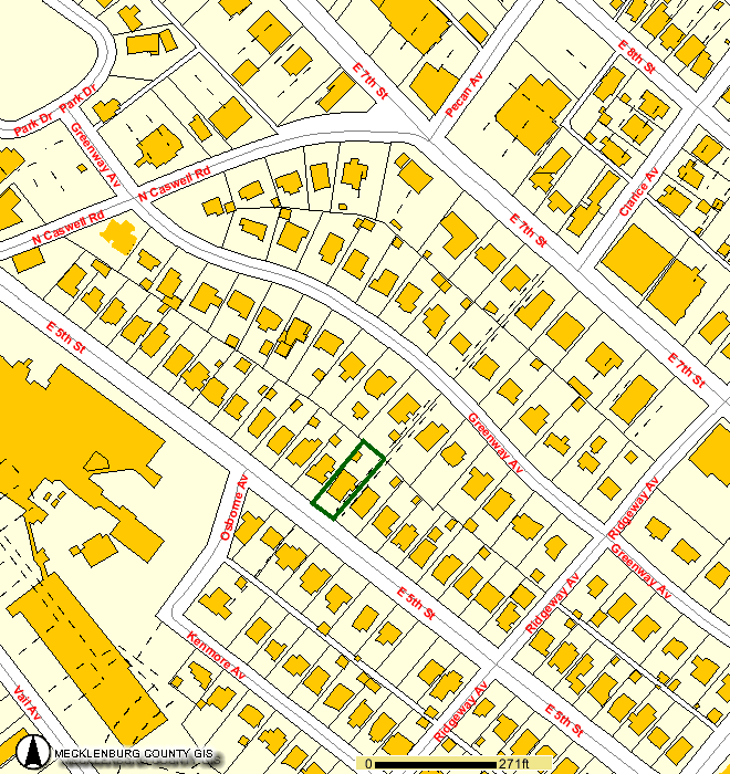
1. Name and location of the property: The property known as the Old Charlotte Supply Company Building is located at 500 South Mint Street, in Charlotte, North Carolina.

2. Name, address, and telephone number of the present owner and occupant of the property: The present owners of the property are:

Charlotte Supply Partners
P.O. Box 35566
Charlotte, NC 28235

Telephone: Not Listed

3. Representative photograph of the property: This report contains a representative photograph of the property.

4. A map depicting the location of the property: This report contains a map which depicts the location of the property.

5. Current Deed Book Reference to the property: The most recent deed to this property is listed in Mecklenburg County Deed Book 4593 at page 607. The Tax Parcel Number of the property is 077-123-08.

6. A brief historical sketch of the property: This report contains a brief historical sketch of the property prepared by Dr. William H. Huffman.

7. A brief architectural description of the property: This report contains an architectural description of the property prepared by Odell Associates, Inc.

8. Documentation of why and in what ways the property meets the criteria set forth in N.C.G.S. 160A-399.4:


a. Special significance in terms of its history, architecture, and/or cultural importance: The Commission judges that the property known as the Old Charlotte Supply Company Building does possess special significance in terms of Charlotte-Mecklenburg. The Commission bases its judgment on the following considerations: 1) D. A. Tompkins, famous New South prophet, founder of the Charlotte Observer, and leading industrialist, was one of the founders of the Charlotte Supply Company 2) the Charlotte Supply Company, founded in November, 1889, was a manifestation for over seventy years of the importance of the textile industry in Charlotte-Mecklenburg; 3) the current building, designed by Lockwood, Greene and Company and completed in November, 1923, is an especially fine example of industrial and warehouse construction in the 1920s; and 4) the recent conversion of the Charlotte Supply Company building into offices has adhered to the highest standards of sensitive preservation and adaptive reuse.

b. Integrity of design, setting, workmanship, materials, feeling and/or association: The Commission contends that the attached architectural description by Odell Associates, Inc. demonstrates that the Old Charlotte Supply Company Building meets this criterion.

9. Ad Valorem Tax Appraisal: The Commission is aware that designation would allow the owner to apply for an automatic deferral of 50% of the Ad Valorem taxes on all or any portion of the property which becomes “historic property.” The current appraised value of the one acre of land is $60,980. The current appraised value of the building is $95,200. The total current appraised value is $156,180. The property is zoned I3.

Date of Preparation of this report: September 6, 1983

Prepared by: Dr. Dan L. Morrill, Director
Charlotte-Mecklenburg Historic Properties Commission
218 North Tryon Street
Charlotte, North Carolina 28202

Telephone: (704) 376-9115


Historical Overview


For eighty-six years, the Charlotte Supply Company played an active role in the business and industrial life of Charlotte and the Carolinas, and the building which bears its name is one of the few monuments left in the city to an industry that caused the region and the city to flourish as part of the economic growth of the New South. Although there is very little information available about the economic history of Charlotte and the corporate records of Charlotte Supply are no longer extant, a general picture of the company’s role in the regional economy may be drawn.

The growth of Charlotte from a rural village in 1850 to a thriving center of the Southern textile industry by the end of the century was the result of several factors: its locale in the cotton-producing region, the development of rail transportation, the availability of power, low taxation and cheap labor. Starting in 1852, when Charlotte was linked by rail with Columbia, SC, giving it easy access to the sea for the first time, and followed in 1855 by completion of a line to Norfolk, the city became a cotton trading center. By 1875, when Charlotte was connected to many of the surrounding cotton-producing counties by rail as well as being located on the line stretching from New York to New Orleans, cotton trading had increased from less than three thousand bales annually twenty years before, to 40,000 bales that year. It was not too long afterwards that a quickening interest in the industrial potential of the New South gathered momentum, and by 1880 a number of textile mills built in the Piedmont crescent from Virginia to Alabama, with Charlotte in the center, were already operating. In 1880, the South had just over a half million spindles operating, but by 1900, this number had jumped to four and a half million, and ten years later it was 11.2 million. Although the battle cry was to move the cotton mills from New England closer to the source of supply, the fact is that the Southern mills were, even in 1922, eighty-four percent owned by Southern capital, and it was-only after that time when large amounts of northern capital moved into the region and the New England mills suffered great decline. Many individuals, however, who were trained in textile manufacturing in the north, came south during this period to take advantage of the tremendous growth of the industry here. Such was the case of those who founded and built up the Charlotte Supply Company.

Charlotte’s first cotton mill, and the only one in Mecklenburg County at the time, was built in 1880. Originally operating 6240 spindles which was eventually increased to 9000 in the one-story building, the Charlotte Cotton Mills was founded by J. M. Dates (1829-1897) and his three nephews, all of whom were cotton traders in the city.5 In 1882, a thirty-year-old native of South Carolina who had been educated and trained in manufacturing in the North, Daniel Augustus Tompkins (1852-1914), came to Charlotte as a representative of the Westinghouse Company to sell textile machinery. Recognizing the great potential for textile development in the region, in 1884 he started the D. A. Tompkins Company, a machine shop, contracting and consulting engineering firm, which was greatly responsible for the growth of textile manufacturing and related businesses in the Piedmont Carolinas. In his thirty-two year career in Charlotte, Tompkins, a tireless advocate of Southern industrialization, constructed over one hundred cotton mills, various fertilizer works, electric light plants and ginneries. He transformed the cotton oil of the region from a waste product to a major industry by building about two hundred processing plants and helping to organize the Southern Cotton Oil Company.6

Tompkins, who was instrumental in establishing textile schools at North Carolina State University, South Carolina and Mississippi, was interested in every phase of the textile business. Thus in 1889, when the D. A. Tompkins Company completed Charlotte’s second, third and fourth cotton mills (the Alpha, Ada and Victor), he was also involved in establishing the Charlotte Supply Company.7 On November 7, 1889, the Charlotte Supply Company was incorporated by E. A. Smith, D. A. Tompkins and R. M. Miller, Jr., who were the sole subscribers of the 250 shares of stock with par value of one hundred dollars.8 The D. A. Tompkins Company interest in the new “mill furnishers” corporation is clear, since R. M. Miller, Jr. (1856-1925) was also the secretary-treasurer of Tompkins’ firm. (Tompkins also built and headed Charlotte’s sixth mill, the Atherton, in 1893, and Miller was president of the city’s tenth, the Elizabeth Cotton Mill, in 1901).

The president of the new mill supply company, Edward Arthur Smith (1862-1933), was a native of Baltimore, Maryland, who came to Charlotte as a young man to be the traveling representative for Thomas K. Carey and Son, an industrial supply firm of Baltimore. Located at 20-22 East Fourth Street in Charlotte, the company advertised itself as “general cotton mill furnishers, manufacturers of leather belting, dealers in machinery, machinist’s tools, etc.” Indeed, for most of its years of operation, it was the intention of the company to be able to supply a textile mill with every piece of equipment, machinery, tools, belts and replacement parts, large or small, which would be necessary for its operation. Since the textile machines of the time were belt-driven, manufacturing leather belts also provided a steady source of sales.

By 1900, mill growth in the several-county area around Charlotte had progressed rapidly to provide customers for the supply company. In North Carolina, Gaston County had 32 mills; Alamance County, 23; Guilford, 10; and Mecklenburg, 19 (the city of Charlotte held eight of these); but even greater growth was yet to come.12 In that year, Smith, Tompkins and Miller sold the supply company to three natives of Warren, RI, and Smith subsequently built the Chadwick Mill in Charlotte (1901), another in Rhodhiss, NC in 1910, and the Phoenix Mill in Kings Mountain, NC five years later. The new president and principal stockholder was now Henry C. Clark (1850-1917), the vice-president Jerimiah Goff (1858-1931) and the secretary-treasurer was Henry Walter Eddy (1857-1932). As a youth of nineteen, Clark began his textile career in the card room of the Warren Manufacturing Company, where he eventually advanced to superintendent of the 100,000-spindle mill. In the early 1890s, he took a position with Brown Brothers of Providence, RI, for which firm he traveled extensively in the South for several years. A few years later, he was one of the organizers of the Standard Mill Supply in Providence, and in 1899 was elected mayor of Warren. The following year he sold his business interests and resigned the office of mayor to move to Charlotte, where he ran the Charlotte Supply Company for seventeen years.

In 1914, the Certificate of Incorporation was amended to reflect some changes in the structure of the company. The length of existence of the business was changed from thirty to sixty years, and the amount of authorized capital stock was raised from 250 to 1250, which remained at the same par value. The outstanding shares were distributed as follows: H. C. Clark, 143 shares; E. B. Graham, Sr., the new vice-president, 60 shares; and H. W. Eddy, 47 shares.16 The greatly increased stock authorization was designed to raise money for an expanding business to meet the needs of the ever-growing textile plants in the Piedmont. Before the expansion plans could be fully carried out, however, H. C. Clark died in 1917, and was succeeded as president by his son, Albert Barton Clark (1892-1945), who had moved to Charlotte with his parents in 1900, and attended Alabama Presbyterian College.17

Just two and one-half years after taking over the leadership of the firm, A. B. Clark started to move ahead with plans for expansion. On January 10, 1920, the company purchased a corner parcel of land in Charlotte’s Third Ward which had 150 feet frontage on Mint Street and went back 350 feet on West First Street to the Southern Railway tracks.18 The large engineering firm of Lockwood, Greene and Company (which also had offices in Atlanta, Chicago, New York, Detroit, Cleveland, Montreal and Paris) was engaged to design a new five-story building for the mill supply company, and the plans and specifications for it were completed in November, 1923.19

The following February, 1924, the contract for construction was let to the Charlotte firm of Blythe and Isenhour (John F. Blythe and William L. Isenhour, Sr.) for a concrete and brick building with 21-inch thick walls of five stories and measuring 40 by 150 feet at the base. It was estimated to cost $65,000.00. Construction of the new place of business took a year, and was completed in March, 1925. The formal opening of the new building, where leather belts were manufactured on the fourth floor, parts and machinery were warehoused on the other floors, and offices were located in front of the first floor, was modestly announced in a newspaper advertisement offering its services to the public. Undoubtedly it had long been announced to its mill customers in person. From the time of its original construction and continuing to the present, the Charlotte Supply Company building has dominated the Third Ward landscape of Charlotte in its immediate four-block square area, which is still the case today.

The decision to build a new building was a sound one at the time, given the state of the industry in the region. A boost to the building of new mills came in the 1880s with the use of steam boilers to run the machinery instead of relying purely on water power, and with the introduction of electric motors in the 1890s. In 1905, James B. Duke, the tobacco magnate, and an engineer, William S. Lee, organized the Southern Power Company (later Duke Power Co.), and by 1925, this dynamic power source had ten hydroelectric stations along the Catawba-Wateree River system which supplied electricity for three hundred cotton mills as well as many cities and towns of the Piedmont Carolinas. The result of similar developments elsewhere and new inventions in the industry caused the number of spindles in the South to jump from 4.4 to 17.3 million, an increase of 293 percent, from 1900 to 1925.23 As can be seen from figure 1, in 1925 Charlotte was in the center of a dense concentration of the Southern textile industry, and therefore the Charlotte Supply Company was in an advantageous geographical position with good rail transportation.

By the time the Charlotte Supply Building was built in 1925, the days of rapid expansion in the textile industry were over, but the Southern mills fared much better than those in the North because of the advantage in the cost of labor. Between 1923 and 1933, New England lost forty percent of its mills and over half of its laborers, while in the South textile employment rose seventeen percent.24 Thus through the leveling off period in the Twenties and the Great Depression of the Thirties, the Southern mills continued to operate for the most part, if sometimes at a lower level. World War II and the postwar boom brought a tremendous demand for textile goods which lasted until relatively recent times when the industry was faced with increasing foreign competition.25

Although no sales figures are available, one can assume that the fortunes of the Charlotte Supply company rose and fell with those of the industry as a whole. When A. B. Clark retired from the presidency of the company in 1942, he was succeeded by Eugene B. Graham, Sr. (1874-1947), who had, as mentioned earlier, joined the company in 1914. When Graham died five years later, he was followed as head of Charlotte Supply by another longtime employee, Palmer G. Black (1882-1976). Without doubt, the long tenure with the company of Graham and Black contributed greatly to its success. Black began his sixty-two-year-long service with Charlotte Supply in 1908 as a “drummer,” or outside salesman of mill supplies. For all of those years until his retirement in 1970 at the age of eighty-seven, he made weekly visits to industrial plants, primarily textile mills, in the Piedmont region of North Carolina. In the early days, he would take the train from Charlotte to such towns as Lincolnton, Newton, Conover, Hickory, Rhodhiss, Granite Falls, Hudson and Lenoir; for the outlying towns it was necessary to hire a wagon and team by the day. Once the automobile became a reliable means of transportation, he mostly counted on Buicks and Packards to take him on his rounds, but the first one was a Dodge purchased in 1918.

Much of Palmer Black’s long-lived success was due to his personality. He was known for his steady, genteel manner which incorporated unfailing common sense and a fine sense of humor. His unusual memory carried the company’s entire inventory, and he carefully cultivated the friendship of the machinists, purchasing agents and top executives of all the plants he visited in the Piedmont. This familiarity and experience with his products and his customers paid off to the extent that there were some years when Palmer Black was responsible for about half of the company’s sales, in addition to earning him and his company great respect throughout the industry in the region.

When Palmer Black became president of the company in 1947, he continued his duties as outside salesman, and four of E. B. Graham, Sr.’s children constituted the remaining operating officers: E. B. Graham, Jr. (1897-1970), vice-president and manager; Thomas P. Graham, vice-president; Robert G. Graham (1912-1982), secretary; William A. Graham, treasurer. The business operated under this structure until 1969 when it was bought out by Arthur Gould Odell, Jr., who heads the Charlotte architectural firm of Odell Associates. Shortly thereafter, Palmer Black and E. B. Graham, Jr. retired from the business, and a new firm was set up under the name of Graham Supply Company under the direction of Robert and William Graham. Under this arrangement, Charlotte Supply continued to own the building and provided the new company with inventory finance service, but in December, 1971, Charlotte Supply was reactivated as a mill supplier and the Graham company liquidated. In June, 1975, all the inventory of Charlotte Supply Company was sold to the Atlas Supply Company, a Winston-Salem firm with a branch office in Charlotte.30 Thereby almost nine decades of a business tradition in the textile industry of the Piedmont Carolinas came to an end. The company itself continued on with auto leasing, downtown parking and printing interests until recently.

In recent months, the Charlotte Supply Company building has been renovated and adapted for office space. The work was carefully done to preserve it in as nearly original condition as possible, the thus a landmark, which at one time was symbolized by the word “Charlotte” painted on its roof so that airplanes flying overhead could identify the city, will be preserved as part of the heritage unique to the region.31


NOTES

1 LeGette Blythe and Charles Brockman, Hornet’s Nest: the Story of Charlotte and Mecklenburg County (Charlotte: McNally of Charlotte, 1961), p. 21.

2 Beasley and Emerson’s Charlotte Directory for 1875-76 (Charlotte: Beasley and Emerson, 1876?), p. 141.

3 Gilbert Merrill and Alfred Macormac, American Cotton Handbook, 2nd ed. (New York: Textile Book Publishers, 1949), p. 23.

4 George B. Tindall, The Emergence of the New South (New Orleans: Louisiana State University Press, 1967), p. 76.

5 Charlotte Observer, Dec. 28, 1897, p. 6.

6 George T. Winston, A Builder of the New South: Being the Story of the Life Work of Daniel Augustus Tompkins (Garden City, N.Y.: Doubleday, 1920), passim.

7 Dan Morrill, “A Survey of Cotton Mills in Charlotte,” Charlotte Mecklenburg Historic Properties Commission, 1979, p. 2.

8 Mecklenburg County Corporation Book A, p. 146.

9 Morrill, p. 3.

10 Charlotte Observer, May 1, 1933, p. 1.

11 Charlotte City Directory, 1897/98, p. 149.

12 Holland Thompson, From the Cotton Field to the Cotton Mill (Freeport, N.Y.: Books for Libraries Press, 1971), p. 76.

13 See note 10.

14 Charlotte City Directory, 1902, p. 236.

15 Charlotte Observer, June 17, 1917, p. 11.

16 Certificate of Amendment, Secretary of State’s Office, Raleigh, NC.

17 Charlotte News, June 13, 1945, p. 1B. No further information on A. B. Clark has been uncovered.

18 Mecklenburg County Deed Book 419, p. 102.

19 Plans and specifications in possession of Odell Associates, Charlotte, NC.

20 Records of Blythe and Isenhour, Charlotte, NC; City of Charlotte Building Permit No. 5000 dated March 3, 1924.

21 Records of Blythe and Isenhour. Actual cost was $54,576.31.

22 Charlotte Observer, March 15, 1925, p 11D.

23Merrill and Macormac, pp. 26, 28; Tindall, p. 74.

24 Tindall, p. 78.

25 Ibid., p. 78 et passim.

26 Charlotte City Directory, 1934, p. 140; Ibid., 1942, p. 162; Charlotte News, March 8, 1971, p. 1B; Hickory Daily Record, January 23, 1970, p. (?).

27 Interview with David Black, Charlotte, NC, 6 April 1982.

28 Charlotte City Directory, 1948/9, p. 152.

29 Interview with Wayne Beachum, President of Charlotte Supply 1978-80, controller, Odell Associates, 31 March 1982.

30 Ibid.

31 Interview with William A. Graham, Charlotte, NC, 3 April 1982.


Architectural Description


Odell Associates, Inc.

The Charlotte Supply Company Building, with its entrance on South Mint Street yet its principal facade facing West First Street, is a four story (plus basement) brick building measuring forty feet on its east front and west rear elevations and 127 feet along its north and south side elevations. While the building was constructed as the offices, manufacturing facility, and warehouse for the Charlotte Supply Company the industrial function of the structure is enlivened with a program of classical ornament and balance symmetrical proportion which provides the building a handsome impressive appearance. The north elevation parallel to West First Street received the principal focus of the designer’s talents and would appear to have been designed to impress both the pedestrian and others traveling along NC 16, West Trade Street–the principal east-west artery out of downtown Charlotte. When erected, the building towered above its neighbors and continues to be a landmark in the near downtown landscape of Charlotte’s Third Ward.

The Charlotte Supply Company Building was designed by Lockwood, Greene, and Company Engineers who for some time maintained an office in Charlotte in the Piedmont Building in addition to offices in Atlanta, Chicago, New York, Detroit, Cleveland, Montreal and Paris. Prints of the original drawings, dated 16 November, 1923 to 16 April 1924 together with construction specifications are in the possession of Odell Associates, Inc., architects for the present owners of the building. These prints consist of Sheets A-201 (Site Plan, Foundation Plan, Basement Floor Plan), A-202 (Plans of First, Second, Third and Fourth Floors), A-203 (Building Sections and Stair Section), A-204 (Elevations and Wall Section), C-201 (Power and Light Wiring Plans) plus numerous multisized and multiscale drawings of details and shop drawing.

The building rests on a full basement covered with concrete having a skim coat finish. The grade of the lot on which the building was erected slopes to such an extent that the first story front east entrance is at street level while the entrance into the basement at the back of the building is also at ground level. There are windows along the north and west sides in the basement wall.

The east front elevation has a symmetrical three bay division with the first story being taller than the three stories above. It can be interpreted as the base in the three part division of the classical column–the base, shaft, and the capital which was often used as the organizing device for the composition of elevations on commercial architectural forms in the late 19th century and to the present. The entrance is set in the center bay below a full transom. The large window openings to either side are slightly taller, however, the projecting vertical elements on the lintel band–representing keystones-above the openings carry at the top of the first story elevation–and along the side elevation-and serves as the base for the shallow three-story brick pilasters which rise to the cornice band at the top of the fourth story defining the three bays. These pilasters have a soldier row at the top whose form is repeated along the top and bottom of the large window openings. At the windows the soldier rows act as a self surround for the openings.

All the window openings have terra cotta sills. The glazing in the openings appears as one window unit but appear to be a pair of units four panes wide and five panes tall. The panes measure twelve inches in width and eighteen inches in height. The bottom two ranks of panes are fixed. The two center panes in the third and fourth rows form an element which pivots for ventilation; a pull chain and spring catch on the interior operates them. The top rank of panes per panel is also fixed.

The definition of the bays on the front elevation and their finish is repeated in the east. Most bays on both side elevations which serve as cantons for the front elevation and in the case of the bay on the north elevation, it is but one of the two framing elements enclosing the broad facade. The entablature continuing across the front elevation, the north side elevation and the east most bay of the south elevation consists of a terra cotta architrave across the top of the pilasters, a brick frieze and a terra cotta cornice. A shallow brick parapet capped by a terra cotta coping carries along the top of the cornice and breaks upward above the entrance on the front elevation. As noted above, the north side elevation is the most elaborate and boasts the name of the company “THE CHARLOTTE SUPPLY COMPANY” in bronze letters in a terra cotta panel–nine bays wide–which is set into the entablature’s brick frieze. The tall vertical panel seen on the first story bays of the east elevation is repeated in the canton-like bay, however, the remaining ten bays of the first story repeat the size and glazing of the front elevations’ other windows being eight panes across and five panes in height. On the shaft of the cantons (the end bays), the second, third and fourth stories have the same size openings and glazing; however, in the nine center bays of each story are long horizontal window strips eight panes wide and but two high. The tops of these openings are level with the tops of the larger openings and in elevation this horizontality is reinforced by the terra cotta panel in the frieze.

The south elevation is largely blind and broken pilaster strips responding to those on the opposite elevation. A flue stack rises above the parapet along the elevation in the back center of the elevation and is flanked on the west by window openings at each level which provide light into the interior stair well. In the eighth bay (from the front of the building) the wall continues above the parapet line to form a clearing for the elevator in the shaft behind this bay. Window openings occur in the third and fourth story level of this bay. There are three (total) additional random openings in the ninth and tenth bays.

The rear (west) elevation maintains the same pilaster spacing from the first floor to the top of the parapet wall of the front (east) elevation, but without the brick and terra cotta ornamentation. Windows in the second, third and fourth floors are identical to those in the front (east) elevation. Windows at the first floor in the middle bay and northernmost bay are identical to those on the north elevation first floor for ten bays from the west end. The southernmost bay of the first floor is solid to cover the concrete vault behind it. The basement level has a window in the center bay and pairs of doors in the northernmost and southernmost bays which served as truck dock service doors.

The interior of perimeter walls are exposed but painted brick. The structure consisting of pipe columns, steel beams and wood mill deck is entirely exposed. Light fixtures are pendant mounted from the wood deck as is the sprinkler system. The finished floor is 1″ wide maple flooring except in the basement where it is concrete. The tenant for the renovated project is requiring carpet floor covering.


Charlotte Streetcar No. 85

Charlotte Streetcar No. 85


This report was written on October 9, 1989

Click here to watch the move of Charlotte’s Streetcar #85 on October 9, 2014.


NOTE: There have been significant developments in the status of the Charlotte Trolley since this report was written. For more recent information, see the end of this report for links to other streetcar-related areas of the Charlotte-Mecklenburg Historic Landmarks Commission site.


1. Name and location of the property: The property known as the Charlotte Trolley is temporarily located at the rear of Discovery Place in Uptown Charlotte.

2. Name, address and telephone number of the present owner of the property: The owner of the property is:

Charlotte Mecklenburg Historic Landmarks Commission
1225 South Caldwell St. Box D
Charlotte, N.C. 28203

Telephone: (704) 376-9115

3. Representative photographs of the property: This report contains representative photographs of the property.

4. A map depicting the location of the property: Because the trolley is a piece of moving equipment, it is not appropriate that this report should contain a map depicting its location.

5. Current Deed Book Reference to the property: There is no deed recorded on this property.

6. A brief historical sketch of the property: This report contains a brief historical sketch of the property prepared by John W. Hancock.

7. A brief architectural description of the property: This report contains a brief physical description of the property prepared by Dr. Dan L. Morrill

8. Documentation of how and in what ways the property meets the criteria for designation set forth in N.C.G.S. 160A-400.5:


a. Special significance in terms of its historical, prehistorical, architectural, or cultural importance: The Commission judges that the property known as the Charlotte Trolley does possess special significance in terms of Charlotte-Mecklenburg. The Commission bases its judgment on the following considerations: 1) the Charlotte Trolley is the only restorable, known remnant of Charlotte’s trolley fleet, which played a decisive role in the physical evolution of this community; and 2) the Charlotte Trolley, when fully restored and placed in service, will enhance the historic image of Uptown Charlotte.

b. Integrity of design, setting, workmanship, materials, feeling and/or association: The Commission contends that the physical description by Dr. Dan L. Morrill which is included in this report demonstrates that the essential form of the Charlotte Trolley meets this criterion.

9. Ad Valorem Tax Appraisal: The Commission is aware that designation would allow the owner to apply for an automatic deferral of 50% of the Ad Valorem taxes on all or any portion of the property which becomes a “historic landmark.” The Charlotte Trolley has no current Ad Valorem Tax value placed upon it.

Date of Preparation of this Report: October 9, 1989

Prepared by: Dr. Dan L. Morrill
Charlotte-Mecklenburg Historic Landmarks Commission
1225 S. Caldwell St. Box D
Charlotte, N.C., 28203

Telephone: 704/376-9115


Historical Overview


John W. Hancock

The history of the electric streetcar currently being restored behind Charlotte’s Discovery Place begins with the foresight of a well-known former Charlottean – Edward Dilworth Latta. It was E.D. Latta’s Charlotte Consolidated Construction Company (created by Latta and five associates and known locally as the Four Cs) which purchased the existing horse-drawn cars from the city of Charlotte in late 1890 and contracted with the Edison Electric Company in February 1891 to install new electric trolley lines. 1


Edward Dilworth Latta

A subsidiary, the Charlotte Railway Company, was formed by these progressive late nineteenth-century developers to manage the new streetcar system. At 3:00 p.m. on May 18, 1891 the first electric streetcar departed from Charlotte’s Square at the intersection of Trade and Tryon and headed toward the recently-created suburb of Dilworth. 2 A new era of transportation had dawned in a New South city.

On January 1, 1910 the Southern Power Company (predecessor of the Duke Power Company) entered into contract with E.D. Latta, president of the Four Cs, to purchase the Charlotte Railway Company at cost plus 6%. 3 A writer in the Southern Public Utilities Magazine metaphorically hailed the electric streetcar as providing the essential “blood” of the expanding suburbs. 4 The Southern Power Company, and its successor, Duke Power Company, successfully operated and managed Charlotte’s streetcar system until its eventual demise.

Advances in technology would eventually render Charlotte’s electric streetcar system inefficient and obsolete. On November 15, 1937 Duke Power Company and the City of Charlotte applied to the North Carolina Utilities Commission for authority to substitute motor buses in place of electric streetcars in and around the city of Charlotte. 5 City Council member J. S. Nance argued that such a substitution would be “one of the most progressive moves that Charlotte has made in quite a long time.” 6 City attorney Basil M. Boyd called it “one of the biggest and the finest things that has perhaps ever happened to the City of Charlotte” and said he did not know of “a single individual in the City of Charlotte who has voiced any objection to the proposed change.” 7 The new motor buses were more flexible, safer and quieter than the outmoded streetcars. On March 14, 1938 streetcar number 85 traveled what was now a nostalgic trip from Presbyterian Hospital through downtown, stopping at the Square for a special ceremony, and continuing to its last stop at the South Boulevard car barn. 8 The era of the electric streetcar in Charlotte was officially over.

Most streetcars were simply scrapped. An internal Duke Power Company memo dated November 28, 1938 documents five streetcars (total value $5000), along with thirty six streetcar bodies (total value $2940), to be salvaged. 9 This would account for most of the Charlotte fleet, which varied between forty and forty-five cars. Some streetcars, however, were to continue serving, but in different capacities. Some of the older model cars were sold to enterprising cafe owners who converted them into dining cars and others were to continue life as cottages. 10 The known history of the streetcar currently being restored in Charlotte lends itself to both of these historical alternatives.

During the week of November 2, 1987 Mecklenburg county planners Carl Flick and Sandra Albrecht were mapping land use on David Street on the southern edge of Huntersville, N.C. Flick, a native of Philadelphia, Pa., which has the largest trolley system in the United States, spotted something at the end of the street. “It appeared to be some kind of diner,” he recalled. 11 Flick called Dan Morrill, consulting director of the Charlotte-Mecklenburg Historic Properties Commission, with news of his discovery.

Flick’s on-the-spot historical analysis proved to be accurate. The streetcar found on David Street had, indeed, been used as a diner/concession stand near Huntersville at Caldwell Station, N.C., which is located on Highway 115 approximately one-half mile north of the intersection of Highway 73 and 115. Many area residents recollected the streetcar concession stand. Edith Brown and Mrs. W. R. Hager of Huntersville remember seeing the streetcar at Caldwell Station during the 1940s. 12 Interestingly, none of those interviewed remembered actually eating at the streetcar concession stand. A possible explanation for this was provided by another long-time Huntersville resident, Mrs. Leggett Blythe. Mrs. Blythe recalled that gypsies often inhabited the land where the streetcar sat, and her parents, undoubtedly like many others, forbade her to stop or patronize the concession stand. 11

The name of the first resourceful owner of the streetcar concession stand has not been established. Duke Power Company archival records do not indicate individual streetcar sales when the fleet was disbanded in 1938. There are no remaining McLeod Trucking Company business records for the period prior to 1950. Mr. Jay Mumpower of Charlotte, a retired rigger for the McLeod Trucking and Rigging Company, recalls hauling several streetcars from the Duke Power car barn on South Boulevard to local sites, but does not specifically recall moving a streetcar to Caldwell Station. A land deed search revealed that the land at Caldwell citation where the streetcar sat was respectively owned during the 1940s by a Mary Wilson, G. D. Moody and a J. N. Barker, but the 1969 telephone book holds no listings for these names and none of the area residents interviewed recognized these names when mentioned. 14

The history of the streetcar after its use as a concession stand is clearer. Daisy Mae Trapp Moore of Huntersville estimates buying the streetcar from its Caldwell Station owners twenty-five to thirty years ago and paying approximately $125 – $150 for it. 15 While she does not recall the exact date of her purchase, an October 28, 1951 Charlotte Observer newspaper, found stuffed behind the paneling as insulation when the streetcar was found in 1987, may provide some evidence as to the date Mrs. Moore bought the streetcar and moved it to David Street in Huntersville. Mrs. Moore originally used the streetcar as housing for some relatives who were down on their luck and Mrs. Moore’s brothers, who were carpenters, renovated the inside of the streetcar to make it habitable. The newspaper’s 1951 date roughly coincides with Mrs. Moore’s recollection of buying the streetcar approximately thirty years ago.

When the streetcar was found in November 1987, it was being used by Mrs. Moore as a rental property. Clay Thompson, a backhoe operator for McCall Brothers, had lived in the streetcar house since the early 1970’s. 16 Shortly before the streetcar was found by Flick, the county had condemned the streetcar house because it had no indoor plumbing.

On April 12, 1988 in Contract of Sale was made between Daisy Mae Trapp Moore and the Emergency Properties Fund of the Charlotte Mecklenburg Historic Properties Commission to sell the streetcar to the Commission for $1000. 17 McLeod Trucking and Rigging Company of Charlotte donated its services and transported the streetcar on a flatbed truck to Charlotte on Friday May 6, 1988.

The streetcar currently resides behind Discovery Place in downtown Charlotte and in the capable hands of professional restorer David Lathrop. While Lathrop has not found any direct evidence of the streetcar being one from the Charlotte fleet, he has found important physical evidence which closely correlates the car to those used in Charlotte during the 1920s. Surviving pictures of Charlotte streetcars of this era closely match the car being restored. Undercarriage components manufactured by the J. G. Brill Company of Philadelphia are the same style as those used by the Perley Thomas Car Company of High Point, North Carolina, the builder of many Charlotte streetcars. Also, the close proximity of the streetcar when found, less than fifteen miles from downtown Charlotte, lends credence to the car as being an original Charlotte streetcar.

Dan Morrill and Bill Huffman of the Charlotte Mecklenburg Historic Properties Commission estimate it will cost $250,000 to make the streetcar operable once again. 18 A fundraising drive is currently underway to raise the necessary money. Charlotte Trolley Inc., a private non-profit organization, wants to operate the streetcar on the abandoned Norfolk and Southern rail line between the ninety-three year old Seaboard station on 12th Street to Dilworth, a distance of about 1.3 miles.

It would be a fitting tribute to the early visionaries of Charlotte, such as E.D. Latta and others, to have a streetcar clambering once again along Charlotte’s streets, headed toward Dilworth almost a full century after the first streetcar left the Square. Perhaps the crowds would turn out amid much hoopla, as they did in May 1891, to usher in the restoration of an important part of Charlotte’s history.


Notes

1 Morrill, Dan. “Edward Dilworth Latta and the Charlotte Consolidated Construction Company (1890-1925): Builders of a New South City. ” North Carolina Historical Review. Volume LXIII, Number 3, July 1985, p.297.

2 Charlotte News May 23, 1891.

3 Letter from H. W. Anderson, President of Archival Consultant, Inc. Winston-Salem, N.C. to Marilyn Usher, Charlotte, N.C. January 10, 1987.

4 “Parable of Transportation.” Southern Public Utilities Magazine. April 18, 1918, p. 1.

5 Docket no. 1128. Courtroom of Utilities Commission. Raleigh, North Carolina. November 15, 1937, p. 1.

6 Nance, J. S. Docket no. 1128. Courtroom of Utilities Commission. Raleigh, North Carolina. November 15, 1937, p. 9.

7 Boyd, Basil M. Docket no. 1128. Courtroom of Utilities Commission. Raleigh, North Carolina. November 15, 1937, p. 5.

8 Charlotte Observer, March 14, 1938.

9 Folder A-842. Duke Power Company Archives. Charlotte, N.C.

10 Charlotte News, January 7, 1938.

11 Charlotte Observer. November 10, 1987.

12 Interview conducted with Edith Brown at White Hall Retirement Homes, Huntersville, N.C. September 14, 1989.

13 Telephone interview conducted with Mrs. W. R. Hager of Huntersville, N.C. September 22, 1989.

14 Land Deed search conducted at Mecklenburg County Tax Office, 720 East Trade St., Charlotte, N.C. September 22, 1989.

15 Interview of Daisy Mae Trapp Moore conducted by Bill Huffman of the Charlotte Mecklenburg Historic Properties Commission. April 10, 1988.

16 Charlotte Observer, November 10, 1987.

17 Contract of Sale. Mecklenburg County, N.C. Pursuant to N.C. Gen. Stat. 160A-399.3

18 Charlotte Observer. May 7, 1988.


Physical Description


Dr. Dan L. Morrill
Professor of History, University of North Carolina at Charlotte
October 9, 1989

When located in 1987 at the end of David St. in Huntersville, the Charlotte trolley or electric streetcar was in a deteriorated condition. Customarily, when an electric company such as Duke Power placed its streetcars up for sale, it would remove the trucks, motors, control systems, and all interior features, including the seats, so that the car could be more easily transported. Such was the case with the Charlotte Trolley. Also, because the trolley had served as a residence for many years, a panel had been removed from the center of one side, providing a opening for the front door, and a small wooden addition, containing a kitchen, had been placed at one end of the car, and a door of the trolley itself had been removed to provide easy access into this space.

Documentary evidence demonstrates that the Charlotte trolley was constructed by the Perley Thomas Car Company of High Point, N.C., most likely in the late 1910’s. The J. G. Brill Company of Philadelphia, Pa., manufactured the mechanical systems. It is a double-truck, double-ended car, originally with flip-over wooden seats. Unfortunately, the original wooden ceiling and floor were not salvageable, nor were the bumpers, the car ends or the knee braces. Happily, the great majority of the main body was restorable, and a major portion of the time spent to date has been devoted to refurbishing the body, including sandblasting and putting the prime layers of paint on the car. Also, new bumpers, knee braces, and car ends, replicating the originals, have been fashioned and are in process of being placed on the car. A new, beaded board ceiling has been constructed on the car, as has a magnificent, red oak floor. When completed, the Charlotte trolley will have reproduction flip-over wooden seats, vintage mechanical gear, and will be carry its original “South Public Utilities Company” insignia.


Treloar, William House

WILLIAM TRELOAR HOUSE
mcneil-paper-co-warehouse-013

This report was written on July 3, 1984

1. Name and location of the property: The property known as the William Treloar House is located at 328 N. Brevard St. in Charlotte, NC.

2. Name, address and telephone number of the present owner of the property:

Dora M. Dellinger (Mrs. S. W.)
1127 Balling Rd.
Charlotte, NC 28207

Telephone: (704) 375-4628

3. Representative photographs of the property: This report contains representative photographs of the property.

4. A map depicting the location of the property: This report contains a map which depicts the location of the property.

treloar-map

5. Current Deed Book Reference to the property: The most recent conveyance of this property was accomplished by will, not a deed. The Tax Parcel Number of the property is: 080-051-16.

6. A brief historical sketch of the property: This report contains a brief historical sketch of the property prepared by Dr. William H. Huffman, Ph.D.

7. A brief architectural description of the property: This report contains an architectural description of the property prepared by Ms. Lisa A. Stamper.

8. Documentation of why and in what ways the property meets the criteria set forth in N.C.G.S. 160A-399.4:


a. Special significance in terms of its history, architecture, and/or cultural importance: The Commission judges that the property known as the William Treloar House does possess special significance in terms of Charlotte-Mecklenburg. The Commission bases its judgment on the following considerations: 1) the original owner, William Treloar (1825-1894), a native of Cornwall, England, and, therefore, initially attracted to this region because of the gold mines, established himself as a leading businessman of this community; 2) the Treloar House is a rare remnant of the Old First Ward neighborhood; and 3) the Treloar House is one of only two examples of “row house” architecture that survive in the central business district of Charlotte.

b. Integrity of design, setting, workmanship, materials, feeling, and/or association: The Commission contends that the attached architectural description by Ms. Lisa A. Stamper demonstrates that the William Treloar House meets this criterion.

9. Ad Valorem Tax Appraisal: The Commission is aware that designation would allow the owner to apply for an automatic deferral of 50% of the Ad Valorem taxes on all or any portion of the property which becomes “historic property.” The current appraised value of the .295 acres of land is $25,740. The current appraised value of the improvements is $54,420. The total current appraised value is $80,160. The property is zoned B3.

Date of Preparation of this Report: July 3, 1984

Prepared by: Dr. Dan L. Morrill
Charlotte-Mecklenburg Historic Properties Commission
1225 S. Caldwell St.
Charlotte, NC 28203

Historical Overview

williamtreloarhse001

Dr. William H. Huffman

The legacy of William Treloar (1825-1894) to Charlotte’s First Ward is the home he built for his family at the southeastern corner of Brevard and Seventh Streets. It is a distinct reflection of the prosperity and expansiveness of the life of the English native, and shows as well the taste and style of a very rare large house surviving from the 1880’s in the area.

Born in Cornwall, England, Mr. Treloar emigrated to the United States in 1844 at the age of nineteen. His port of arrival was Charleston, but after a brief stay he came to Stanly County, where he engaged in mining. About a year later, July 10, 1845, he was married to a native of the county who was born near New London, Julia Franklin Crowell (1829-1906). At this time, the gold mines of this area were quite active, and William Treloar eventually acquired interests in Gold Hill, Rowan County, Pioneer Mills in Cabarrus, and the Ray Mine in Mecklenburg. In addition to these interests, he also conducted a general merchandising business in Salisbury, then in Charlotte.

After moving to Charlotte in the 1850’s, the very successful entrepreneur acquired the Central Hotel, one of Charlotte’s largest, on the first block of South Tryon Street. He also owned the row of store buildings just opposite, which used to be known as Granite Row, and were, in the 1850’s and early 1860’s, called Treloar’s Hall. When the Civil War broke out, Treloar sold the Central Hotel to Miles Wriston, and Granite Row to the Rock Island Company, packed up his family and moved north to Philadelphia, where he went into the boot and shoe business. This was another line of business he had pursued both in Charlotte and Salisbury.

About sixteen years after the end of the war, in 1881 or 1882, the Treloars returned to the South, where William again became interested in mining in Cabarrus County. Five years later, they returned to Charlotte, where they decided to build a large home on North Brevard Street.1 Thus February 13, 1886, a lot for that purpose was purchased in Julia F. Treloar’s name from the Trustees of the Charlotte Baptist Church at the southeast corner of Brevard and Seventh Streets. It was common practice for businessmen to have their residence property in their wives’ names, presumably to protect it from foreclosure due to business losses. The site had been occupied by the Charlotte Baptist Church, now First Baptist.

The Treloars built their large house, which was completed about 1887, to accommodate any of their thirteen children and their spouses who cared to live with them, as well as to be a place fit to show Mr. Treloar’s success in the world. From the City Directories, however, it appears that only four or the children and one husband shared the house with William and Julia Treloar, the rest having married and moved to other parts of the country.

In 1894, at the age of sixty-nine, William Treloar died after a brief bout with pneumonia. His widow Julia remained in the house with an invalid son, Benjamin Franklin Treloar (1859-1908), daughters Louisa Treloar and Julia Treloar Smith (1861-1951), and son-in-law John R. Smith, a traveling salesman. The next year after her husband’s death, Mrs. Treloar deeded the northern side of the house and that half of the corner property to her daughter, Julia Treloar Smith (the property line went through the middle of a brick wall dividing the two sides), for her exclusive use.5

At her own death in 1906, Mrs. Treloar willed the remaining half of the house and property to her children in common, but it was to be kept for the exclusive use of Benjamin Franklin Treloar while he lived.6 Two years later, in 1908, B. F. Treloar died, and the following year, Julia Treloar Smith petitioned the Superior Court to be permitted, as executrix of her mother’s estate, to sell the southern portion of the property to pay expenses, and divide the rest among the heirs. Thus on November 12, 1909, Samuel Lawson Smith (1867-1937), who was apparently not related to John R. Smith, bought the southern half of the house and lot at a court house auction for $4625.50.8 A year and a half later, in 1911, S. L. Smith sold his part of the property to Julia Treloar Smith, who now had possession of both sides of the double house and all the lot. This did not end Samuel Smith’s association with the Treloar house, however, because shortly afterward he married Julia Treloar Smith, whose husband had left a number of years earlier.10

S. L. Smith, a cotton broker and secretary-treasurer of the Merchant and Farmer’s Bonded Warehouse, and his wife Julia occupied the house through the remainder of the Teens, the Twenties and into the early Thirties. Unfortunately, the disastrous effects of the Great Depression caused them to lose the family home, for in January, 1929, they mortgaged the house for five thousand dollars, presumably for business capital, and in September, 1934, the house was sold to W. O. and Ilse Potter on a foreclosure sale.12 For the next thirteen years, the house was rented to various tenants, many of them mill and warehouse workers, until it was bought in 1947 by Steve (d. 1969) and Dora Dellinger, who leased it to Charlotte Auto Parts Company until recently.13

Though modified somewhat to accommodate a business, the Treloar house remains an unusual and stately presence in a part of town that has nothing like it in the immediate area, which is now mostly parking and warehouses. It is a distinct reminder of an era now long past by a hundred years, but it should continue to be a vital part of First Ward in the city, linking future development with a sense of where we have been.


NOTES
1 Charlotte News, January 16, 1894, p. 1; Charlotte Observer, January 17, 1894, p.3; Ibid., November 19, 1906, p.7.

2 Deed Book 60, p.317, 13 February 1886, $2500.00.

3 See note 1; Charlotte City Directories, 1889-1906.

4 Ibid.

5 Deed Book 104, p.592, 18 June 1895.

6 Will Book O, p.500, probated 6 December 1909.

7 Orders and Decrees, Book 13, p.563, 19 May 1909.

8 Deed Book 254, p.570, 3 December 1909.

9 Deed Book 276, p.220, 5 May 1911.

10 Charlotte City Directories, 1912-1935; see note 7.

11 Ibid.

12 Deed Book 733, p.l88, 5 January 1929; Deed Book 858, p.83, 15 September 1934.

13 Charlotte City Directories, 1935-1975; Deed Book 1228, p.23, 7 January 1947.

treloarwilliamhse004


Architectural Description


Lisa A. Stamper

Located on the southern corner of Seventh and N. Brevard Streets, the Treloar House is one of only two surviving examples of “row house” architecture in Charlotte’s central city. Built in c. 1887 of brick, wood, and stone, it is one of the ten surviving homes in what was once a fine Victorian residential district street. This Victorian two-story double home exhibits beautiful Renaissance Revival ornamentation. Much of the Victorian character of the home is still present despite a first-level storefront placed in the front facade in the late 1940s.

The Treloar House is a rectangular building with a steep-sided mansard roof with small decorative gables. Beautiful decorative slate roofing is found on the majority of the mansard roof. The shallow sloped top portion is not intended to be seen, therefore, less expensive roofing material is found on that portion. The gables are complete with pendanted collar braces and decorated collar beams. The prominent eaves of the roof are molded. On the rear side of the roof a metal addition was placed on the tripped part of the roof. Two chimneys on the rear of the roof are side by side, one of which continues down the exterior of the basic facade. On the top of the roof, fancy ventilators longitudinally flank a central flagpole.

The dual-residential nature of the original building was emphasized in the building’s front facade. Rusticated stone blocks were placed vertically in the brick pilasters on both ends of the facade. Another pilaster with identical stone block decoration was located directly in the middle of the facade, dividing it visually into two units. Eighteen blocks started at the ground level and continued up to brick corbelling not far below the eaves. The bottom portion of the middle pilaster was taken out to accommodate the mid-twentieth century storefront, leaving only seven blocks. The middle pilaster had two ornate brackets between the corbelling and the eaves. It is likely that identical brackets were also present on the corner pilasters. The stone blocks, plus the appearance of two identical houses placed side by side gave the house a very strong vertical feeling, which was a common Victorian feature.

Evidence of four-arched openings in the front facade can be seen upon close inspection of the storefront. Four arches can be seen above it as well as where the symmetrically placed openings have been bricked up. Today the storefront has a central double door. Flanking this door are two large, three-sectioned windows. Two concrete steps lead up to the doorway. Metal awnings cover the windows and door.

The upper level windows of the front facade reflect the Renaissance Revival styles. There exist four symmetrically-placed windows on the second-floor; two windows are placed on each side of the center pilaster. They are tall and thin double-hung windows with simple sills and elaborate cast iron Italianate window heads in excellent condition. One small squarish window is located under each front facade gable. These also have simple sills and are a common feature of the Renaissance Revival.

Both the northeast and the southwest sides of the Treloar House were identical. Presently, an addition covers much of the first-level on the southwest facade. A wooden second-level rectangular bay window is located underneath each gable closest to the back-end of the house. Each bay window has Stick Style trim with X braces plus diagonal and vertical siding. Each also as three windows, one facing the front and one facing each side. They are arched windows made of wood with glass in the upper half only.

On the Seventh Street side there are a total of eleven slightly-arched windows (not including the bay window). Six windows are located on the first-level and five are on the second-level. All these windows are bricked sills except for the first-level window nearest to the front, which has a concrete sill. On the first-level, all the windows are bricked up except for the first-level window nearest to the front. On the second level, the window nearest to the backend is about one-half the size of the others and has a more rounded arch. Although not all are of the same shape nor symmetrically placed, the windows are definitely ordered The first four second-story windows from the front are lined up with the first four first-story windows. The other two first-story windows are placed under the bay window. The narrowest second-level window is placed near the back-end of the house. Two-course brick corbelling runs along arches over the window openings. The corbelling appears to continue behind the bay window and along the back-end of the house.

The rear of the house is difficult to see since another addition was placed on the back and other stores were added on adjacent lots. The rear of the house is almost totally blocked from view by a rear addition and stores built on adjacent lots. The back facade contains two slightly arched second-level windows which are considerably smaller than most of the other windows. A long, rectangular sign is located under the corbelling along the back and also cuts across the windows.

The two commercial additions are of brick and concrete blocks and are one-story high. They are rectangular in shape with flat roofs. One was built on the southwest side of the house and the other was added onto the rear. The sides of the additions which face the streets are constructed with brick while the rest of the structures are mace with concrete blocks. The southwest side addition was built as a separate store and has its own door, window, and metal awning. From the late 1940s to the late 1970s the Charlotte Auto Parts Co. used the house as a store and the side addition as a machine shop. It appears as if the addition to the rear of the house was built to expand the building for warehouse storage use. The present use for the house is storage for two different companies.

The Treloar House appears to have been painted at one time. The woodwork at the gables arch eaves, the ornamental winding heads, and the window sills have been painted white. The brickwork and additions were painted brick red. The stone blocks of the front facade were left natural.

An interior wall about the same thickness as the exterior walls was removed to make room for the storefront and business. This wall divided the house into two identical homes. According to the present owner, Mrs. S. W. Dellinger, other major changes have been made to the interior.

The area containing the Treloar House is now zoned for commercial use. Charlotte historian Mary Pratt has found evidence that Brevard Street was once a highly respected residential street. The Treloar double home is two blocks from prestigious Old First Baptist Church (now Spirit Square) and an easy walk from the central business district. Today the area is composed of mostly vacant lots and a few commercial and warehouse buildings. The Treloar House is one of only three houses left on Brevard Street today. The recent renovations of Spirit Square, First United Presbyterian Church along with the proposed rehabilitation of the Philip Carey Warehouse and the Old Little Rock AME Zion Church Afro-American Cultural Center all nearby on Seventh Street, may stimulate reuse of this important reminder of Charlotte’s Victorian residential past.


Trolley Walk

TROLLEY WALK
This report was written on January 10, 1993

trolleywalk005

1. Name and location of the property: The property known as the Trolley Walk connects East Fifth Street and East Seventh Street, at the junction of Clarice Avenue and Seventh Street, in the Elizabeth neighborhood of Charlotte, Mecklenburg County, North Carolina.

2. Name, address, and telephone number of the present owner of the properties. The owners of the property are:

William G. Staton
2113 East Fifth Street
Charlotte, North Carolina 28204 (Tax Parcel Number 127-047-16)

Lynn Andrew Teague and William Henry Curtis
2117 East Fifth Street
Charlotte, North Carolina 28204
(Tax Parcel Number 127-047-17)

Ellen Rubenstein
2062 Greenway Avenue
Charlotte, North Carolina 28204
(Tax Parcel Number 127-047-31)
Baxter T. McRae, Jr.
2100 Greenway Avenue
Charlotte, North Carolina 28204
(Tax Parcel Number 127-047-30)

Jacqueline Levister
2061 Greenway Avenue
Charlotte, North Carolina 28204
(Tax Parcel Number 127-046-15)

G. Howard Webb
1300 Queens Road
Apartment 418
Charlotte, North Carolina 28207
(2101 Greenway Avenue)
(Tax Parcel Number 127-046-16)

D.P.R. Associates
2036 East Seventh Street
Charlotte, North Carolina 28204
(Tax Parcel Number 127-046-26)

K & C Investments
131 Providence Road
Charlotte, North Carolina 28207
(2100 East Seventh Street)
(Tax Parcel Number 127-046-25)

3. Representative photographs of the property: This report contains representative photographs of the property.

4. Maps depicting the location of the property: This report contains maps which depict the location of the property.

trolley-walk

5. Current deed book references to the properties: There is no tax parcel number for the Trolley Walk, which is owned by all adjacent property owners. Tax Parcel Number 127-047-16 is listed in Mecklenburg County Deed Book 6819 at page 151. Tax Parcel Number 127-047-17 is listed in Mecklenburg County Deed Book 4022 at page 520. Tax Parcel Number 127-047-31 is listed in Mecklenburg County Deed Book 5608 at page 368. Tax Parcel Number 127-04730 is listed in Mecklenburg County Deed Book 7221 at page 345. Tax Parcel Number 127-046-15 is listed in Mecklenburg County Deed Book 4030 at page 148. Tax Parcel Number 127-046-16 is listed in Mecklenburg County Deed Book 3115 at page 459. Tax Parcel Number 127-046-26 is listed in Mecklenburg County Deed Book 4365 at page 489. Tax Parcel Number 127-046-25 is listed in Mecklenburg County Deed Book 4593 at page 689.

6. A brief historical sketch of the property: This report contains a brief historical sketch of the property prepared by Frances P. Alexander.

7. A brief architectural description of the property: This report contains brief architectural description of the property prepared by Frances P. Alexander.

8. Documentation of why and in what ways the properties meet criteria for designation set forth in N.C.G.S. 160A-400.5:


a. Special significance in terms of history, architecture, and cultural importance: The Commission judges that the property known as the Trolley Walk property does possess special significance in terms of Charlotte and Mecklenburg County. The Commission bases its judgement on the following considerations: 1) the Trolley Walk was designed ca. 1913 and is one of the original features of the Rosemont subdivision of Elizabeth; 2) the Trolley Walk is one of the few remnants of the streetcar system which spurred suburban development in Charlotte during the early twentieth century; and 3) the walk, with the surrounding early twentieth century housing, clearly illustrate such residential development in the early streetcar suburbs.

b. Integrity of design, setting, workmanship, materials, feeling, and association: The Commission contends that the architectural description by Frances P. Alexander included in this report demonstrates that the Trolley Walk property meet this criterion.

9. Ad Valorem Tax Appraisal: The Commission is aware that designation would allow the owners to apply for an automatic deferral of 50% of the Ad Valorem taxes on all or any portion of the properties which become designated historic landmarks. The current appraised value of the improvements to the Trolley Walk and adjacent properties is $471,410.00. The current appraised value of the Trolley Walk and adjacent properties, Tax Parcel Numbers 127-04716; 127-047-17; 127-047-31; 127-047-30; 127-04-15; 127-046-16; 127-04-26; and 127-046-25, is $626,280.00. The total appraised value of the Trolley Walk and adjacent properties is $1,097,690.00. Tax Parcel Numbers 127-047-16; 127-04717; 127-047-31; 127-047-30; 127-046-15; 127-046-16 are zoned R5. Tax Parcel Numbers 127-046-26 and 127-046-25 are zoned 02.

Date of Preparation of this Report: January 10, 1993

Prepared by: Frances P. Alexander, M.A.
Charlotte-Mecklenburg Historic Landmarks Commission
P.O. Box 35434
Charlotte, North Carolina 28235

(704) 376-9115


Architectural Description


Location and Site Description

The Trolley Walk is located in the Elizabeth neighborhood, an early twentieth century streetcar suburb, of Charlotte, North Carolina. Specifically, the Trolley Walk extends from the west side of East Seventh Street, at the point where Clarice Avenue and East Seventh Street meet, through the middle of the block to Greenway Avenue. From the west side of Greenway Avenue, the walk runs to the east side of East Fifth Street where the path terminates. Along its course, the trolley walk is bounded by early twentieth century residential development, including apartment houses, two-unit dwellings, and single family houses. The proposed designation includes the walkway between East Fifth Street and East Seventh Street.

Architectural Description

The Trolley Walk is a sidewalk, constructed of concrete slabs, which is wide enough to accommodate two lanes of pedestrian traffic. Extending through the center of two city blocks, the walkway is on grade for most of its route, connecting with the public sidewalks along East Seventh Street and Greenway Avenue. However, the walkway ends at concrete steps which lead down to the public sidewalk at East Fifth Street. The Trolley Walk is bordered by residential properties. Two adjoining properties, an apartment house on Seventh Street and a two-unit house on Greenway Avenue, have walkways which connect with the Trolley Walk. In other sections of its path, the Trolley Walk is hedge-lined.


Historical Overview


The Trolley Walk was constructed in the Elizabeth neighborhood, an early streetcar suburb in Charlotte. Elizabeth was developed quickly, but incrementally, in five stages. The first development in Elizabeth was Highland Park, begun in 1891 by the realty company associated with the Highland Mills. Highland Park was located along Elizabeth Avenue, the eastern extension of East Trade Street, near the present location of Central Piedmont Community College. In 1897, the Highland Park Land Company, under the direction of Walter S. Alexander, donated land for a Lutheran College, named Elizabeth College, and the surrounding area soon became known as Elizabeth Hill. At the same time, Elizabeth Avenue was platted as a boulevard, and five years later, in 1903, the East Trade Street electric streetcar line was extended to the college. Begun in 1887, horsedrawn and muledrawn streetcar service in Charlotte already included an established route to what was then the future location of Elizabeth College from West Trade Street at the Richmond and Danville Railway, later the Southern Railway, crossing. The electric trolley network, which began service in March 1891, was expanded over the next 25 years, and by 1903 reached Elizabeth College (Blythe and Brockmann 1961: 264). With the extension of streetcar lines along Elizabeth Avenue, Hawthorne Lane, and Seventh Street, residential subdivision activity quickly followed as reliable and frequent streetcar service provided easy access to the commercial and business centers downtown. By 1907, the boundaries of the city were expanded to include the early rings of suburban development found in Highland Park to the southeast and Dilworth to the south (Hanchett 1984: 7).

In 1900, Piedmont Park, between Central Avenue and Seventh Street, was platted as the second subdivision within the Elizabeth neighborhood. By 1903, Oakhurst, which straddled the main line of the Southern Railroad in the vicinity of the Plaza, Hawthorne Lane, and Central Avenue, was developed to encompass both factory sites as well as residential properties. With trolley service from downtown along Central Avenue and the northern section of Hawthorne Lane through Villa Heights, Central Avenue quickly became a fashionable address. The fourth subdivision within Elizabeth, Elizabeth Heights, was centered around Independence Park, which was built beginning in 1904 as the first municipal public park. Construction in Elizabeth Heights began in 1904 and also included the area between Seventh Street and the present Seaboard Railroad, which had streetcar access along Seventh Street.

The Trolley Walk was built in the Rosemont subdivision, the final phase of construction in Elizabeth and the area farthest from the downtown business district. Rosemont was platted on the former Henry C. Dotger farm which extended roughly from Caswell Road to Briar Creek. Development plans were begun in 1913 for what was initially called Dotger Estates, or alternately, the Pines (Hanchett 1984: 20). The Trolley Walk appears to have been a unique feature of the initial plan (ca. 1913), and the developer intended the Trolley Walk to be a publicly owned right-of-way. However, the city never accepted ownership, and the walk is now owned by adjacent property owners (Pressley 1993). In 1915, Dotger sold his farmland to the newly formed Rosemont Company, comprised of George Watts and Gilbert White of Durham and C.B. Bryant, W.S. Lee, Z.V. Taylor, E.C. Marshall, and Cameron Morrison of Charlotte. The following year, the company hired noted planner, John Nolen of Boston, to design Rosemont. However, little of Nolen’s plan for the new subdivision was implemented. In 1918, Gilbert White had sold his portion of the company to Charlotte real estate agent, E.C. Griffith, who also developed Wesley Heights, the west side residential neighborhood, the West Morehead Street industrial district, and Eastover, an affluent suburb on the east side of Charlotte (Blythe and Brockmann 1961: 173). Griffith was largely responsible for the abandonment of Nolen’s plan, evidently for economic reasons. The curvilinear streets proposed by Nolen created oddly configured lots and increased the costs of surveying (Hanchett 1984: 21). As a result, most of the streets of Rosemont were platted in a conventional grid pattern although East Fifth Street followed a curve so as to meet East Seventh Street, one feature of Nolen’s design.

As the name suggests, streetcar suburban development was, in large measure, determined by the routes of the street rail systems (Warner 1978: 46-65). These transportation networks allowed residential development beyond the historical confines of city cores. Prior to the initiation of rapid and frequent street rail service, development had been limited by the distances people could walk from home to places of businesses and commercial activity. Streetcar service created development opportunities, and as Elizabeth illustrates, residential construction for both the wealthy and the middle class usually followed the extension of routes rather quickly.

The geography of streetcar suburbs generally followed similar patterns. In contrast to the automobile-oriented suburbs of the post-World War II era, the streets along which the trolleys ran were often laid out as grand avenues or boulevards and became prime residential locations for the wealthy. During the early years of the twentieth century, this pattern held true in Elizabeth, and many of the elite of Charlotte built impressive houses along Elizabeth Avenue in Highland Park, Hawthorne Lane in Elizabeth Heights, Central Avenue in Piedmont Park. Now associated with heavy traffic and noise, the wide streets served by the trolleys were desirable precisely because of their proximity to the street rail lines. As grand houses were built on the streetcar boulevards, the side streets, farther from trolley paths, were developed for the middle class. Property values and development potential were inextricably tied to the location of this fixed system of trolleys, and areas, located several blocks from the streetcar line, would command lower prices than properties situated directly on the trolley route. Thus, development patterns in streetcar suburbs were less economically segregated than later automobile suburbs, with housing for the middle class, the wealthy, and sometimes the working class, often found within one suburb although development and property values were determined by proximity to the streetcar route (Warner 1978: 65).

The construction of a walkway, such as the Trolley Walk, at the terminus of the streetcar line was designed to make side street property more valuable than it ordinarily would have been. By designing a public pathway, the developers sought to make Fifth Street lots almost as desirable as Seventh Street, along which the trolleys ran. Indeed, in a 1923 advertising pamphlet for Rosemont, Fifth Street lots sold for $1500.00 while Seventh Street property was valued at $2500.00 per lot, which underscores the role of the streetcar in determining land values (Hanchett 1984: 22). Although the Trolley Walk is not solely responsible, it is clear that the houses found on Fifth Street do not differ substantially from Greenway Avenue and Seventh Street and that Rosemont is more thoroughly middle class than earlier subdivisions of Elizabeth. Developed primarily in the 1920s, Rosemont also reflects the explosion in automobile ownership which occurred after World War 1. Throughout the interwar era, expanding automobile use gradually, but effectively, eliminated dependence on streetcars for inter-city transportation. Consequently, residential development patterns changed with the shift in transportation. Particularly for the affluent, automobiles allowed greater freedom in location. With the weakening of fixed transportation routes, residential development became more segregated by income, and suburbanization became more fluid and far-flung. Nonetheless, streetcar service during the 1920s was still necessary for the working and middle classes and continued to play a role in suburban development. Rosemont, as an area of bungalows, small Tudor Revival cottages, duplexes, and small apartment houses strongly reflected this increasingly homogeneous composition as well as a continued reliance on trolley service.

By the late 1930s, however, streetcar use had declined significantly, and Duke Power Company, which owned the electric street rail system ended operations. By the 1950s, the main boulevards, once some of the most valuable residential real estate in Charlotte, had become undesirable because of noise and congestion. Streetcar routes shifted from residential to commercial use in many cases, and demolition, because of zoning, became commonplace. Indeed, the 1960 master plan for Charlotte slated one-half of Elizabeth for razing (Hanchett 1984: 29). In Elizabeth, the changes in transportation and land use patterns has greatly altered the characteristic streetcar suburban patterns, particularly as institutions, such as hospitals and Central Piedmont Community College, now occupy vast areas of the neighborhood. Consequently, elements such as the Trolley Walk remain as one of the few vestiges of the streetcar system that defined the nature of early twentieth century suburban development.

Conclusion

The Trolley Walk specifically illustrates the importance of the streetcars in determining residential development patterns in the early twentieth century. By constructing this walkway from the terminus of the Elizabeth Avenue-Hawthorne Lane-Seventh Street streetcar line at Clarice Avenue, all the lots in the new subdivision of Rosemont were sited within a two block walk of the streetcar. The Trolley Walk thus created higher values for properties not located directly on the streetcar route. In an area which has undergone tremendous alteration, the Trolley Walk, and the early twentieth properties surrounding the pathway, are remarkably intact and vividly illustrate early twentieth century, middle class, suburban construction.


Bibliography
Bishir, Catherine. North Carolina Architecture. Chapel Hill: University, of North Carolina Press, 1990.

Blythe, LeGette and Charles Raven Brockmann. Hornets’ Nest: The Story of Charlotte and Mecklenburg County. Charlotte: McNally of Charlotte, 1961.

Hanchett, Thomas W. Charlotte Neighborhood Surveys: An Architectural Inventory. Volume III: Cherry, Elizabeth, Crescent Heights, and Plaza Midwood. Charlotte-Mecklenburg Historic Properties Commission, November 1984.


Pressley, R.N., Jr., P.E., Director, Charlotte Department of Transportation. Letter to Frances P. Alexander, Charlotte-Mecklenburg Historic Landmarks Commission, March 11, 1993.

Sanborn Fire Insurance Company. Sanborn Fire Insurance Maps, 1929, and 1953.

Warner, Sam Bass, Jr. Streetcar Suburbs. Cambridge: Harvard University Press, 1978.