

2. Name and address of the current owner of the property:
Mecklenburg County
600 East 4th Street
Charlotte, NC
3. Representative photographs of the property: This report contains representative photographs of the property.
4. A map depicting the location of the property: This report contains a map depicting the location of the property.
5. Current deed book reference to the property: The most recent deed to the property is found in Mecklenburg County Deed Book 1044, page 216. The tax parcel number for the property is 67-014-01.
6. A brief historical sketch of the property: This report contains a brief historical sketch of the property prepared by Emily D. Ramsey.
7. A brief physical description of the property: This report contains a brief physical description of the property prepared by Emily D. Ramsey.
8. Documentation of why and in what ways the property meets the criteria for designation set forth in N.C.G.S. 160A-400.5.
3. Located in an increasingly dense area of urban development (now escalating after the completion of nearby Ericsson Stadium), Bryant Park is the only public park and green space remaining in Charlotte’s West Morehead Street industrial sector.
b. Integrity of design, workmanship, materials, feeling, and association.
The Commission contends that the architectural description by Emily D.
Date of Preparation of this Report:
August 1, 2001
Prepared By:
Emily D. Ramsey
745 Georgia Trail
Lincolnton, NC 28092
Statement of Significance
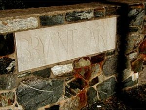
Bryant Park
1701 West Morehead Street
Charlotte, NC
Summary
Bryant Park, begun in 1930 and completed during the height of the Great Depression, is a property that possesses local historic significance as one of Charlotte’s first small-scale public parks, and as a tangible reminder of the early stages of the twentieth century push for public green space within the city. Although Latta Park, Charlotte’s first public park, was completed with much fanfare in the early 1890s, the concept of public recreational and natural green spaces gained acceptance slowly among city officials. Despite the creation of the Charlotte Park and Tree Commission in 1904, in the years between the turn of the century and the end of World War II the city’s parks system continued to rely on the staunch support of Charlotte-Mecklenburg’s private sector, rather than the support and funding of local government. Established on land donated by prominent developer E. C. Griffith, Bryant Park was one of the first projects of the Charlotte Park and Recreation Commission, which replaced the Charlotte Park and Tree Commission in 1927. Independence Park, Latta Park and Revolution Park, established in the years before the Great Depression, were large, sprawling expanses of carefully landscaped natural areas (Revolution Park encompassed over 240 acres), funded in large part by private funds and located outside of the center city area to service newly developed garden suburbs. The creation of Bryant Park in the early years of the Charlotte Park and Recreation Commission heralded a new kind of green space, the small neighborhood park, which would become extremely popular in the boom period after World War II. Although small and minimally landscaped, these parks would provide recreation space for the majority of Charlotte’s residents throughout the twentieth century.

Bryant Park is also significant as the earliest public park established within one of Charlotte’s most prolific industrial sectors, stretching along West Morehead Street. Serviced by a line of the Southern Railroad (which connected Charlotte to the nearby textile center of Gastonia) and connected to center city Charlotte by a newly constructed streetcar line, the area west of Charlotte’s central business district quickly developed into a thriving industrial district. Developers erected rows of working class houses in the Wilmore and Wesley Heights neighborhoods, and working class families flocked to west Charlotte in the early decades of the twentieth century. Bryant Park, located between Wesley Heights and Wilmore, provided west Charlotte residents with green space for a welcome respite from the noise of the factories and with specialized spaces (including a softball field, tennis courts, a volleyball court, and horseshoe pits) for a variety of recreational activities. Although the park has since lost many of these recreational amenities, Bryant Park, with its terraced hillside leading down to a wide expanse of green playing fields, and with its intricate and distinctive stonework, remains an important reminder of the evolution of green space within Charlotte’s urban landscape.Bryant Park’s development began in 1929-1930, but was stymied by the onset of the Great Depression, when public monies became scarce. The park’s construction, which primarily involved the construction of a complex configuration of stone boundary walls, terrace walls and stone seating for the large softball field, was completed during the height of the Great Depression, most likely with funding and labor provided by the Work’s Progress Administration, a federal government agency created by New Deal legislation to give local men and women needed jobs. Although the impact of New Deal work programs in Charlotte were most visible in the few large-scale projects like Memorial Stadium, Bryant Park reflects the influence of Federal programs on the neighborhood level.
Historical Background and Context Statement
The concept of public green space, although fully developed among academic circles and within northern cities by the end of the nineteenth century, did not gain widespread acceptance in New South cities like Charlotte until well into the twentieth century. In the mid-nineteenth century, cemeteries often served double duty as recreational green space, where residents and visitors could go to escape the noise and congestion of the city, and Charlotte continued to use their shady, quiet cemeteries as impromptu parks until the turn of the century . Charlotte had experienced unprecedented economic and physical growth in the last decades of the nineteenth century, yet “the amount of green space within the city . . . remained a constant: Settlers’ and Elmwood cemeteries.”1 Not surprisingly, Charlotte-Mecklenburg’s New South leaders, who had transformed Charlotte from a small farming community into a regionally important cotton trading and textile center, were among the first to grasp the importance of green space as an integral part of the city’s built environment. Entrepreneurs such as Edward Dilworth Latta, George Stephens, and Daniel Augustus Tompkins threw their support behind the concept of public green space by creating impressive, meticulously planned early examples of garden suburbs like Myers Park and Dilworth and neighborhood parks like Latta Park and Independence Park..
Initially, Charlotte seemed ready to embrace full-scale, long term city planning and the development and preservation of green spaces. Inspired by the success of Myers Park, the Charlotte Chamber of Commerce hired John Nolen, Myers Park’s designer, to conduct a civic survey and create a comprehensive city plan to control and direct future growth.2 Despite the city’s initial enthusiasm, Nolen’s ambitious plan for Charlotte’s growth, which included room for parks, lush garden suburbs and a scenic byway, was ultimately rejected by the Chamber, a decision which would affect the evolution of Charlotte-Mecklenburg’s green space for the rest of the century. Without financial support from the city and local government, green space developed only where sufficient private funds existed to pay for it. Not surprisingly, the first park established within the Charlotte area was created by businessman and developer Edward Dilworth Latta. Latta Park, completed in 1890, encompassed over seventy acres in the middle of the newly developed Dilworth neighborhood, but, with its large recreational lake and scenic walkways, it attracted people from all over Charlotte, and created interest in the possibility of green spaces within Charlotte’s center city communities.
Although interest in and demand for public parks grew significantly in the late nineteenth and early twentieth century, Charlotte’s government remained too small and unorganized to take on the responsibility of public green spaces. As historian Brian Sturm writes, Charlotte’s Board of Aldermen “refused to make parks a city priority because of the assumption that recreation was not the business of city government.”3 Once again, private interests came through to support the development of a formal government body devoted to establishing public parks and green spaces. D. A. Tompkins exerted his significant influence with the city, and lobbied tirelessly in favor of public parks in general and, specifically, the development of Independence Park, Charlotte’s first municipal park. Public parks, Tompkins argued, would bring upper and working classes together and were an important part of a productive work environment. “There are working people in our factories,” he told the Board, “who scarcely ever see the green grass, flowing water, and waving trees of the country. The park will afford them these with the few aides of nature we can put out there.”4 Tompkins succeeded, despite the apathetic nature of the board – in 1904, the Charlotte Park and Tree Commission was established, with Independence Park as the commission’s first project.5 After Independence Park’s completion, however, the activity of the Charlotte Park and Tree Commission practically ceased, due to lack of funding. Even with Tompkins serving as chair, the commission failed to create significant green spaces during the early decades of the twentieth century, despite the fact that Charlotte’s economy was booming and public buildings were being constructed at an unprecedented rate.6

In the late 1920s, E. C. Griffith, a prominent local developer and large center city landowner, donated 16 acres of land between the Wilmore and Wesley Heights neighborhoods in the rapidly developing industrial sector of west Charlotte to the Charlotte Park and Recreation Commission.7 The plot of land, named Bryant Park, was slated for development as a small neighborhood recreational center. Work began tentatively in 1930, but the onset of the Great Depression and subsequent shrinking budget forced the Charlotte Park and Recreation Commission to stop work on most of its projects, including Bryant Park.8The push for public green space entered its second stage in the year 1927, when the Charlotte Park and Tree Commission became the Charlotte Park and Recreation Commission. Although the new commission received funds through a small city tax, it remained financially unable to build new parks without the help of private funds. However, with several parcels of land, ranging from over 200 acres to less than ten acres, donated by wealthy local entrepreneurs, the commission began, slowly but surely, establishing parks in Charlotte. Most of these new parks, in contrast to Latta Park, Independence Park, and the recently completed Revolution Park, were mainly small parcels of land developed to serve specific neighborhoods. Bryant Park was among the first of these small neighborhood parks.
Despite the initial complications caused by the severe economic downturn of the late 1920s and early 1930s, the New Deal programs of the Roosevelt administration that came out of the Great Depression proved to be “a boon to parks and recreation” programs across the country. The Charlotte Park and Recreation Commission received Federal funds for a variety of projects, with most of the money and labor coming from the Works Progress Administration (later renamed the Works Projects Administration) and the Civilian Conservation Corps. Although only the biggest of Charlotte’s Federal parks projects, including Memorial Stadium and the city’s first municipal swimming pool, received widespread attention, a variety of small park projects that had been stalled by the economic slowdown were completed with the help of 1930s New Deal work programs. Bryant Park was most likely one of the small park projects to benefit from these Federal programs. The elaborate stonework seen throughout Bryant Park, which created seating for the park’s softball field and circled the perimeter of the park as a network of low walls, is nearly identical to the stonework used in W.P.A. projects across North Carolina, including the stonework in nearby Independence Park, which was completed in part through Federal funding during the 1930s.9 Moreover, the park was completed by the early 1940s, before the 1949 bond initiative that promised to create “a playground within a half-mile of every home” in Charlotte-Mecklenburg, and well before the 1950s boom period for parkland acquisition.10 As one of the earliest small public parks completed in Charlotte, Bryant Park was a model for the dozens of neighborhood parks constructed in the post-war period, and, with its softball field, volleyball and tennis courts, and horseshoe pits, it served as a recreational center for the surrounding Wesley Heights and nearby Wilmore neighborhoods. However, as the Charlotte Mecklenburg Park and Recreation Commission suffered from ongoing lack of funding in the 1960s and 1970s, and as more and more industrial development crowded along the main artery of West Morehead Street in the last half of the twentieth century, Bryant Park lost many of its original recreational spaces. The park today has retained only 6.6 of its original 16 acres, and the only designated recreational space that remains is the centerpiece of Bryant Park, the softball field.

Bryant Park, set among the dense clustering of low brick industrial buildings that line West Morehead Street, is also locally significant as the earliest public park established within one of Charlotte’s most prolific industrial sectors, stretching along West Morehead Street. Serviced by a line of the Southern Railroad (which connected Charlotte to the nearby textile center of Gastonia) and connected to center city Charlotte by a newly constructed streetcar line, the area west of Charlotte’s central business district quickly developed into a thriving industrial district. Prominent businesses such as the Grinnell Company and the Coca-Cola Company built their plants along West Morehead Street Developers such as F. C. Abbott erected rows of working class houses in the Wilmore and Wesley Heights neighborhoods, and working class families flocked to west Charlotte to work and live in the early decades of the twentieth century.11 The construction of Bryant Park in the 1930s reflected the increasing importance of these west Charlotte working class neighborhoods and the industrial economy they supported.Physical Description and Site Context
Bryant Park comprises 6.6 acres of terraced hillside and flat playing field, bound on the north by West Morehead Street, on the west by Suttle Avenue, and on the east by a small creek bed. The main entrance to the park is located on the south end of the property, on the park’s highest elevation, and leads to the most impressive feature of the park – the stone seating for the park’s only remaining recreational space, the softball field. A complex network of steps, walls of varying heights, and wide benches are arranged organically into the steeply sloping hillside, and, from a distance, seem almost to be a natural outcropping. The stone bleachers, like the retaining walls along the terraced hill south of the softball field and the low walls and entrance that line the north side of the park, along West Morehead Street, are made of a thick layer of common stone and rubble faced with more finished granite stones. A shady, steeply sloped area to the west of the softball field is dotted with benches and mature trees. The hilly area and the softball field on the southern end of the park give way to a broad, uninterrupted expanse of green lawn, which stretches north to West Morehead Street. As the only green space located within the industrial sector of west Charlotte, which once provided the residents Wilmore and Wesley Heights with a welcome respite from the noise of the factories and with specialized spaces (including a softball field, tennis courts, a volleyball court, and horseshoe pits) for a variety of recreational activities, and as one of the earliest public parks completed in Charlotte, Bryant Park remains an integral part of the city’s built environment and a visual reminder of the evolution of green space within Charlotte’s urban landscape.
_________________________________
1. Brian W. C. Sturm, “The Evolution of Green Space: A History of Urban Landscape in Charlotte, North Carolina, 1890-1990” (honors thesis, University of North Carolina at Chapel Hill, 2000), 1-2.
2. Thomas W. Hanchett, “Charlotte’s Neighborhood Planning Tradition,” (Charlotte-Mecklenburg Historic Landmarks Commission, 1986), 3.
3. Sturm, 21.
4. The Charlotte Observer, August 2, 1904.
5. The Charlotte Observer, November 8, 1904 and Jun 6, 1905.
6. Ibid.
7. Legette Blythe and Charles R. Brockmann, Hornet’s Nest: The Story of Charlotte and Mecklenburg County (Charlotte, 1961).
8. The Charlotte Observer, February 28, 1950.
9. J. S. Curt, W. A. Cutter, and Thomas Morse, Emergency Relief in North Carolina: A Record of the Development and Activities of the North Carolina Emergency Relief Administration (Raleigh, 1936).
10. Sturm. Clippings from file labeled “Parks and Recreation,” located in the Vertical files of the Robinson Spangler North Carolina Room of the Charlotte Mecklenburg Public Library.
11. Dr. Dan L. Morrill, “Survey and Research Report on the Electric Supply and Equipment Company” (Charlotte Mecklenburg Historic Landmarks Commission).

1. Name and location of the property: The property known as the Walter Brem House is located at 211 East Boulevard, in Charlotte, North Carolina.
2. Name, address and telephone number of the present owner of the property: The present owner of the property is:
Mr. Henry Blume
3601 Kelway Avenue
Charlotte, N.C. 28210
Telephone: 552-6391
3. Representative photographs of the property: This report contains representative photographs of the property.
4. A map depicting the location of the property: This report contains a map which depicts the location of the property.
5. Current Deed Book Reference to the property: The records of the Mecklenburg Tax Office do not contain a current deed book reference to the property. The Tax Parcel Number of the property is: 123-0742.
6. A brief historical sketch of the property: This report contains a brief historical sketch of the property prepared by Dr. William H. Huffman.
7. A brief architectural description of the property: This report contains an architectural description of the property prepared by Lisa A. Stamper.
8. Documentation of why and in what ways the property meets the criteria set forth in N.C.G.S. 160A-399.4:
a. Special significance in terms of its history, architecture, and/or cultural importance: The Commission judges that the property known as the Walter Brem House does possess special significance in terms of Charlotte-Mecklenburg. The Commission bases its judgment on the following considerations: 1) the Walter Brem House, erected in 1902-03, was designed by C. C. Hook, Charlotte’s first permanent resident architect and an architect of local and regional significance; 2) the original owner, Walter Brem, was married to the daughter of Governor Todd Robinson Caldwell, was an early business associate of George Stephens, develop of Piedmont Park and Myers Park, and was an important civic leader in Charlotte until his death in 1925; 3) Mr. R. D. Craver, a subsequent owner, was a pioneer in the motion picture business in the two Carolinas; 4) the Walter Brem House is one of the earliest and grandest examples of the Colonial Revival style in Charlotte; 5) the Walter Brem House is one of the oldest houses on East Boulevard and occupies a strategic townscape position in Dilworth, Charlotte’s first streetcar suburb.
b. Integrity of design, setting, workmanship, materials, feeling and/or association: The Commission contends that the attached architectural description by Miss Lisa A. Stamper demonstrates that the Walter Brem House meets this criterion.
9. Ad Valorem Tax Appraisal: The Commission is aware that designation would allow the owner to apply for an automatic deferral of 50% of the Ad Valorem taxes on all or any portion of the property which becomes “‘historic property.” The current appraised value of the .321 acres of land is $42,000. The current appraised value of the improvements is $55,420. The total current appraised value is $97,420. The property is zoned B1.
Date of Preparation of this Report: July 12, 1983
Prepared by: Dr. Dan L. Morrill, Director
Charlotte-Mecklenburg Historic Properties Commission
218 N. Tryon Street
Charlotte, North Carolina 28202
Telephone: 704/376-9115
Dr. William H. Huffman
August, 1981
In July, 1902, the Charlotte Consolidated Construction Company, otherwise known as the Four C’s, began building one of the early houses on Boulevard East in the new streetcar suburb of Dilworth for Walter and Hannie Caldwell Brem. 1 The Four C’s was organized in 1890 by Edward Dilworth Latta to develop 250 acres of rural land south of the city, the accomplishment of which was facilitated by the opening of Charlotte’s first trolley line from the Square to Latta Park in 1891. The Brems had engaged C. C. Hook, Charlotte’s first resident architect, to design the house. 2 Charles Christian Hook (1870-1938) had settled in Charlotte in 1891 to teach in the Charlotte Graded School at South Boulevard and E. Morehead Streets. His arrival in the same year as the beginning of the Four C’s development of Dilworth resulted in many early commissions for dwellings in that community. Some of the best known structures designed by Hook were the Charlotte City Hall and the James B. Duke mansion. 3

Sketch of the Walter Brem house
from “Some Designs,” a promotional booklet published by Hook & Sawyer Architects ca. 1902
Walter Brem was born in Charlotte July 31, 1849, and was one of the few citizens of the city whose parents were also born in town. He was the son of Col. Thomas H. Brem, commander of Brem’s Battery in the Civil War, and Martha Fox Brem, who descended from the prominent Erwin family of Burke County. Walter Brem, in association with William H. Martin, was at one time the owner of a hardware store at the southeast corner of Trade and Tryon Streets, and, about 1890, went into the insurance business with George S. Stephens, who was a college friend of his son’s from Chapel Hill. In 1902, Mr. Stephens married Sophie Myers, daughter of John Springs Myers, and subsequently developed his father-in-law’s 1200-acre farm into the Myers Park subdivision. Mr. Brem spent the remainder of his business career as head of Walter Brem and Sons, general agents for the Traveler’s Insurance Co. During his life he was actively involved in the Charlotte public school system and the city YMCA. He died at the age of 76 on February 11, 1925. 4
Hannah Caldwell Brem, who was born in Morganton on November 4, 1851 and died in Charlotte April 21, 1931, was the daughter of Governor Todd Robinson Caldwell of Morganton. 5 The Brems had four children: Dr. Walter Brem (a fraternity brother of, and semi-pro ballplayer with George S. Stephens), who practiced medicine in Los Angeles; Todd Robin Brem, Mina Brem (Mrs. Robert A.) Mayer, and Helen Brem (Mrs. R. R.) Beatty, all of Charlotte. In 1903, when they moved into the fine house on Boulevard East (for which they paid $6045.86), the latter three children were still at home, but Mina Brem was married later that same year and no longer lived at the residence. 6 In 1912, the Brems bought a smaller, Queen Anne style house a block to the east of the one they had built, which was constructed eight months after theirs. 7 Their original house was rented briefly and stood vacant for some months before it was sold to Regger D. Craver in 1914 for the consideration of $9000.00. 8
Mr. Craver was a pioneer in the motion picture business in the Carolinas. At one time, he was one of the largest individual theater owners in the South, which included movie houses in the Carolinas and Virginia. In Charlotte, he operated the old Broadway theaters on East Trade and West Trade Streets, and afterward operated the Broadway theater on South Tryon. The Cravers lived on East Boulevard with their four sons, Gilda, R. D., Jr., William and Alton. In 1928, Mr. Craver was stricken and died after a brief illness at the age of 50. He was survived by the children and his wife, the former Bessie Jenkins of Gastonia. 9 Mrs. Craver continued to live in the house after he husband’s death, but apparently could not maintain it when the Great Depression hit with full force, for in 1931, it was sold at a foreclosure sale to the South Atlantic Investment Corp. for $8470.64. 10
Once more the house stood vacant as it changed owners among investors twice in 1932, then went back to the ownership of the South Atlantic Investment Corp. in 1934. 11 In the latter year, the house was rented to Thomas K. Culp, a foreman for the Southern Power and Utility Company, who remained until it was purchased in 1936 by Mrs. Mae King Blume. 12 Mrs. Blume, the widow of John H. Blume, converted the property to the Colonial Apartments, a name which was maintained for many years. 13 In 1936, Mrs. Blume was the proprietor of the Piedmont Hotel, Queen City Hotel, Frances Hotel, Windsor Hotel, Southern Hotel, the Franklin Hotel and the manager of the New Albert Hotel. 14 Mrs. Blume moved to 211 E. Boulevard in 1939, and has lived there to this date. 15
NOTES
1 Charlotte Observer, July 15, 1902, p. 6.
2 Some Designs by Hook and Sawyer, Architects, Charlotte, N.C. (Charlotte: Queen City Printing, 1902, p. 38.
3 “Survey and Research Report on the Seaboard Air Line Railroad Passenger Terminal,” Charlotte Mecklenburg Historic Properties Commission, undated.
4 Charlotte Observer, Feb. 12, 1925, p. 4; Interview with Dr. Walter Brem Mayer, 28 July 1981.
5 Certificate of Death, Book 48, p. 615; Charlotte Observer, Feb. 12, 1925, p. 4.
6 See note 4; Deed Book 173, p. 497, 20 Feb. 1903.
7 The house was built for William G. Crutchfield, who purchased it from the 4 C’s on 13 Oct. 1903. (Deed Bk. 182, p.8) See “Historical Sketch of the Crutchfield House,” by Dr. William H. Huffman, Charlotte-Mecklenburg. Hist. Prop Comm., August, 1981.
8 Charlotte City Directory, 1913, p. 530; 1914, p. 591; Deed Book 327, p. 574, 7 Sept. 1914.
9 Charlotte Observer, Dec. 20, 1928, p. 6.
10 Deed Book 809, p. 487, 14 Nov. 1931.
11 Deed Book 814, p. 593, 28 April 1932; Deed Book 827, p. 49, 25 Oct. 1932; Deed Book 849, p. 266, 20 Feb. 1934.
12 Deed Book 900, p. 467, 9 May 1936.
13 Charlotte City Directory, 1937, p. 776 and subsequent years.
14 Ibid., 1936, p. 105.
15 Ibid., 1939, p. 747.
by Lisa Stamper
Located near the corner of East and South Boulevards, the Walter Brem house still exhibits the grandeur of the fine Colonial Revival homes of the turn of the century. One of Charlotte’s first examples of the style, this magnificent two-story residence was designed by C. C. Hook, a prominent Charlotte architect. When erected in c. 1902-1903, East Boulevard was a fashionable residential street which was the showplace of Dilworth, the city’s first streetcar suburb. The Brem House has been added to over the years, and the original wooden clapboard siding has been covered with white asbestos siding. However, much of its fine detailing remains intact.
Originally, the Brem House was basically a rectangular house with two squarish, small ‘pavilions’ on both front corners. Between the projecting pavilions was a large one-story balconied entry portico. It also had a balconied one-story back porch. Over the years, numerous additions have been made to the back of the house. Also, an addition has been made to each side of the building.
The main portion of the house has a decorative slate tile roof, with a low pitch. It also has two small, symmetrically placed dormers at the front. the dormers are heavily pedimented and have diamond shaped glass panes. The two pavilions have flat roofs with broad bracketed eaves. Originally a wooden balustrade topped these roofs. These balustrades had heavy, paneled corner posts.
The Brem House has four original brick chimneys. Two identical exterior side chimneys bisect the sides of the pavilions. Another chimney is an interior one which is located in the back and off to one side. It was an interior chimney to avoid interference with the back porch design. the first two chimneys mentioned are thin, arcaded stacks with slightly stepped shoulders. The tops of these stacks have five courses of corbelling. These two chimneys have been painted brick red from the ground to the eaves, but have not been painted above the eaves. The interior chimney within the hipped roof is thicker and more square than the side chimneys. However, the five-course corbelled top is the same style. The back chimney is very simple. It is just a thin, rectangular stack without embellishment. New brick can be seen at the top of this chimney; therefore, possibly the top of this chimney once had corbelling like the others.
The composition of the impressive front facade was symmetrical and very well planned. Decorative corner boards on the second level of the wings lightened the second story as well as defined it. The first level was separated from the second level by horizontal wooden coursing. Repetition of the pedimented dormers was created by the pediment window heads of the second-level windows of the wings. On the second level, two more single-paned, double-hung windows were placed below the dormers. The first level of the front facade had for single-paned windows, topped with stained glass rectangular panels. Straight wooden window heads and frames unified the two types of glass. One windows was located in each wing, while the other two flanked the double door. The door was horizontally paneled with glass in its upper portion. Wooden pilasters flanked the door.
The front portico was magnificent. Six symmetrically placed columns held up the portico. These columns, along with the plain entablature, were of the Tuscan Order. Large projecting brackets support the projecting cornice. Its balustrade had six thick, paneled posts that corresponded to the columns below. However, these posts were thinner than those on the pavilions’ balustrades. These posts were topped with urns. Steps lead from the columns up to the porch deck, which extended from pavilion to pavilion. A railing identical in style to the pavilions’ balustrades enclosed the high porch.
Today, the corner boards are gone. One pediment window head is missing. A door has been placed between the two second story windows in the central section to allow access to the top of the portico. An awning covers the doors and windows. The portico’s wooden balustrade has been replaced with a simple, cast iron one. The other balustrades are gone. A side section of one porch was removed and a set of metal stairs was added. However, only one bracket is missing, the rest of the railing is intact, the columns are in excellent condition, the dormers seem unaltered, and the slate tile is still intact.
The sides of the house were identical before the additions were made. It is difficult to discern exactly how many windows were on each side, but it appears to have been six, four on each wing and two on the main portion, near the back. Both the first- and second-story windows were single-paned, double-hung sash. Probably all the windows of the Brem House, and definitely the ones on the sides and front, had dark, louvered shutters. None of these shutters remain on the house today.
The back facade is covered with a hodgepodge of additions, so it is difficult to determine what was once there. To visually balance the asymmetrically placed back chimney, a pediment was located on the back. From an early photograph, a corner of the back porch can be seen. The back porch was not as impressive as the front, but it also had a balustrade complete with urns, wide eaves, Tuscan Order columns, and a surrounding wooden rail. The columns, railing, etc., were removed when the back porch was converted into part of an apartment.
The additions are used as apartments, as is the original house. Some of the additions are two-story and some are one-story. Stairs run wild on the exterior of these additions. The additions have brick foundations, as does the original house. For uniformity, all the brick was painted, and white asbestos siding with wood grain texture was placed on all the additions and the original house.
Inside the Walter Brem House, the original floor plan seems to have been symmetrical, as befitting a Colonial revival style house. Many walls were later added to create apartments, especially on the second level, and original walls are often hard to identify. The first level rooms all have high ceilings, while the second level rooms all have standard height ceilings. All of the original flooring was probably of wood. Much of the original wall molding is intact. The first level original rooms still have their simple, horizontal wooden wainscoting along most of their walls.
The front entry door opens into a small foyer. Another wooden double door with eighteen glass panes (three panes by six panes) in each side opens into what was once the great hall and is currently used as a lobby. Except for a small additional wall at the left back corner, the great hall is practically unaltered. Much of the early paneled wainscoting and wooden chair rails are still intact. A chandelier was recently removed from the middle of the great hall.
The grand stair begins slightly to the left of the foyer, turns to continue up the back wall of the great hall, and turns once more to connect with the second level. Its wooden balustrade, with thick paneled posts resembling those of the exterior balustrades’ posts, is still intact. Also, the same type of wainscoting found on the great hall walls is found on the walls of the grand stair. Large round pendants hang from underneath the stair posts at the ceiling.
A brick mantel is located in front of the stair facing the front door, offset slightly to the right. Brick brackets support a wide wooden shelf. The fireplace is not currently used.
It appears that four doors lead from the sides of the great hall to the remainder of the home. One single eighteen glass-paned door leads to each pavilion room. The other doors lead to the back rooms of the home.
The mantle in the pavilion room to the right is very ornate. The mantle is mainly of wood, with a brick interior and an intricately-detailed solid metal screen. The mantel has flanking wooden stylized Ionic columns plus large brackets supporting the shelf. Egg and dart molding plus fine dentil molding is used freely in the design, as are garland and festoon ornamentation. It may be assumed that the other pavilion’s mantle is also very elaborate and similar in design. Neither of the pavilion fireplaces are currently in use.
The mantle at the back of the house is of very decorative brickwork. In the middle of the upper portion of the mantle a diamond shaped pattern is created with bricks. The upper portion is separated from the lower portion by massive corbelling. Vertical corbelling is also employed as a decorative feature. This is the only fireplace in the house still in use, according to Mr. Trull, resident of approximately 23 years.
East Boulevard runs in front of the Brem House. A driveway runs next to the South Boulevard side of the house and to the rear of the property. The back of the site is used as a small parking lot for residents. The front yard is well kept and landscaped. Boxwood foundation plantings dominate the yard.
Although a good bit of the interior and exterior decoration is missing from the Brem House, enough is still present to justify historic designation. Also, with the aid of an early photograph, copies of which are in the possession of the Charlotte-Mecklenburg Historic Properties Commission, a very accurate restoration could be made.
This grand home sits on the outskirts of Dilworth, in an area which is fighting to keep its historic character despite the insensitive commercial construction which is replacing many of its interesting earlier buildings. However, this area still has many of those turn of the century grand homes which have been beautifully restored and currently house a variety of businesses. The Brem House is currently for sale, and historic designation could save this home from losing all of its historic significance while encouraging buyers who would positively use the house as an asset to the community.
Name and location of the property: The property known as the Bradford Farm and Store is located at 15908 Davidson Concord Road in Huntersville, North Carolina.
Name, address, and telephone number of the current owner of the property:
The current owners of the property are:
House:
Elizabeth Bradford Milsaps
15908 Davidson-Concord Road
Huntersville, NC 28078
Telephone: (704) 875-2587
Store:
Mary Stewart Bost
P.O. Box 1245
Davidson, NC
Representative photographs of the property: This report contains representative photographs of the property.
A map depicting the location of the property: This report contains a map depicting the location of the property.
Current deed reference of the property: The most recent deed to the property found under Tax Parcel Number 007-47-107 is found in Mecklenburg County Deed Book 4887, page 809. The most recent deed to the property found under Tax Parcel Number 011-09-204 is found in Mecklenburg County Deed Book 5803, page 285.
A brief historical sketch of the property: This report contains a brief historical sketch of the property prepared by Emily and Lara Ramsey.
A brief architectural description of the property: This report contains a brief architectural description of the property prepared by Emily and Lara Ramsey.
Documentation of why and in what ways the property meets the criteria for designation set forth in N. C. G. S. 160A-400.5:
Special significance in terms of its history, architecture, and/or cultural importance: The Charlotte-Mecklenburg Historic Landmarks Commission judges that the property known as the Bradford Farm and Store possesses special significance in terms of Charlotte-Mecklenburg. The Commission bases its judgment on the following considerations:
1) The Bradford Farm and Store are tangible reminders of the robust cotton economy that characterized Mecklenburg County in the last half of the nineteenth century.
2) The Bradford Farm and Store served as an integral part of the Ramah Community – in addition to his store, William Bradford ran a cotton gin, a blacksmith shop, and a sawmill on his property. William Bradford also served three terms as county commissioner during the 1910s.
3) The Bradford Farm is a well-preserved example of a sprawling post-Civil War farmstead. The farmhouse itself is an excellent example of a gable-front-and-wing variation of Mecklenburg County’s most popular rural vernacular form—the I-house. The farm complex as a whole characterizes the diverse, self-sufficient nature of life in rural Mecklenburg County during the late nineteenth and early twentieth century.
4) The Bradford Farm contains three unusual examples of early twentieth century concrete construction—the Bradford Store, along with two outbuildings close to the house, all completed in the early to mid-1910s, are rare rural examples of this new building technology in Mecklenburg County.
-
- Integrity of design, setting, workmanship, materials, feeling, and/or association: The Commission judges that the architectural description included in this report demonstrates that the property known as the Bradford Farm and Store meets this criterion.
- Ad Valorem Tax Appraisal: The Commission is aware that designation allows the owner to apply for an automatic deferral of 50% of the ad valorem taxes on all or any portion of the property which becomes a designated “historic landmark.” The total current appraised value of the house ($99,600) and associated five acres of land ($72,000) is $171,600.00. The current appraised value of the store ($4,550) and the associated sixteen and one-half acres ($235,850) is $240,400.
Date of Preparation of this Report:
April 18,2002
Prepared By:
Emily and Lara Ramsey
2436 N. Albany Ave., #1
Chicago, IL 60647
Statement of Significance
William Bradford Farm and Store
Huntersville, NC
Summary
The William Bradford Farm and Store, which flourished in the Ramah Community from the late-nineteenth century through the mid-twentieth century, possess local historic significance as tangible reminders of the robust cotton economy that characterized Mecklenburg County in the last half of the nineteenth century, and as integral parts of the rural farming community that centered around Ramah Presbyterian Church in northwest Mecklenburg County. Although the South’s plantation system of agriculture was destroyed by defeat in the Civil War, Mecklenburg County’s farming communities, made up primarily of small-scale farmers who did not own slaves, recovered quickly in the postwar period. The last half of the nineteenth century was one of the most prosperous times for farmers in the area—innovations in fertilizer and equipment made cotton easy to grow, and Charlotte’s emergence as a regional cotton trading and textile hub made cotton easy to sell. Farmers like William Bradford were able to profit handsomely from this post-war cotton boom. Between 1890 and 1928, Bradford served as the head of a large farmstead situated prominently along the Davidson Concord Road. Although Bradford grew primarily cotton and corn as cash crops, he supplemented this income with several profitable side operations, providing the members of the Ramah Community with a country store, a cotton gin, a blacksmith shop, and a sawmill.
Architecturally, the Bradford farmstead is significant as an excellently preserved example of a turn-of-the-century farm complex. The farmhouse itself, a sprawling Queen Anne-inspired variation on the tradition vernacular I-house form, is a reflection of William Bradford’s success as a farmer, businessman, and politician (he served three terms as a Mecklenburg County commissioner in the 1910s) and a tangible reminder of the family’s prominent position within the Ramah Community. The house and the assortment of outbuildings that remain on the property—including a barn, a smokehouse, several storage and shed buildings, and the store across the street—form a comprehensive farm complex that characterizes the diverse and self-sufficient nature of life in rural Mecklenburg County during the late nineteenth and early twentieth century.
In addition to its significance as a social center and community store, the Bradford Store (completed in 1911) is also architecturally significant as an early example of hand cast concrete block construction in Mecklenburg County. Although concrete block was used as a cheap and durable alternative to wood in small communities throughout the United States between 1900 and 1930, relatively few examples of this early form of concrete block construction survive in rural Mecklenburg County. The unusual collection of cast concrete block outbuildings in the Ramah Community can be attributed to the example set by William Bradford, who built his store and one of his farm outbuildings with the new material, and who most likely sold the blocks (or the machinery to make them) to other nearby farmers.
Agricultural Context and Historical Background Statement
The last half of the nineteenth century was a time of unprecedented development and prosperity for some farmers in Charlotte and Mecklenburg County. Emerging relatively unscathed from years of war, with railroads intact and a strong agrarian population of small farmers who had never relied on slave labor, the city and surrounding farming communities of Mecklenburg County entered a prolonged period of growth spurred by the a postwar boom in cotton prices.1 Notoriously difficult to grow in Mecklenburg County, cotton had never been a particularly profitable crop for the area’s farmers before the war. However, with the introduction of the fertilizer Peruvian guano in 1860, Mecklenburg County farmers were able to grow cotton in unprecedented amounts in the postwar period, just in time to take advantage of skyrocketing prices, especially after the Panic of 1893. Mecklenburg farmers also took advantage of their close proximity to Charlotte, which had emerged by the turn of the century as a vital cotton trading hub and the center of one of the country’s most profitable textile regions.2 These favorable economic and geographical conditions helped to make the period between 1860 and 1910 one of tremendous growth and expansion for successful farmers like William Bradford.
William Bradford was thirty-four when he purchased a parcel of farmland along the Davidson-Concord Road near Ramah Presbyterian Church from S. L. W. Johnson in 1890. He moved, along with his wife Mary and their children, into the modest one-story house already standing on the property and began farming cotton.3 It did not take long for the family to outgrow the house; to accommodate his six small children, William Bradford began work on a major addition to the small farmhouse in the late 1890s. By the turn of the century, the four-room building had been transformed into a spacious two-story farmhouse, which served both as a visible reflection of Bradford’s economic success and as a more fitting centerpiece for what was quickly becoming one of the largest and most prosperous farmsteads in the Ramah Community.
During the early decades of the twentieth century, William Bradford began several business ventures that would make his farm a community center. In 1911, he constructed a one-story general store across the road from his home. Bradford’s Store carried farming equipment, groceries, cloth, livestock, and a host of other provisions. “You could get almost anything at the Bradford Store,” Joe Washam, a lifelong resident of the Ramah Community and owner of the nearby Washam Farm, recalled. “And if they didn’t have, it, they could order it for you.”4 By 1913, Bradford had constructed a cotton gin just behind the store; inspired by its success, he added a blacksmith shop. Farmers could now get their cotton ginned and their horses shod while they bought feed and other supplies; in winter months, they drove in to sit by the big pot bellied stove in the center of store and swap stories.5 William Bradford’s popularity among his peers extended beyond the walls of his store – he was elected and served as county commissioner from 1912 to 1914, and again from 1916 to 1920.6
Although William Bradford and his son, Hurd Grier Bradford, continued to grow cotton, corn, and grain as cash crops along with the rest of the farmers in the Ramah Community, they were constantly undertaking new projects to increase the profitability of their growing farmstead. The Bradfords took up chicken farming (an operation that included more than 10,000 chickens at its peak), built a large, two-story smokehouse that served the community, and started a sawmill in the glen behind the main house (an operation that eventually grew so large that Hurd Grier Bradford had to hire an overseer, John Overcash, to manage it). The Bradford House continued to grow and expand along with the farmstead; by 1928, the year William Bradford sold the farm to his son, Hurd, the farmhouse included two large, gabled rear additions and a wrap-around front porch. Hurd Bradford added a shed-roofed addition to the side of the house in the 1930s.7
Hurd Bradford continued to run the family farmstead, including the store, the cotton gin, the blacksmith shop, and the sawmill, after his father’s death. In the late 1930s, the Works Progress Administration widened and paved Davidson-Concord Road. Hurd Bradford was forced to shorten the front of the store, but he still had room to put in a new gas pump—an amenity that would keep the store in business until the late 1950s.8 The cotton gin, not as important after the Great Depression, burned to the ground in 1945, was rebuilt, and burned again in 1953. Cotton prices continued to fall in the 1930s and 1940s, but the Bradford family, along with several of their neighbors, continued cotton farming until 1965, when the combined effects of the boll weevil and a “killing frost” ruined almost every farmer’s crop. After that, Joe Washam recalled, “most people around here just didn’t plant cotton the next year. You couldn’t make money off it unless you had a cotton picker and at least couple of hundred acres.”9 Hurd Grier Bradford had died several years earlier, in 1959. After the last crop of cotton, his widow moved into Huntersville.10 The house was rented to a series of occupants until the 1970s, when Elizabeth Bradford Milsaps and Hurd Grier Bradford III, great grandchildren of William Bradford, inherited the property. Elizabeth Milsaps moved into the house in 1975, where she continues to reside.
Architectural Significance and Background Statement
Architecturally, the Bradford Farmstead is significant as an extraordinary example of a diverse and profitable turn-of-the-century farm complex, and as a tangible reminder of the wide variety of roles that a farmer could play within his small rural community. The typical farm in late nineteenth and early twentieth century Mecklenburg County was a self-sufficient complex, supporting not only cash crops like corn, cotton and grain, but also a variety of livestock (mainly hogs, cows and chickens) and kitchen gardens for family consumption. The daily operation of the average farm required an array of barns, storage sheds, and other outbuildings in addition to the farmhouse. William Bradford’s farming operations alone necessitated two large barns, a number of large chicken houses, cotton sheds, and even an unusual poured concrete building directly behind the house that served as a large cooling house where the family stored fruits and vegetables. A large farmstead in its own right, the additional buildings that housed William Bradford’s other business ventures (the sawmill, cotton gin, blacksmith shop, and store) made the Bradford Farmstead an exceptional complex. 11 Although not all of the original outbuildings remain – the sawmill is gone, as are the chicken coops (torn down in the 1970s), the cotton gin and blacksmith shop, along with one of the farm’s two barns—the farmstead as it stands today still conveys a sense of the original magnitude of Bradford’s operations, and reflects the self-sufficient nature of life in early-twentieth century Mecklenburg County. In addition, the Bradford Farmstead has retained its original pastoral setting, surrounded by open fields and mature groves of trees.
The Bradford farmhouse itself is significant as the centerpiece of the Bradford Farm and as a representative example of late-nineteenth century rural vernacular architecture in Mecklenburg County. As Sherry Joines-Wyatt writes: ” The period between the close of the Civil War and 1910 was one of rapid development and change,” characteristics that were “expressively shown” through changes and developments in the design and construction of vernacular farmhouses.12 New technologies in mass-production of decorative details, coupled with an ever-expanding network of railroads meant that even the most isolated farmer could easily update the look of his house. By the late 1800s, otherwise modest farmhouses were adorned with scrolled brackets, finials, decorative scrolled eaves, and turned porch details indicative of the wildly popular Victorian style. Although the I-house continued to be the most popular choice for Mecklenburg County farmers, even this conservative form showed subtle signs of Victorian influence—wrap-around porches, irregular plans (most often in an ‘L’ or ‘T’ in plan), and a ‘triple A’ roofline helped to “modernize” the traditional I-house form.13 The Bradford House, a gable-front-and-wing modification of the typical I-house plan, exhibits all of these typical “folk Victorian” features.
Standing across the road from the house, the Bradford Store, which served as a social gathering place for members of the Ramah Community, is also architecturally significant as an early example of hand-cast concrete block construction in rural Mecklenburg County. By the time William Bradford began plans to build his general store around 1910, concrete block had become a relatively popular and widely-used building material—in 1907, over a hundred companies across the United States were producing cast iron hand-tamped concrete block machines. Not only was concrete more durable than wood, it was cheaper, easier to build with and required no specialized labor. Early promoters of concrete block construction claimed that “two men [with no prior experience], one mixing and one tamping, could make some eighty to one hundred blocks a day.”14 William Bradford and his son Hurd Grier Bradford purchased a concrete block machine and set up production across the street. By 1911, the store – a one-story building made primarily of smooth-faced block with rusticated “stone block” corners – was completed. The Bradfords were so impressed with the result, they used concrete block for another small outbuilding close to the main house. The presence of other similar concrete block outbuildings in the area—including the well house at the nearby Washam Farm—suggests that the Bradfords may have made concrete block to sell at their store or loaned their machine to neighbors. A 1997 inventory of Mecklenburg County’s historic rural resources makes no mention of concrete block outbuildings, and the vast majority of the area’s early twentieth century outbuildings listed in the survey are simple frame structures. The Bradfords’ use of concrete block for several of their buildings represents a break in traditional rural construction methods.
Physical Description
The Bradford Farm consists of two parcels of land that stand opposite one another along Davidson-Concord Road. The Bradford Farmhouse and surrounding outbuildings stand on the northern side of the road, on a rectangular parcel of land. The house, a two-story gable-front-and-wing frame structure with a triple-A roofline and original clapboard siding, stands at the front of the parcel. A large hipped roof front porch runs the entire length of the façade. Several later additions extend from the main body of the house. One of two similar gabled rear additions extends from the eastern side of the rear elevation and houses the family kitchen; a small shed addition, built in the 1930s, adds pantry space and a separate entrance onto the eastern side of the kitchen. The second gabled addition extends behind the house’s central hallway, and is connected to the kitchen by what was originally a rear shed porch. The porch was enclosed and turned into a sitting room in the 1990s—the exterior of this addition features aluminum siding and a new brick chimney. The house retains many of its original six-over-six double hung windows, with the exception of paired two-over-two windows on the east elevation, a configuration of three single paned windows on the rear of the 1990s addition, and a one-over-one window (with what may be an original sunburst transom) on the rear of the kitchen. The metal roofing was put into place in 2001. The house’s two original chimneys are simple brick with a corbelled top – the rear chimney is of a similar design. The house has little in the way of exterior decoration for a Victorian era house – a small, rounded design graces the ends of the house’s gables, and simple Doric columns support the porch. The interior of the house retains many of its original features, including hardwood floors, wooden fireplace mantels, wainscoting, board and batten ceilings, and the original staircase (although the newel post has been replaced).
The outbuildings surrounding the Bradford House are all early-to-mid-twentieth century structures; to the west of the house stands a small concrete block building (with blocks identical to those used on the store) built in the 1910s that served until the late 1950s as the residence of the Bradford’s African American farmhand, Rob Billy. Elizabeth Milsaps added the frame rear addition to this tiny structure, which now serves as her studio. A large, two-story unpainted frame storage building and a small frame chicken coop stand behind the studio. Immediately behind the house are the remains of a 1915 poured concrete building that, according to Hurd Grier Bradford III, was used as a large cooling house, where the family would store vegetables and fruits from the kitchen gardens. The family’s two-story frame smokehouse stands behind this cooling house. Beyond the smokehouse, the land slopes downward towards the woods. On the edge of the woods stands the farmstead’s remaining barn, a large, front gable frame structure covered in vertical wood planks and constructed in 1949.
The only building on the complex’s southern parcel, the Bradford Store, stands on
the edge of the road, facing the house. It is a one-story rectangular, front-gabled structure made of plain-faced, hand-cast concrete block with rusticated concrete block corners. The entrance to the building features a pair of wooden doors inset with ten glass panes flanked by large window openings filled with twenty-five fixed glass panes and topped by three transom openings with five panes apiece. The rear (south) elevation features two double-hung, six-over-six windows with large wooden lintels, and a plain wooden entranceway on the east elevation once gave access to the store’s office. A gabled wooden overhang extending off the front of the building provided shelter for customers. The 1930s gas pump has been removed.
The Bradford Farmstead, despite minor alterations and the loss of several outbuildings, retains its integrity as a well-preserved example of a large turn-of-the-century farm complex in Mecklenburg County, an integral part of the Ramah Community in northeast Mecklenburg County, and a tangible reminder of Mecklenburg County’s robust post-Civil War cotton economy. The Bradford Farm and Store, surrounded by pristine cornfields and woodland, both retain their original rural settings in the midst of rapidly expanding commercial and residential development.
1 Thomas Hanchett, “The Growth of Charlotte: A History” (Charlotte-Mecklenburg Historic Landmarks Commission, 1997), www.cmhpf.org.
2 Sherry J. Joines and Dr. Dan Morrill, “Historic Rural Resources in Mecklenburg County, North Carolina” (Charlotte-Mecklenburg Historic Landmarks Commission, 1997), www.cmhpf.org.
3 Eric Lang, “Report on the Bradford House and Store” (unpublished research paper, UNC-Charlotte, 2001), 3-4.
4Emily and Lara Ramsey, interview with Joe Washam conducted January 10, 2002. Hereinafter cited as Washam Interview.
5 Lang, 4.
6 Lang, 2.
7 Emily and Lara Ramsey, interview with Hurd Grier Bradford II, conducted January 11, 2002, hereinafter cited as Bradford interview. Lara Ramsey, interview with Elizabeth Bradford Milsaps, conducted January 13, 2002. Hereinafter cited as Milsaps Interview.
8 Bradford Interview.
9 Washam Interview.
10 Milsaps Interview.
11 Bradford Interview.
12 Joines and Morrill, 4.
13 Ibid.
14Pamela H. Simpson, Cheap, Quick and Easy: Imitative Architectural Materials, 1870-1930 (Knoxville, 1999) 11-15.

1. Name and location of the property: The property known as the Blythe Homestead is located at 16001 Beatties Ford Road, Huntersville, North Carolina.
2. Name, address and telephone number of the present owners of the property: The owners of the property are:
Mr. John C. Blythe and Mrs. Helen Blythe (wife)
16001 Beatties Ford Road
Huntersville, N. C. 28078
Telephone: (704) 875-6568
Tax Parcel Numbers: 001-022-19 and 001-021-03
Miss Christine Blythe
18110 Hwy. 73 West
Huntersville, N. C. 28078
Telephone: (704) 892-0286
Tax Parcel Number: 001-022-01
3. Representative photographs of the property: This report contains representative photographs of the property.
4. A map depicting the location of the property: This report contains maps which depict the location of the property.
5. Current Deed Book Reference to the property: The most recent deed to this property is listed in Mecklenburg County Deed Book 5042 at page 984.
6. A historical sketch of the property: This report contains a brief historical sketch of the property prepared by John C. Blythe, Jr.
7. A brief architectural description of the property: This report contains a brief architectural description of the property prepared by John C. Blythe, Jr., and Nora M. Black.
8. Documentation of why and in what ways the property meets criteria for designation set forth in N.C.G.S. 160A-400.5:
a. Special significance in terms of its history, architecture, and /or cultural importance: The Commission judges that the property known as the Blythe Homestead does possess special significance in terms of Charlotte-Mecklenburg. The Commission bases its judgment on the following consideration: 1) the Blythe Homestead is an intact homestead dating back to the land acquisition by Samuel Blythe in 1772; 2) the house located on the Blythe Homestead is architecturally significant as an intact and finely preserved example of rural, vernacular architecture constructed in the mid-19th century; 3) the setting of the Blythe Homestead with its pastoral vista is a reminder of Mecklenburg County’s farm past; 4) the outbuildings of the Blythe Homestead represent traditional forms and a variety of construction techniques including a log outbuilding; and 5) the Blythe Homestead, still owned by descendants of Samuel Blythe and including the house, outbuildings, and fields, provides valuable insights into life for early settlers and yeomen farmers of Mecklenburg County.
b. Integrity of design, setting, workmanship, materials, feeling. and/or association: The Commission contends that the architectural description by John C. Blythe, Jr., and Nora M. Black included in this report demonstrates that the Blythe Homestead meets this criterion.
9. Ad Valorem Tax Appraisal: The Commission is aware that designation would allow the owners to apply for an automatic deferral of 50% of the Ad Valorem taxes on all or any portion of the property which becomes a designated “historic landmark.” The current appraised value of the improvements is $48,340. The current appraised value of the 21.69 acres is $619,340. The total appraised value of the property is $667,680. The property is zoned RR and R15.
Date of Preparation of this report: 29 April 1991
Prepared by: Dr. Dan L. Morrill, in conjunction with Ms. Nora M. Black
Charlotte-Mecklenburg Historic Landmarks Commission
1225 South Caldwell Street, Box D
Charlotte, North Carolina 28203
Telephone: 704/376-9115
Note: The following historical report was prepared by Mr. John C. Blythe, Jr., under the auspices of members of the Blythe family. The Charlotte-Mecklenburg Historic Landmarks Commission is not responsible for errors.
Prepared by:
John C. Blythe, Jr.
Samuel Blythe (1727?- 1795?) is reported to have immigrated to America from the northern part of Ireland about 1740.1 In 1772, he acquired from John Wilson four hundred acres of land in Mecklenburg County on the north side of the Catawba River. 2 This is the only listing for Samuel Blythe in the “Grantee Index to Real Estate Conveyances — Mecklenburg County.” Samuel Blythe is believed to have lived in a house that was located on the east side of Beatties Ford Road, less than a mile south of the extant Blythe House. 3
Of his four hundred acres, Samuel Blythe deeded one hundred acres to his son-in-law Thomas Martin in 1789, one hundred and twenty-five acres to his son Richard Blythe in 1790, and two and one-half acres to the Trustees of Gilead Church in 1791.4 His will provides for the “dwelling house and plantation whereon I now live” to go to his grandson William Conner at his wife’s decease. Samuel Blythe died between 1793 and 1796. 5 Of the property he inherited, William Conner deeded nineteen and three-quarter acres to William Henderson in 1798 and one acre to the Trustees of Gilead Church in 1804.6
The one hundred and twenty-five acres deeded to Richard Blythe is believed to be the property on which the Blythe Homestead is located. The 1790 Census shows Richard Blythe as head of a household composed of one male over the age of sixteen and two females. 7 Richard Blythe (1750s?-1800) married Margaret (Peggy) Patton, probably in the 1780s. They had two children, Rebecca (1780s?-1809/18)and Samuel (1790/93?-1866).8 Richard Blythe died on 31 March 1800, 9 and neither he nor his widow is listed as head of a household in the federal census for that year.
One could surmise that Peggy Blythe moved with her two children to the home of her father, Charles Patton, on Gar Creek in the Hopewell community, by the year 1800, and continued to make her home there. When Rebecca Blythe married Anderson Sadler in 1809, Charles Patton was bondsman. 10 Peggy Blythe was still living and had not remarried in 1818, when she was deeded land from her father’s estate. 11
In May of 1818, Anderson Sadler gave his brother-in-law Samuel Blythe a quitclaim deed for property “on the East side of Catabaw [sic] river near to Gillead [sic] Meeting house & East of sd. House being about 162 acres owned & possessed by Richard Blyt” 12 In August of that same year, Joseph McKnitt Alexander sold Samuel Blythe forty acres “on the Waters of the East side of the Catawba river near “Gillead [sic] Meeting House.” This property was part of a two hundred and fourteen acre tract “subdivided from Samuel Blythe’s tract of 400 acres” Alexander had purchased at a sheriff’s sale in 1813. 13
Samuel Blythe (1790/93?- 1866), son of Richard and Peggy Blythe, married Isabella Nantz (1794/5?- 1876) in 1822.14 The 1830 census lists Samuel Blythe as head of a household; at that time he appears to be living at the Blythe Homestead tract in the Gilead community. 15 It is probable that he either was living in the house occupied by his parents in 1790 or had built a house of his own. 16 Samuel Blythe is reported to have served as postmaster of the Cowan’s Ford post office from 10 June 1847 to 8 December 1866. 17 Samuel and Isabella Blythe had seven children. The eldest, Richard Franklin Blythe (1824-1885), married Violet Jane McCoy (1829-1899) in 1848.18 It is probable that Franklin Blythe built the extant house ca. 1848. 19 Both Samuel and Franklin Blythe were farmers, although the 1850 Census lists Franklin Blythe’s occupation as Constable. 20 During their lifetimes, both men acquired and disposed of tracts of land in the area. Undoubtedly, some of this property included parts of the original four hundred acre tract as well as adjacent parcels. 21
In 1850, Samuel Blythe owned six hundred acres of land, valued at $1800, about a third of which was improved for farming. He had seven horses, six milch cows, eight other cattle, seven sheep, and forty swine. He produced one hundred bushels of wheat, one thousand bushels of Indian corn, two hundred bushels of oats, and smaller quantities of other products. Ten years later, Samuel Blythe had one hundred and seventy acres of improved land and three hundred and thirty acres of unimproved land with a total cash value of $3000. R. F. Blythe had one hundred acres valued at $1200, half of which was improved. Together, they had eleven horses, nine milch cows, three other cattle, fifteen sheep, and thirty swine. The farms produced wheat, corn, oats, cotton, wool, peas and beans, Irish and sweet potatoes, butter, hay, beeswax, and honey. 22
By 1870, Samuel Blythe had died, and his widow and youngest child, Jim (b. 1839), a Confederate War veteran, were the only persons living in their household. 23 Isabella Blythe died in 1876. Jim Blythe never married and lived with different relatives for periods of time throughout his life. The fate of Samuel and Isabella Blythe’s house is not known, although it had disappeared by the early twentieth century. 24
Franklin and Violet Blythe were the parents of eleven children, ten of whom grew up in the ca. 1848 Blythe House and lived to adulthood. The youngest child, John Clifford Blythe (1878-1936), acquired forty-eight acres of the “old homestead of R. F. Blythe” (including the residence) from his siblings and their spouses in 1902. In 1908 he purchased an adjacent twenty-four acres from the W. C. Hastings estate and married Mary Bailes (1883-1976). 25 Cliff and Mary Blythe reared their five children in the Blythe House. Cliff Blythe, like his father and grandfather, made his living as a farmer, and Mary Blythe continued to operate the farm after her husband’s death.
Cliff and Mary Blythe’s youngest son, John Charles Blythe (b. 1921) remained at the homestead and carried on the family tradition of operating a farm, in addition to working full time in Charlotte. He discontinued active farming when much of the property was inundated by Lake Norman in the early 1960s. In 1951, J. C. Blythe married Helen Johnson (b. 1922). They reared their son, John C. Blythe, Jr., (b. 1958) at the homestead and continue to live there. Christine Blythe, daughter of Cliff and Mary Blythe, has maintained a residence at the homestead while living elsewhere.
The construction of Lake Norman in the early 1960’s claimed 27.1 acres of the farmland associated with the Blythe Homestead. The Blythe House was built on high ground and was spared, but many of the pastures and fields were flooded. At the time of the settlement of the Cliff Blythe estate in 1985, an updated survey revealed that 51.75 acres remained. 26 Three contiguous tracts, comprising 21.69 acres, owned and occupied by. J.C., Helen, and Christine Blythe, are proposed for designation as an historic landmark. These three tracts include the house built by R. F. Blythe ca. 1848, the site of the Samuel and Isabella Blythe residence, and associated outbuildings and landscapes. Collectively, this property represents that part of the Blythe property that has neither been developed nor separated from the homesite by the waters of Lake Norman.
Notes
1 John Brevard Alexander, M.D., Biographical Sketches of the Early Settlers of the Hopewell Section… (Charlotte, N.C.; Observer Printing and Publishing House, 1897), p. 62; Annie Blythe Ingram, Notes on the Pedigree of the Family of Blyth or Blythe of Mecklenburg County, North Carolina: Authentic Facts 1752-1959 (Wadesboro, N.C.: unpublished typescript, 1959), p. 2.
2 Mecklenburg County Deed Book 8, p. 88.
3 Family tradition holds that the original Blythe home was located across the road from Gilead Associate Reformed Presbyterian Church, in the same vicinity as the present-day Gilead Church manse.
4 Mecklenburg County Deed Book 13, pp. 618, 758, and 930; Ingram, pp. 3 and 18.
5 Mecklenburg County Will Book A, p. 99, transcribed in Ingram, pp. 5-6.
6 Mecklenburg County Deed Book 16, p. 123; Mecklenburg County Deed Book 18, p. 118; Ingram, pp. 3, 19. No other deeds of William Connor pertaining to this property have been located.
7 Cited in Ingram, p. 4. This suggests that Richard Blythe was living in a home of his own, most probably on the 125-acre tract he acquired that year from his father. Family tradition and physical evidence indicate that there was an earlier residence a few hundred feet south of the extant (ca. 1848) house. This undoubtedly was the house occupied by Samuel and Isabella Blythe in 1850 and may have been the place where the Richard Blythe family was residing in 1790.
8 Ingram, p. 9.
9 Estate Papers of Richard Blythe. The estate inventory lists 125 acres of land, assorted clothing, and one bedstead, suggesting that the household had been broken up prior to his death. These papers reveal that the estate administrator, William Conner (Richard Blythe’s nephew), had also been serving as Richard Blythe’s guardian for several years prior to his death.
10 1800 Census of Mecklenburg County, p. 552; 1810 Census of Mecklenburg County; 1820 Census of Mecklenburg County, p. 166; Ingram, p. 9. Patton’s household in 1800 includes members that could have been Peggy, Rebecca, and Samuel Blythe. Neither Peggy nor Samuel are listed as head of a household in 1810, although they again can be accounted for in the household of Charles Patton. By 1820 Charles Patton had died, and Samuel Blythe was listed as head of a household that appears to be in the same location as the earlier Patton household.
11 Mecklenburg County Deed Book 19, p. 32.
12 Mecklenburg County Deed Book 19, p. 32. The difference in acreage between the 125 acres cited in the inventory of Richard Blythe’s estate and the 162 acres included in the quitclaim deed has not been accounted for.
13 Mecklenburg County Deed Book 19, pp. 345, 800. The 1818 deed further states that “Sd. land does not include any claim of sd. Meeting House land & is to be understood as fairly run within the bounds of the land conveyed by sd. Sheriff….” The 1813 deed describes the property as “Containing 214 acres, exclusive of Gillead [sic] meeting house land.”
14 Ingram, p. 9. A notation in the records of Hopewell Presbyterian Church states that Isabella Blythe died in August 1876.
15 1830 Census of Mecklenburg County, p. 369. Samuel Blythe is listed next to Joseph Walker in the 1830 Census; Joseph was the son of Thomas and Mary Blythe Walker (sister of Richard Blythe), whose property adjoined the original Blythe tract. Other names listed near Samuel Blythe’s in the Census are closely associated with the Gilead community.
16 AIexander states that “Samuel Blythe … occupied the homestead” (p. 62). Ingram writes that the house [referring to the one standing in 1959 and still extant] was built in the early 1830’s by Samuel Blythe.” (p. 10) Alexander’s use of the word “homestead” may not have referred to a house, but it indicates that Samuel lived an the property he inherited from his father. Ingram likely was mistaken regarding the construction of the extant house by Samuel Blythe in the early 1830s (see footnote 19), but may have been correct in the fact that Samuel Blythe built a house — the one that stood to the south of the extant house and in which he was living in 1850 and 1860.
17 Ingram, p. 9.
18 Ingram, pp. 9-10.
19 Alexander, p. 62; 1850 Census of Mecklenburg County, pp. 32-33. Alexander writes, “Franklin married Violet McCoy, and built a house in the northern part of the homestead.” Because Alexander was a neighbor and about 14 years of age in 1848, he likely had firsthand knowledge of the house’s construction. The 1850 census shows R. F. and Violet Blythe living adjacent to (and apparently north of) Samuel and Isabella Blythe. This census information also lends credibility to the supposition that the earlier house on the property was the homestead of Samuel (and possibly Richard) Blythe. Moreover, the form and profile of the R. F. Blythe House bear a striking similarity to the Rozzelle House (about seven miles away), reported to have been built in 1849 (burned and demolished in 1990).
20 1850 Census of Mecklenburg County, pp. 32-33; 1860 Census of Mecklenburg County, p. 159.
21 Grantee and Grantor Indexes to Real Estate Conveyances -Mecklenburg County. Among the parcels sold were two (237.5 ac. & 54.5 ac.) to James and William C. Hastings.
22 1850 Agricultural Census of Mecklenburg County, p. 889; 1860 Agricultural Census of Mecklenburg County, p. 9.
23 1870 Census of Mecklenburg County, p. 166; Ingram, pp. 9, 15.
24 Records of Hopewell Presbyterian Church; Personal communication of various members of the Blythe family. Mary Bailes Blythe (1883-1976) moved to the Blythe homes as a bride in 1908; the earlier house was gone by that time. Jim Blythe lived with Cliff and Mary Blythe for a period early in their married life; he died and was buried in Raleigh, N.C.
25 Ingram, pp. 10, 23-31; Mecklenburg County Deed Book 241, p. 573; Mecklenburg County Deed Book 232, p. 570.
26 Mecklenburg County Deed Book 2267, p. 251; Spratt & Brooks Land Surveying, “Boundary Survey of John C. Blythe Est. Divided” (12 September 1984).
Prepared by:
Mr. John C. Blythe, Jr. and Ms. Nora M. Black
The Blythe Homestead is located at the termination of Beatties Ford Road and the south shore of Lake Norman in northern Mecklenburg County. The property is approximately one-tenth of a mile northwest of the intersection of Beatties Ford Road with N.C. Highway 73. The house is situated on the tax parcel on the southwest side of Beatties Ford Road. The two additional tax parcels that comprise the homestead are located on the northeast side of Beatties Ford Road.
The Blythe House is believed to have been constructed ca. 1848; a large addition was constructed in 1928. Other modifications were made as early as the late 1800s and as recently as 1989. These alterations reflect the size, needs, and financial condition of the family at various times.
As originally built, the facade of the house was oriented to the South, rather than to the East and Beatties Ford Road. This peculiar orientation may be explained by taking into account the earlier Blythe house, located several hundred feet to the South. Family members recall “the old road” which ran from the general vicinity of the earlier house toward the south facade of the ca. 1848 house before curving back toward Beatties Ford Road.
In 1928, Cliff Blythe reoriented the facade to the East. The rear wing of the house was removed, and a new, larger wing was built. A driveway was constructed, leading straight from Beatties Ford Road to the new front entrance. The original facade remains, but is not readily noticeable from Beatties Ford Road. Family members still refer to the south elevation as the “old front” and the east elevation as the “new front.”
EXTERIOR
The entire house has siding of lapped horizontal boards painted gray. Window and door surrounds, porch supports, roofline trim, and cornerboards are painted white. The window surrounds are very simple and undecorated; they consist of wide boards with no moldings. Windows vary in each wing, but they are generally composed of 4/4, 6/9, and 6/6 double hung sash.
Neither the roof nor the wall surface is the dominant feature of the house; the view upon approach is dominated by the one-story porch that wraps the house. The gray fiberglass shingle roof has a low pitch over the ca. 1848 wing; the roof pitch is steeper over the ca. 1928 wing. The gable ends have a moderate overhang; the cave overhangs are boxed and have shingle moldings.
The ca. 1848 wing of the Blythe House is a two-story, rectangular, gable-roof building of mortise-and-tenon construction, sheathed in painted weatherboarding. The three-bay facade has a central, single-door entrance on the first story. All windows in this wing are single. Each gable end features a centrally-placed, exterior, brick chimney on a fieldstone foundation. Two windows were located on each story, and the lower end of each bargeboard has sawn ornamentation. The house rested an piers of fieldstone. A dug cellar is located beneath the southwest room. The house as originally constructed was a typical ‘I-House.’
The earliest change to this section of the house apparently was the reconstruction of the roof structure. Family members do not recall having heard anything about this alteration, and physical evidence suggests that it occurred quite early. Tell-tale signs of the change are the pole rafters (rather mortise-and-tenon framing) and the extension of the roof to intersect with the chimneys.
It is presumed that the first-story windows originally held nine-over-nine sash and the upper-story windows held nine-over-six sash. By 1923, the lower sash had been replaced by four-over-four sash. The upper-story sashes had deteriorated by 1966 and were replaced. As many of the original panes as could be salvaged were reused in an attempt to replicate the original windows; however, the contractor installed the sash incorrectly resulting in the present six-over-nine configuration.
The east chimney was coated in plaster about 1928, and the west chimney was painted in an attempt to arrest deterioration of the soft brick. In 1965 the fieldstone piers were replaced with a solid brick foundation. Two of the windows in the west elevation have been removed in order to add a bathroom on each story.
The earliest documented porch, as shown in ca. 1923 photographs, had a hip roof supported by four chamfered posts. Sometime during the 1920s, these posts were replaced by boxed pillars. In 1989, the chamfered posts were replicated and installed at the original locations.
The ca. 1928 wing is probably at least the third structure in this location. It replaced a much smaller wing built by Cliff Blythe about the turn of the century. What preceded that wing is not known, but it is likely that there was a shed wing, gabled ell, or breezeway/kitchen. Older family members recall vague references to a rear porch on the east side of the rear wing, but no one now living remembers such a configuration.
The wing built by Cliff Blythe about the turn of the century was a gable-roof ell containing a dining room and kitchen. It was attached to the east side of the rear, and a porch was located along its west elevation. In 1928, the wing was detached from the house and moved to a site adjacent to the old garage, where it served an outbuilding until it collapsed and was torn down in 1986.
The 1928 addition not only provided much more room for the family, but also acknowledged the owner’s desire to have his home face the main road. By this time the old house had been long gone, and there was no need for the long driveway that led to the old (ca. 1848) front of the Blythe House. Cliff and Mary Blythe determined to create a “new” house, facing Beatties Ford Road for the first time. The new wing contained a living room, dining room, kitchen, and back porch on the first story, and a large bedroom upstairs. An interior brick chimney served fireplaces in the living and dining rooms.
To reinforce the creation of the new facade, the old front porch was extended along the entire east elevation, and a driveway, leading in a straight line toward the new front door, was built. The horizontal lines of the new porch served to tie the old and new wings together visually and softened the verticality of the original gable end and chimney that otherwise would have been much more prominent. The strategic placement of trees and other plantings further helped to define this new orientation.
The 1928 wing is of frame construction, sheathed in painted weatherboarding. The gable roofs have boxed cornices, as does the original wing. The windows have four-over-four sash to match that installed earlier in the ca. 1848 wing. All windows are single, with the exception of those in the living and dining room, which are paired. The porch roof is supported by half-pillars on brick piers. In 1989, the porch was extended to wrap around the northeast comer of the house, connecting the roofs of the front and back porches.
INTERIOR
The interior of the house has been modified numerous times and retains little of its original fabric. The placement of the stair along the rear wall of the ca. 1848 wing suggests that the house originally had a hall-and-parlor plan, rather than a central hall with flanking rooms. Physical evidence reveals that the bottom four steps originally opened into the downstairs room; planed board paneling in the stairwell above this level appears to be original. The stair has been enclosed throughout the twentieth century. By 1908, when Mary B. Blythe moved to the house, there was a central hall. This was removed ca. 1950. The original first story floor has been replaced or covered with hardwood. The upper floor of the ca. 1848 wing has original, pine floors. In 1908, the upper story was a single room. Partitions were added soon thereafter. These were removed and new partitions installed in 1966.
The interior of the 1928 wing retains the original brick mantel in the living room. The hardwood floors and beaded ceilings on the first story are intact but obscured. Plaster walls in the living and dining rooms were replaced with sheetrock in 1965, but the picture and crown moldings were replicated. French doors connect these two rooms.
SETTING AND OUTBUILDINGS
Although the Blythe House is the central focus of the Blythe Homestead, it is only one component of the property’s significance. Other components include a smokehouse, well house, garage, terraced field, orchard site, fence rows, and sites of several farm buildings.
The smokehouse is a two-story, square-cut log structure located to the West of the house. The logs are joined with half-dovetail notching. The end gables are covered with planks since the logs extend only as high as the ceiling joists. The roof is covered with metal sheets; the open eaves have exposed rafters. Some chinking is still evident between the logs. The first story is probably contemporary with the earliest part of the residence; the second story was added by Cliff Blythe, probably ca. 1900. A frame garage was attached to the north side of the smokehouse in the early twentieth century.
The structure closest to the Blythe House is the well house, a frame building located to the North of the residence. The metal-roofed structure has board siding. Approximately one-half of the structure is enclosed; the other half is open although roofed. It was probably built by Cliff Blythe in the early twentieth century.
The chicken house was converted into a garage in the early 1960s. This building is located northwest of the well house. It is a frame building with horizontal weatherboarding. Metal roofing covers the gable roof.
Other buildings that once stood on the nominated property include the earlier Blythe House, the ca. 1900 kitchen/dining room wing, baths (at least three), gear room, crib, privy, woodshed, blacksmith shop, and another kitchen. The approximate sites of these are known, but no excavations have been undertaken to evaluate their archaeological potential.
A prominent landscape feature directly across Beatties Ford Road from the Blythe House is a terraced field. The original terracing was accomplished in the early 1930s with assistance from the Civilian Conservation Corps; it was redesigned in the 1950s. This is the last remaining field contiguous to the homesite.
The old orchard was planted to the South of the Blythe House by Cliff Blythe in the early twentieth century. This area includes the site of the earlier Blythe House. Many of the fruit trees were diseased and dying by the 1960s, and J. C. Blythe planted a new orchard of dwarf fruit trees in the corner of the old orchard nearest the Blythe House. The far end of the orchard has been allowed to grow up in pine, dogwood, and cherry laurel trees to screen noise generated by traffic on NC Highway 73.
When Lake Norman flooded the original pastures and fields, the farm buildings became obsolete, as did the fences that separated different areas of the farm. Gradually many of the fences were removed, but their locations are marked in some areas by shrubbery and trees that grew up along them.
Lake Norman forever altered the landscape of the Blythe homestead, but just as the lake has become a part of Mecklenburg County’s history, it has become a part of the Blythe Homestead’s history. Unlike their nearest neighbors, the Blythes were fortunate that their home was spared from the lake’s floodwaters. The family is challenged now with determining the role of the homestead in its changing environment, particularly in the face of mounting development pressures. Just as Cliff and Mary Blythe sought to reorient their home to the Beatties Ford Road in 1928, the present and future generations will seek to adapt the homestead for its new situation, taking care to preserve that which has been left by previous owners.