Charlotte-Mecklenburg Historic Landmarks Commission

Author: Mary Dominick

McIntyre Site

I. Statement of Purpose: It is the purpose of this report to set forth the reasons why the McIntyre Site Committee of the Charlotte-Mecklenburg Historic Properties Commission believes that the McIntyre Site, located to the northwest of Charlotte , NC, at the intersection of Beatties Ford Road and McIntyre Avenue, is worthy to be listed in the National Register of Historic Places. First, the report will describe the historic significance of the site. Second, it will explain the committee’s understanding of the National Register of Historic Places. Third, it will measure the site against the criteria of the National Register of Historic Places. Hopefully, this report will persuade the State Historic Preservation Officer to nominate the McIntyre Site for listing in the National Register of Historic Places.

II. Historic Significance of the McIntyre Site:

The historic significance of the McIntyre Site to Charlotte and Mecklenburg County has long been recognized. Indeed, The Charlotte Daily Observer of February 22, 1908, included it in a list of historic places. Further documenting the longevity of its recognition is the fact that two markers were erected on the site in the first decade of this century. The justification most commonly used for singling out the McIntyre Site is its association with the Revolutionary War skirmish, locally known as the “Battle of the Hornets’ Nest” or “Battle of the Bees.” On October 3, 1780 (according to some sources the skirmish occurred on October 5, 1780), elements of Lord Cornwallis’s army, having occupied Charlotte on September 26, encountered a small detachment of American militiamen on and in the vicinity of the McIntyre Site. Although not a major engagement, the skirmish between some 14 Scotch-Irish settlers and approximately 300 foraging Red Coats takes on wider significance in light of assessments advanced by Samuel Eliot Morison in his widely-acclaimed The Oxford History of the American People. Professor Morison contends that the ultimate defeat of Lord Cornwallis at Yorktown and, therefore, the victory of the United States of America in the Revolutionary War were the result of “two unexpected factors.” “The Carolina Loyalists,” he writes, “were neither numerous nor strong enough to counteract the local Patriots, and the French navy intervened at a crucial point.” Clearly, the McIntyre Site, the only relatively undisturbed battleground of the Revolutionary Era in Charlotte and Mecklenburg County, possesses local historic significance.

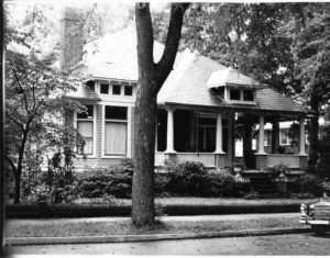
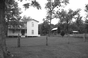
McIntyre Site also contains the foundation of the log house which John McIntyre built soon after he purchased the property in 1769. Unfortunately, the house was destroyed in the early 1940’s. However, Mr. Stuart Schwartz, who has had academic training in historic archeology, asserts that the site promises to yield significant archeological data. Also noteworthy is the fact the McIntyre Cabin was recorded by the Historic American Building Survey in the 1930’s, thereby providing measured drawings which allow an authentic reconstruction to occur as soon as funds are available. That the McIntyre Cabin was regarded as an architecturally significant is certain. For example, it received substantial attention in the widely acclaimed book co-authored by F. B. Johnson and T. T. Waterman, The Early Architecture of North Carolina. On balance, the evidence suggests that the McIntyre Site possesses local historic significance, both because it promises to yield significant archeological data from an 18th century Mecklenburg farm and because it contains the foundation of an architecturally important structure which could be easily reconstructed.

In the second quarter of the nineteenth century the McIntyre Site served as the location of the Hipp Gold Mine. The first record of gold in the area was the discovery of a large nugget in 1790 in what is now Cabarrus County. Conrad Reed’s young son, while fishing, saw it shining in a creek on his father’s farm and took it home. Not knowing what it was, the family used it as a doorstop for several years. In 1825 Samuel McComb made the first successful attempt to follow a vein of gold, located on his farm just to the south of Charlotte. Soon thereafter prospectors poured into the Piedmont, thereby creating the first gold rush in the United States. Small mines, consisting of surface trenches on hillsides above streams, dotted the landscape. Stuart Schwartz has confirmed that the McIntyre Site contains many of the trenches of the Hipp Gold Mine. Consequently, it is reasonable to assume that archeological data associated with nineteenth-century gold mining operations is present on the property. This information underscores the local historic significance of the McIntyre Site.

That the people of Charlotte and Mecklenburg County consider the McIntyre Site to be historically significant is certain. Attached are several newspaper articles and other printed materials which document this fact. Perhaps the most convincing evidence, however, was provided by the development of the McIntyre Historic Site as a Bicentennial Project. Funding for this undertaking was secured from several sources: Charlotte-Mecklenburg Bicentennial Commission, Charlotte-Mecklenburg Historic Properties Commission, Mecklenburg County, Junior Woman’s Club of Charlotte, and the North Carolina American Revolution Bicentennial Committee. The official opening of the park on October 5, 1976 (see attached program), was an official Bicentennial Activity (#021438) and was recorded on the Bicentennial Information Network — BINET.

The McIntyre Historic Site is an educational complex which consists of a pathway, along which one encounters signs that interpret the history of the site and of the larger context within which the site has evolved (see photographs 1, 2, 3, and 4). The initial theme centers around the Revolutionary skirmish and its place within Cornwallis’s Southern Campaign. Highlights include the remains of the cabin (photograph 5), an explanation of the skirmish (photograph 6), and a description of Cornwallis’s Campaign from Charleston to Yorktown (photographs 7 and 8). The visitor then encounters a series of signs which interpret gold mining in the Piedmont (photographs 9 and 10). Adding to the effectiveness of the signs is the fact that they are placed beside and among the mining trenches (photographs 11 and 12).

III. Committee’s Understanding of the National Register of Historic Places: The committee understands that the National Register of Historic Places, created by the National Historic Preservation Act of 1966, represents an expansion of the Federal government’s concern for properties of historic significance to include those of State, regional, and local significance. Furthermore, the Committee views the National Register as a planning device, whereby the Federal government takes into account the impact of Federally licensed and Federally funded programs upon properties of State, regional, and local historic significance. Finally, the Committee believes that the National Register is not intended to be exclusively a list of buildings or structures.

IV. Measurement of the McIntyre Site against the Criteria of the National Register of Historic Places: The Committee believes that the evidence presented in Section II of this report demonstrates that the McIntyre Site is historically significant to Charlotte and Mecklenburg County. Consequently, the Committee believes that the McIntyre Site qualifies for listing in the National Register of Historic Places.


Historical Overview
 

For a full understanding of the skirmish at McIntyre’s Farm some contextual information might be useful. On August 16, 1780 the British army commanded by Lord Charles Cornwallis routed an American Army under the command of Horatio Gates at the Battle of Camden in South Carolina. For all practical purposes the American Army ceased to exist in the South. Gates retired to Hillsborough, North Carolina, where he began the arduous task of rebuilding. This left Cornwallis in nominal control of South Carolina. To the considerable surprise of Cornwallis, that control was contested by bands of partisan irregulars, including those commanded by the famous South Carolina triumvirate of Francis Marion, Thomas Sumter, and Andrew Pickens. Although not strong enough to take on the main British army, these irregulars interrupted communications, ambushed supply trains, picked off stranglers, and harassed Loyalists. Patriots in North Carolina were likewise mobilized into action. On September 8 a group under the command of William R. Davie, later governor of North Carolina, surprised the British at Wahab’s Plantation, just south of the border, in a hit and run raid that resulted in numerous British Casualties.

Despite this constant harassment Cornwallis decided to move into North Carolina. His first stop would be Charlotte, then a small community which was attractive to the British primarily because of its relatively large number of mills. From Charlotte he would go to Salisbury, Salem, and Guilford Courthouse, before finishing at Hillsborough, which he had been led to believe was a hotbed of Loyalism. His advance through the state would embolden North Carolina Loyalists, who would fly to the King’s standard. Not only would this campaign secure North Carolina, but it would also overawe the by now isolated South Carolina rebels, ending resistance in that state. Cornwallis would then advance into Virginia and win the war for the King. For this plan to work it was essential for Cornwallis to keep his west flank secure, for he feared the hostile mountain and transmontane men of the west. To that end he sent a large force of Loyalist militia under the command of Patrick Ferguson to the foothills of the Carolina mountains. Ferguson’s job was to protect Cornwallis’ left flank and raise Loyalist militia. He was not to seek a general engagement.

Cornwallis moved into Charlotte on September 26 (some accounts say the 27th, even the 28th). A militia contingent under the command of Davie fought a vigorous rearguard action in the streets of the village before being forced to retire. Although Cornwallis knew the area was not completely loyal he had every expectation that his presence would intimidate opponents while attracting supporters. He overestimated both Loyalist numbers and initiative, a common British mistake during the war. We have plenty of contemporary evidence that the British found Charlotte most inhospitable. On October 3 Cornwallis wrote a correspondent that “Charlotte is an agreeable village but in a damned rebellious country.” His subordinate, the controversial Banastre (Bloody) Tarleton, recalled the next year: “The town and environs abounded with inveterate enemies. . . . It was evident, and it had been frequently mentioned to the King’s Officers, that the counties of Mecklenburg and Rowan were more hostile to England than any others in America. The vigilance and animosity of the surrounding districts checked the exertions of the well affected and totally destroyed all communication between the King’s troops and the loyalists in the other parts of the province.” Charles Stedman, a British historian who served with Cornwallis as a surgeon and wrote a detailed history of the southern campaign, said of the Mecklenburgers: “So inveterate was their rancour that the messengers with expresses for the commander in chief were frequently murdered, and the inhabitants, instead of remaining quietly at home to receive payment for the produce of their plantations, made it a practice to way-lay the British foraging parties, fire their rifles from concealed places, and then fly into the woods.” Patriot Davie concurred with this assessment: “. . . .no party of the enemy ventured out without being attacked, and often retired with considerable loss; the people of the neighboring country were strongly attached to the American cause, and gave his Lordship no assistance, and all information was cut off by the vigilance and activity of the militia cavalry.” 1

The point of all this that the skirmish at McIntyre’s Farm was not an isolated incident. Tarleton, Stedman, and Davie all agree that during Cornwallis’ stay in Charlotte, the British were subject to attack in the countryside virtually every time they showed themselves outside the village. Unfortunately, none of the these men discuss the particular skirmish in question. The one contemporary account I have been able to find comes from a newspaper, the Pennsylvania Packet of January 9, 1781: “Captains Thompson and Knox, with fourteen men, attacked above 300 of a foraging party, who were entering Mr. Bradley’s plantation (eight miles from Charlotte) with near 60 waggons [sic], and drove them back with such precipitation that, as I am well informed, many of their horses fell dead in the streets on their return.” 2 General William Davidson, overall militia commander in the area, made a brief reference to the action in a letter to Jethro Sumner but gave no particulars. 3

Unfortunately, later accounts of the skirmish disagree in virtually every detail, including whether the fight took place at McIntyre’s (or McIntire’s) Farm or Bradley’s Farm. Most accounts date the skirmish on October 3 but some say October 4. An 1820 letter from Joseph Graham, a Revolutionary War officer, places the engagement on October 3 and that seems to be the accepted date. 4 One lengthy mid-nineteenth century account comes from the pen of the Reverend William Henry Foote. It appears that his account has served as the basis for later tellings of the story. Inasmuch as some of Foote’s information may have come from contemporaries and inasmuch as this is apparently the most detailed account of the skirmish, I will quote it in full, rather than attempt to condense.


The repulse at McIntire’s is a good illustration of what Tarleton says in there quotations. The commander in Charlotte having heard of the abundant supply of grain and fodder that might be obtained from the rebel neighborhood, some seven miles from Charlotte, on the road to Beattie’s Ford, sends out a force sufficient, as was supposed to overawe the neighborhood, accompanied with a sufficient train of baggage wagons to bring in the necessary supplies. A lad, who was ploughing a field by the road side, upon seeing the advance of the soldiers, leaves his plough, mounts his horse and gallops through bye-paths to give notice to the inhabitants that a foraging party was out. They, of course, fled and spread the alarm, riding away their horses, and hiding or removing their most valuable effects.

The family at Mr. McIntire’s had just time to escape; the men in the fields armed themselves and took to the woods; and the women and servants rode off towards the residences of neighbors, whose houses were supposed to be out of the track of this armed force; the house and all the property were left to the mercy of the foragers. The neighboring men, conjecturing the object of the party, rallied around McIntire’s farm, according to the rules which had been voluntarily adopted, that neighbors would help each other; and about a dozen of them, armed with rifles and divided into companies of two, lay concealed in the woods in sight of the house, not far from each other.

While lying there, they witnessed the advance of the British,– saw them pause on the brow of the hill near the branch and reconnoitre, and then slowly advance to the house. The dragoons dismounted and fastened their horses, and the work of plunder began. Harnessing some of their horses to the farm wagons they began to load them forage; and when the baggage wagons arrived they proceeded to load them with corn and oats. While this was doing the soldiers were running down and catching the poultry in the yard and killing pigs and calves. By accident, some of them overset the beehives ranged by the garden fence, and the enraged insects fell in fury upon the soldiery. The scene became one of uproar and boisterous merriment. The commander of the forces, a portly florid Englishman, stood in the door with one hand on each post, enjoying the scene of the plunder, and laughing at the antics of the soldiers discomforted by the bees.

The owner and his neighbors had approached within rifle shot of the house, under cover of the woods, and were exasperated witnesses of the merry plunder of the foragers. At length one of them cried out – “Boys, I can’t stand this – I take the captain. Every one choose his man and look to yourselves.” Quick as his word, the sharp crack of a rifle was heard; and the captain fell from the doorway. The rifles of the other eleven answered in quick succession; and nine men and two horses lay on the ground.

The trumpet sounded a recall; and the dragoons hastened to form a line. The assailiants shifted their position, and from another direction, from a skirt of woods, poured in another straggling fire, with fatal accuracy. The dragoons began a pursuit, and set on the dogs; but soon a fire from another direction alarmed them, lest they were surrounded. The dogs came on the trail of these retreating men, and the leading one sprung upon the heels of a man who had just discharged his rifle. A pistol-shot laid him dead; and the other dogs, coming up to him, paused, gave a howl, and returned. The alarm became general, and the troops hastened their retreat, attempting to carry off the loaded wagons. But the more distant neighbors had now rallied and the woods echoed on all sides with rifles and guns of concealed enemies. The leading horses of the wagons were some of them shot down before they ascended the hill by the branch, and the road was blocked up; and the retreat became a scene of confusion in spite of the discipline of the British soldiers, who drew up in battle array and offered to fight the invisible enemy that only changed their ground and renewed their fire. In full belief that they were assailed by a numerous foe, and disappointed of their foilage, they returned to camp — swearing that every bush on the road concealed a rebel. 5

Foote’s account contains most of the elements that appear in later renditions of the fight. Since Foote is not footnoted it is not clear where he obtained his information. It is possible that an earlier account, besides those already mentioned, exists but I have been unable to come across one. Considering that the Foote account was written in 1846 it was most likely written, at least in part, from some first hand oral traditions. A point of interest is that Foote has the patriots firing from the woods, with no mention of mounds. Other accounts of the skirmish consistently place the attackers in the woods. It is also interesting that Foote does not specifically discuss the number of combatants involved in the skirmish, although a careful reading indicates that well over a dozen patriots were engaged near the end of the encounter. Foote does, however, mention the tombstone of George Graham (d. 1826), which reads in part “one of the Gallant Twelve who dared attack and actually drove 400 British troops at McIntire’s.” This is only one of several estimates of the relative size of the forces. The 1820 letter by Joseph Graham claims 450 British infantry, 60 cavalry, and 40 wagons, opposed by 14 locals. The most extreme estimate was made in 1853 by his son, then former governor William A. Graham, who has 400 British troops attacked by only 7 patriots. In his 1903 history of Mecklenburg County, D. A. Tompkins has militia Captains James Thompson and George Graham, in command of 12 men, attacking a force of 450 foragers under the command of Major Doyle. Tompkins also has the patriots following the British through the woods for miles in order to set up an ambush. A completely different interpretation of events comes from Samuel Ashe, who wrote that Cornwallis dispatched for foraging detail a contingent of 450 infantry, 60 cavalry, and 40 wagons under the command of Major Doyle. (This agrees with Joseph Graham.) However, according to Ashe, when the party reached McIntyre’s farm, Major Doyle left 100 men and 10 wagons at the farm, while taking the remainder of the party further down the road towards Long Creek. Ashe gives the number of patriot attackers as 14 men, who left 8 British dead and 12 wounded. The entire force, including Doyle’s contingent, then returns to Charlotte with only 4 wagons loaded with provisions. The 20 casualties (killed and wounded) agrees with the total arrived at by Joseph Graham and by Howard Peckham in his authoritative The Toll of Independence. 6 Nothing that I have read on the skirmish, by the way, has any mention of American casualties.

Regardless of the number of combatants, all accounts agree that a large number of British foragers were attacked by a much smaller group of patriots and driven back to Charlotte in some disorder. On October 7 Ferguson’s forces were surrounded and slaughtered at the Battle of Kings Mountain. When Cornwallis heard the doleful news he made immediate plans to withdraw back to South Carolina. There is little question that Cornwallis’ withdrawal was a direct response to the exposure of his left flank and the sudden vulnerability of his South Carolina bases. In Stedman’s words, Ferguson’s defeat “put a stop, for the present, to the farther progress of the commander in chief, and obliged him to fall back into South Carolina, for protection of its western borders against the incursions of a horde of mountainers, whose appearance was as unexpected as their success was fatal to the protections of the intended expedition.” In other words, the hostility of the citizens of Mecklenburg County towards his lordship was not a primary factor in this withdrawal. It should also be kept in mind that Stedman maintained that while in Charlotte the British army “was sufficiently supplied with provisions, notwithstanding the hostile disposition of the inhabitants.” 7 Perhaps more important than the persistent attacks against British foragers was the constant interruption of Cornwallis’ communications. This was particularly the case with Ferguson’s important force, which sent several unreceived requests for aid to Cornwallis. The poor communication between Cornwallis and Ferguson was almost certainly a contributing factor in the later’s crushing defeat.

The historiography of the skirmish is interesting. With the exception of the one line in Peckham already mentioned, the accounts of the fight were written in the eighteenth and early nineteenth century. Outside of Charlotte the Skirmish has been largely forgotten. None of the recent standard histories of the Revolutionary War, even those devoted exclusively to North Carolina, mention the fight specifically, although most discuss Cornwallis’ difficult situation in Charlotte in more general terms. The site has apparently never been proposed or considered for a North Carolina Historical Highway Marker. In 1961 author and local historian LeGette Blythe bemoaned the neglect of the site: “Now the site is a tangled, densely overgrown spot known to hardly any of the thousands who stream by it daily over the asphalt highway that has succeeded the narrow clay road of Revolutionary days. 8 Thus the attention shown in Charlotte towards the site in recent years is a reversal of a long trend of scholarly and physical neglect.

None of this is to suggest that the fight or the site are unimportant. Clearly the skirmish as McIntyre’s Farm has strong local significance. The hostility of Mecklenburg County’s populace towards Cornwallis and the British is well documented and has long been a source of pride to Charlotteans. In more general terms the failure of the British to attract and utilize Loyalists elements has been cited as a contributing cause in their defeat by virtually every historian of the Revolution. During their two plus weeks in Charlotte (they left on October 14) and the difficult withdrawal back to South Carolina, the British faced unremitting and implacable opposition to their cause at virtually every step. McIntyre’s Farm is highly symbolic of that opposition.


Endnotes

1 Walter Clark (ed.), State Records of North Carolina (Winston, Goldsboro, and Charlotte, 1895-1905), 15:172; Banastre Tarleton, Campaigns of 1780-1781 in Southern America (London, 1781), 160; Charles Stedman, The History of the Origin, Progress, and Termination of the American War (London, 1794), II, 216; Blackwell Robinson (ed.), The Revolutionary War Sketches of William R. Davie (Raleigh, 1976), 26.

2 Quoted in Charles Davidson, Piedmont Partisan: The Life and Times of Brigadier-General William Lee Davidson (Davidson, NC 1951).

3 Davidson, Piedmont Partisan, 80.

4 Clark, State Records of North Carolina, 19:990.

5 William Henry Foote, Sketches of North Carolina: Historical and Biographical (New York, 1846), 506-508.

6 Foote, Sketches of North Carolina, 508; Clark, State Records of North Carolina, 19:990; William A. Graham, “British Invasion of North Carolina, in 1780, and 1781,” in Revolutionary History of North Carolina, compiled by William D. Cooke, (New York, 1853), 168; Daniel A. Tompkins, History of Mecklenburg County and the City of Charlotte, (Charlotte, 1903), I, 62-63; Howard Peckham, The Toll of Independence (Chicago and London, 1974).

7 Stedman, History, 218, 216.

8 Legette Blythe and Charles Raven Brockman, Hornets’ Nest: The Story of Charlotte and Mecklenburg County (Charlotte, 1961), 87.


McElroy House

  1. Name and location of the property. The property known as the McElroy House is located at 10915 Beatties Ford Road in the Huntersville vicinity of Mecklenburg County, North Carolina.
  2. Name, address, and telephone number of the present owner of the property.

The owner is :

Thomas M. and Mildred D. Snyder

10915 Beatties Ford Road

Huntersville, NC 28078

Telephone Number: (704)875-2831


  1. Representative  Photographs  of the  property. This  report representative photographs of the property.


  1. Current deed book references to the property. The most recent deed to the McElroy House is listed in Mecklenburg County Deed Book 4537 at Page 964. The Tax Parcel Number of the property is 023-031-09.
  2. A brief historical description of the property. This report contains a historical sketch of the property prepared by Dr. William Huffman.
  3. A brief architectural description of the property. This report contains an architectural description of the property prepared by Dr. Richard Mattson.
  4. Documentation of why and in what ways the property meets criteria for designation set forth in N.C.G.S. 16OA-400.5.
  5. Special significance in terms of history, architecture, and cultural importance, The Commission judges that the property known as the McElroy House House does possess special significance in terms of Charlotte and Mecklenburg County. The Commission bases its judgment on the following considerations: 1) the McElroy House was constructed ca. 1883 for Samuel Jefferson McElroy, and early Mecklenburg County resident of Scots-Irish ancestry; 2) as a volunteer during the Civil War, McElroy fought at the Battle of Gettysburg; 3) Margaret Janet Sample McElroy, his wife, was a great grand-daughter of a signer of the alleged Mecklenburg Declaration of Independence ; 4) the McElroy House is architecturally significant as an outstanding example of the vernacular Victorian farmhouses built in Mecklenburg County following the Civil War; 5) the interior of the McElroy House retains much of the early woodwork including mantels, turned post staircases, board-and-batten ceilings, and original doors with early hardware; 6) the attached smokehouses appears to be a unique feature for Mecklenburg County; and 7) the tack house, with early harness still hanging on the walls, is a well-preserved example of free-standing farm outbuildings.
  6. Integrity of design, setting, workmanship, materials, feeling, and association. The Commission contends that the architectural description by Dr. Richard Mattson included in this report demonstrates that the McElroy House meets this criterion.
  7. Ad Valorem Tax Appraisal. The current Ad Valorem appraised value of the .692 acres of land is $28,800.  The current Ad Valorem appraised value of the house is $123,300. The total Ad Valorem appraised value is $152,100. The property is zoned R- 3.

Date of Preparation of this Report. November 1, 1998


Prepared by:

Dr. Richard S. Mattson & Dr. William H. Huffman Historic Landmarks Commission 2100 Randolph Road Charlotte, N.C. 28207


Architectural Description

The Samuel J. McElroy House is among the finest and most intact of a collection of vernacular Victorian, two-story, T-shaped farmhouses to appear in Mecklenburg County (including five along Beatties Ford Road) after the Civil War.  The house is situated in a rural setting  just north of , the historic Hopewell Presbyterian Church and the ca. 1800 Latta Plantation.  An operating farm stands to the southeast of the property and an open field is located northeast across the road.  The dwelling’s asymmetrical form stands in contrast to the typically balanced facades of I-houses, which predominated in rural Mecklenburg during the 19th century. Built in the late 1880s, the McElroy House is a picturesque mix of vernacular Victorian influences.  Although the original weatherboards were covered with aluminum siding about 1980, the exterior retains much of its original decorative woodwork, including the late Victorian sawnwork on the front porch.  The house’s gable-front section features a front-facing bay window on the first floor and a sash window with six panes in each sash on the gable-front facade of the second story.  Original sash windows with six-over-six panes survive throughout the residence.  The two-bay, one-room-deep, side-gable portion features the largely intact front porch.  This porch includes pairs of slender wooden, chamfered supports with decorative sawn brackets.  These posts are connected by a sawnwork balustrade.  The main entrance, positioned at the corner of the two sections of the house and leading into the central hall, features a crossetted surround and double doors with four panels in each.  The paired screen doors are highlighted by ornate jig-sawed woodwork. The rear of the house includes a one-story, one-story bedroom wing on the north side that is probably original.  Its original gable roof replaced by a shed roof in the early 1980s.  At the south end of the rear facade is a one-story kitchen wing topped by a gable roof that extends to incorporate an original smokehouse.  The two units are separated by a narrow breezeway.  This configuration is unique in Mecklenburg County.  An engaged porch extends along the north and south elevations of the attached smokehouse and originally covered how partially remodeled south-elevation of the kitchen ell. A presumably original back porch with chamfered, supports and foundation of stone piers wraps around the rear of the smokehouse.  The porch’s irregularly-shaped  low-pitched roof is a later modification, and the porch has been partially rebuilt, with several of the original posts replaced with square wood supports, and a simple wood railing erected.  All of the roofs on the McElroy House are covered with standing-seam metal sheathing.

The interior of the main body of the house is essentially intact.  The interior follows a central-hall plan, with a parlor on the northwest side (side-gable portion) and a living room and dining room on the southeast side (gable-front portion).  The dining room leads into the kitchen wing, which has been remodelled and enlarged to include a section of the engaged porch on the northwest side.  The original bedroom wing on the north side of the rear elevation has been remodelled as a family room and now also incorporates a portion of this porch.  However, in the main T-shaped block of the McElroy House original vernacular Victorian elements survive intact.  The central hall features an open-string staii ascending  in two runs from the main entrance to three bedrooms in the second floor.  The stairway has turned balusters anchored by a sturdy turned newel.  Original mantels, four-panel doors, and delicately moulded door surrounds survive throughout the interior of the main block.  The mantel in the south front room–the living room–is particularly elaborate. The frieze has a curvilinear motif with raised  curved panels, and three heavy wooden corbels supporting the snelf.  The pilasters also have raised panels topped by moulded caps.  Flanking this mantel are two original closets with doors having two vertical panels, a lingering vernacular Greek Revival trait.  The other mantels–in the parlor, dining room, and three upstairs bedrooms–are simpler, but all reflect the vernacular Victorian style exemplified by the living room mantel. The original ceiling in the living room is covered by a modern rough-finished plaster coating; but all of the other rooms in the main bock of the house have original board-and-batten ceilings. The walls of the house have original plaster, and original hardware, porcelain door knobs, and wood flooring survive throughout.

The McElroy yard, shaded by mature oak trees, comprises a mix of historical and modern elements.  The remains of a fieldstone chimney (perhaps once a summer kitchen, but more research is needed to confirm its original function) stands behind the house to the south.  It is not classified in this nomination as either contributing or noncontributing.  Other  contributing and non-contributing resources are listed below:


Tack house     Contributing     ca. 1885 

This frame gable-front building stands on granite slabs.  It was built to store bridles, harnesses, and saddlery for horses and mules.  Measures about eight by twelve feet.  Present wood-shingled roof put on in 1988.


The Samuel J. McElroy House is architecturally significant under Criterion C as an outstanding example of the T-shaped, two-story, vernacular Victorian farmhouses that were built in the county after the Civil War (see Associated Property Type l-~Houses–Postbellum Farmhouses).  Erected in the 1880s for Samuel J. McElroy, a farmer, the dwelling features one of the more ornate post-Civil War front porches remaining in rural Mecklenburg.  The interior, though not exceptionally decorative, retains mantels with curviliner friezes and raised decorative panels, a turned-post staircase, board-and-batten ceilings, and intact doors and simply moulded door surrounds that exemplify the interior finishes of middle-class farmhouses across the county in the late 19th century.  The house’s asymmetrical form reflects the emerging preference among well-to-do farmers in the area for up-to-date picturesque domestic architecture, over the more conservative I-house.  Yet, the basic design remains restrained both inside and out compared to the picturesque styles appearing in Charlotte and other substantial North Carolina cities in this period. The focus of stylistic attention is placed on the front porch and bay window.  The attached smokehouse, which is unique in Mecklenburg County, reflects McElroy’s concern for function as well as style in the overall design of his farmhouse.  The tack house, which is the only surviving free-standing farm outbuilding on the tract, contributes to the architectural significance of the McElroy property (see Associated Property Type 2–Outbuildings).


Historical Essay

The Samuel J. McElroy House was built sometime after November, 1883, when Samuel Jefferson McElroy (1840-1927) purchased a ninety-one acre parcel on what is now Beatties Ford Road.1 McElroy was descended from Scotch-Irish ancestry who came to America in 1729 and settled in Cumberland County, Pennsylvania. Sometime later they moved on to Virginia, then to Kentucky. One of the descendents, Samuel Jefferson McElroy, Sr., moved to Waihaw in Union County, N.C., where he was engaged in mining and farming. One of his sons, Samuel Jefferson McElroy, Jr., moved to Mecklenburg County as a young man (he appears as a resident of the county in I860).2 A volunteer during the Civil War, McElroy was wounded at the Battle of Gettysburg, where he lost a finger, and was taken prisoner. After the war, on January 16, 1866, he married Margaret Janet Sample (1846-1928) of Hopewell, who was a great-grandaughter of Richard Barry, Sr., a signer of the Mecklenburg Declaration of Independence. They started their married life on the Dr. George Dunlap farm near Hopewell Presbyterian Church, which was part of her father’s estate.

Samuel and Margaret McElroy had eight children: William Edward; Henry Lynn; John Grier; Carrie Jane (Mrs. John Underwood); Flora May (Mrs. William E. Luckey); Una Dunbar (Mrs. Frank Patterson); Margaret Eugenia; and Martha Ellen. All were active members of Hopewell Presbyterian Church. John Grier McElroy (1878-1958) became an elder of the church in 1907.  He also inherited the homestead from his father in 1928, where he lived and farmed.5

Just a few months before his death in 1958, John Grier McElroy sold off fifty acres of the ninety-three he had inherited from his father, and his children, John Grier Jr., Robert Sidney and Samuel Jefferson divided the remainder into three 5-l/2-acre lots. The S. J. McElroy House was acquired by John Grier McElroy, Jr. in the division.6   In 1976, J. G. McElroy, Jr. sold a 1.88-acre parcel fronting on Beanies Ford Road that contains the house to Donald C. and Timola B. Moore, who in turn sold it to the present owners, Thomas M. and Mildred D. Snyder, in 1982.


__________________________________________________________________________________________

*Footnotes:


1 Mecklenburg County Deed Book 36, p. 102.

21850 U. S. Census. Mecklenburg County, N.C.

3 Charles William Sommerville, The History of Hopewell Presbyterian Church (Charlotte: Hopewell Presbyterian Church, 1939; reprint, 1987), p. 163; Mecklenburg County Will Book U, p. 318.


4Ibid., pp. 163-164.

5lbid., p. 164; Mecklenburg County Will Book U, p. 318

6 Mecklenburg County Deed Books 2001, p. 469; 2640, p. 365; 2640, p.368

7Ibid., 3860. p. 243; 4537. p. 964.


McCoy House

This report was written on January 6, 1982

1. Name and location of the property: The property known as the W. T. McCoy House is located at 429 East Kingston Avenue in Charlotte, North Carolina.

2. Name, address, and telephone number of the present owners and occupants of the property: The present owners and occupants of the property are:

John B. Geer and Gary Benner
429 East Kingston Avenue
Charlotte, NC 28203

Telephone: (704) 372-4449

3. Representative photographs of the property: This report contains representative photographs of the property.

4. A map depicting the location of the property: .

5. Current Deed Book Reference to the property: The most recent deed to this property is listed in Mecklenburg County Deed Book 3948 at page 706. The current tax parcel number of the property is 123-082-09.

6. A brief historical sketch of the property: This report contains a brief historical sketch of the property by Dr. William H. Huffman, Ph.D.

7. A brief architectural description of the property: This report contains a brief architectural description of the property by Thomas W. Hanchett.

8. Documentation of why and in what ways the property meets the criteria set forth in N.C.G.S. 160A-399.4:


a. Special significance in terms of its history, architecture, and/or cultural importance: The Commission judges that the property known as the W. T. McCoy House does possess special historic significance in terms of Charlotte-Mecklenburg. The Commission bases its judgment on the following considerations: (1) the house was designed by the architectural firm of Hook and Rogers, designers of seminal influence in this community; (2) the house exhibits a rare combination of Queen Anne and Bungalow styles for Charlotte-Mecklenburg; and (3) the house occupies a pivotal position in terms of the townscape of the oldest portion of Dilworth, Charlotte’s first streetcar suburb.

b. Integrity of design, setting, workmanship, materials, feeling and/or association: The Commission judges that the architectural description included herein demonstrates that the property known as the W. T. McCoy House meets this criterion.

c. Ad Valorem Tax Appraisal: The Commission is aware that designation would allow the owner to apply annually for an automatic deferral of 50% of the Ad Valorem taxes on all or any portion of the property which becomes “historic property.” The current Ad Valorem tax appraisal of the entire .241 acre tract is $3,750.00. The Ad Valorem tax appraisal on the improvements is $11,190.00. The total Ad Valorem tax appraisal is $14,940.00. The land is zoned R6MF.

Date of preparation of this report: January 6, 1982

Prepared by: Dr. Dan L. Morrill, Director
Charlotte-Mecklenburg Historic Properties Commission
3500 Shamrock Drive
Charlotte, NC 28215

Telephone: (704) 332-2726


Historical Overview

Dr. William H. Huffman

On the twelfth of April, 1910, William T. McCoy bought the house presently located at 429 E. Kingston Avenue in Dilworth from the Charlotte Consolidated Construction Company for the total price of $7,089.20.1 The Four C’s had been organized by Edward Dilworth Latta in 1890 to develop that streetcar suburb from 250 acres of farmland just to the southeast of the city.2 According to the usual practice, the house was contracted for in 1909, then purchased upon acceptance on the above date. The actual construction contractors for the Kingston Avenue residence were the R. N. Hunter Co., and the architect was the firm of Hook and Rogers.3 Charles Christian Hook (1870-1938), the first resident architect of Charlotte, designed a number of houses in Dilworth in addition to many important structures throughout Charlotte; the latter included the old Charlotte City Hall and the James B. Duke mansion on Hermitage Road.4

William T. McCoy, who was born December 24, 1876 in Camden, SC, came to Charlotte in 1895. Four years later, in 1899, he started his own furniture business, W. T. McCoy and Company, located at 209-211 S. Tryon Street.5 The furniture business flourished, becoming one of the best known in the area, and in 1923, Mr. McCoy built a new building at 423-425 S. Tryon to accommodate the expanding trade.6 Because of failing health, William McCoy retired in 1931 and liquidated the business. Despite his “quiet nature,” he was quite active in business, civic and church affairs. He was a founding member of the Greater Charlotte Club, which was the predecessor of the Chamber of Commerce; was president of the Charlotte Merchant’s Association; and served as president of the Southern Furniture Dealers Association and as a director of the National Furniture Dealers Association. He was also affiliated with the Charlotte Country Club, the Myers Park Club, and the Myers Park Presbyterian Church. In addition, Mr. McCoy was well known as a generous contributor to charitable and philanthropic causes. He died in Richmond, Virginia, following surgery, on February 17, 1933, and was buried in Elmwood Cemetery, Charlotte.7

Mrs. McCoy, the former Willie Beckton, was born in Charlotte and became the mother of five children, three of whom died as infants. The two surviving daughters, Edna and Helen (later Mrs. Richard A. Cannon and Mrs. Jack Prause, respectively), and the family were able to enjoy the commodiousness of the house with its large-windowed, high-ceilinged rooms and second-floor ballroom for many years.8 In 1928, the McCoys moved from Kingston to a house at 1125 Queens Road, but Mrs. McCoy reportedly spent the happiest times of her life at the Dilworth home.9 The following year, likely due to ill health, William McCoy deeded his real estate holdings to his wife.10 Some fifteen years before, he had suffered an extreme illness and had never fully recovered his strength. The house on Kingston was rented to various tenants by the McCoys until 1936, when management of it and six other holdings were placed in the hands of the American Trust Company, from which Mrs. McCoy received the income.11 Upon her death September 4 1953, she was also buried in Elmwood cemetery in Charlotte.12

Well before her death, however, the Kingston Avenue property was sold by the American Trust Company in 1944. In that year William S. and Bruce Gates Berryhill acquired the residence at an estate sale. 13 Mr. Berryhill was an accountant for the firm of Allison Erwin and subsequently became the accountant and controller for the Wrenn Brothers, who were the forerunners of Industrial Finance Co. When they moved to Kingston Avenue, the McCoys enjoyed the area as an established and pleasant residential neighborhood, but by 1960, deterioration had set in to the extent that they decided to move, and thus relocated on Park Road. For the ensuing nine years, the house was rented to various tenants.14

In 1969, the Kingston avenue residence was sold to John and Sally Howie.15 Mr. Howie worked at that time for the Charlotte Pipe and Foundry Company and also did house painting and repairs, and Mrs. Howie was a cook for County Social Services. It was through his work for the Berryhills that later resulted in Mr. Howie’s purchase of the house. About 1971, Mr. Howie separated two sections of the house by building a dividing wall in the downstairs hallway, thus converting the house to a duplex. For the first two years of their ownership, the Howies lived in the house themselves, and afterward rented the duplexes to various tenants.16

Ruth Little-Stokes, an architectural historian, purchased the house from the Howies in 1977.17 While pursuing her advanced degree in that discipline in Chapel Hill, Ms. Little-Stokes leased both apartments of the house and had a very strong interest in preserving its architectural integrity.18 In March, 1981, she sold the house to the present owners, John Geer and Gary Benner, who have exerted considerable effort to restore the house to as close to its original condition as possible.


NOTES

1 Deed Book 257, p. 603.

2 “The New South Neighborhoods: Dilworth,” CMHPC, May, 1981.

3 Charlotte Evening Chronicle, June 19, 1909, p. 6.

4 Survey and Research Report on the Seaboard Air Line Terminal, CMHPC, undated.

5 Charlotte Observer, Feb. 19, 1933, p. 6; Charlotte City Directory, 1911, p. 285.

6 Charlotte News, Feb. 19, 1933, p. 9; Charlotte City Directory, 1925, p. 629.

7 Ibid.

8 Interview with Bruce Cates (Mrs. W. S.) Berryhill, Charlotte, NC, 24 August 1981.

9Ibid.

10 Deed Book 735, p. 188, 13 Feb. 1929.

11 Deed Book 884, p. 23, 22 Jan. 1936.

12 Monument in Elmwood Cemetery, Charlotte.

13 Deed Book 1137, p. 49, 12 Dec. 1944

14 See Note 8.

15 Deed Book 3115, p. 265, 25 September 1969.

16 Interview with Sally Howie by Ruth Little-Stokes, 2 April 1979.


17 Deed Book 3948, p. 706, 1 June 1977.


18 Interview with Ruth Little Stokes by & Sally McMillen, 21 March 1979.

19 Deed Book 4407, p. 331, 9 March 1981; interview with John Geer and Gary Benner, 23 August 1981.


Architectural Description

Thomas W. Hanchett

The W.T. McCoy House is an elegant one-and-one-half story Bungalow designed by the firm of Hook and Rogers, leading Charlotte architects. Built 1909-1910 by well-to-do furniture store owner William T. McCoy, its plan and decorative details illustrate the transition then occurring from the Queen Anne style to the new Bungalow style. Its prominent location at the corner of East Kingston and Lyndhurst Avenues, combined with its original design qualities and good state of preservation, make it an architecturally-important part of the proposed Dilworth historic district and of Charlotte as a whole.

The home is basically a low rectangular block under a spreading hip roof. Porches wrap around the sides that face Kingston and Lyndhurst Avenues. In these characteristics it is distinctively a Bungalow. Architectural Historian Clay Lancaster has traced the origin of the term Bungalow back to the East Indian word “bangle”, which meant “a low house with porches all around”.1 Americans first borrowed the idea from the British in the late nineteenth century and around 1900 it caught on with a bang in sunny California, then spread across the U.S., becoming the most popular style of the 1910’s and 1920’s.

Before the Bungalow became popular, the major style in the United States was the Queen Anne, the climax of the Victorian era. It was characterized by complex roof shapes, complex wall treatment, and details chosen eclectically from all eras of the past. Hook and Rogers’ design for the W.T. McCoy House was strongly influenced by this style.

The basic hip roof of the home is complicated by two smaller hip roofs that extend out over the front (south) and east side porches. There are also several dormered windows poking through the roof planes. Four complex bay windows with their own complicated roofs pop out of the front, sides, and rear of the building. The walls of the house are given additional interest through the use of a wide variety of window types, transomed, double-hung sash, casement, and fixed pane.”

Exterior details were chosen to add to the Victorian feeling of varied textures. The three chimneys are asymmetrically placed. Rafter ends are left exposed for decorative effect in the eaves. Walls are sheathed in grooved “German” novelty-siding with corner boards. The main entry vestibule with its leaded glass sidelights and transom has a Colonial Revival feel. “The oriel window bracketed out from the west side, the diamond-paned dormer window casements, and the composite Ionic porch columns set on weatherboard pedestals are drawn from English architecture built during the sixteenth and early seventeenth centuries”, according to architectural historian Ruth Little-Stokes in her architectural analysis of the proposed Dilworth historic district.2

The interior of the McCoy House also shows the transition from Victorian to Bungalow, especially in light of earlier homes in the neighborhood. In her essay, Little-Stokes compares it to the more Victorian 1908 Davidson House at 321 East Park Avenue. The McCoy House has lower, more “modern” ceilings and a much more open, flowing plan, typical of twentieth century design. Its details, however, are strongly Victorian and show a craftsmanship that reflects owner McCoy’s familiarity with fine furniture design.

The front half of the main floor of the residence is given over to the “semi-public” spaces. From the vestibule the guest moves through double doors into a large reception hall. From it one can look into the wide central hallway that runs back to the bedrooms. To the left of the reception hall, through a wide archway with no doors, one can see the main parlor. Moving into the central hallway, the first room to the right is a “back parlor” with its own door onto the porch, located behind the reception hall. The first room to the left is an elegant dining room with chest-high dark stained wainscoting. Dentil molding atop the wainscoting has been replicated by the present owners and a fine stained glass window by owner John Geer is the focal point of the bay at the end of the room. Each of these four main rooms has a different mantle: oak in the reception hall, painted pine in the main parlor, Birdseye maple in the back parlor, and oak in the dining room (oak columns and an overmantel were taken by the Berryhills when they sold the home). Each mantle has an ornate cast-iron fire door surrounded by ceramic tile. Most of the original brass hinges, doorknobs, and other hardware remain in these rooms.

The rear half of the main floor contains the more private spaces of the house, which were arranged on the assumption that the family would have a full-time servant. A butler’s pantry behind the dining room separates that room from the kitchen, which has an unusual gently coved ceiling. Behind the kitchen was a small rear porch, enclosed probably in the 1940’s.

In the northeast corner of the residence are three bedrooms, all interconnected, and two bathrooms. These are grouped around a closet-lined hall that must have been the province of the maid. The bathrooms were quite modern for their day, with ceramic tile and legless tubs. Some of the original fixtures remain.

Nestled next to the butler’s pantry and opening off the central hallway is the enclosed stairwell. Up the stairs is the “ballroom”, a large finished room under the roof that is nearly as large as the entire first floor. Downstairs is the brick-wall basement. The foundation appears to have been continuous wall from the start, rather than brick piers as in many homes in this region. One area of the basement is a plastered room, with its own outside entrance, that was originally the maid’s quarters. The electric bell system used to signal the maid still extends throughout the house, though it is no longer working.

Surprisingly few major changes have been made in the home over the last seventy-one years. Gas sconces were removed from the dining room and ballroom, the rear porch enclosed, and some changes made to the butler’s pantry in the years before World War II. In 1971 the residence was converted to a duplex with great care, the only change being the addition of two walls in the central hallway, done in such a way as to leave the original molding intact. The present owners have installed a new kitchen and furnace, and replaced lost bathroom fixtures. They have done a fine job of highlighting the McCoy Home’s intrinsic elegance. With the minor exception of some light fixtures and heating registers they have not, as is so often the case in Charlotte, succumbed to the temptation to add new “old” features from other homes or renovation catalogs.


NOTES

1 Clay Lancaster, “The American Bungalow”, The Art Bulletin 40, no.3 (1958): 241.

2 Ruth Little-Stokes and Dan Morrill, Architectural Analysis:Dilworth: Charlotte’s Initial Streetcar Suburb (Charlotte, NC: Dilworth Community Association, 1978), pp.41-43.


McCoy Farm


  1. Name and location of the property:  The property known as the Albert McCoy Farm is located 10401 McCoy Road, Huntersville, N.C. 28078.
  2. Name and address of the current owner(s) of the property:


Thomas & Robin McCoy

431 Fenton Place

Charlotte, NC 28207


  1. Representative photographs of the property: This report contains representative photographs of the property.


  1. A map depicting the location of the property: This report contains a map depicting the location of the property.


  1. Current deed book reference to the property: The most recent deed to the Albert McCoy Farm can be found in Mecklenburg County Deed Book 8731 Page 409.  The Tax Parcel Identification Number for the property is 015-20-101.  The property is zoned R.


  1. A brief historical sketch of the property: This report contains a brief historical sketch of the property prepared by Dr. Richard Mattson.


  1. A brief architectural description of the property: This report contains a brief architectural description of the property prepared by Mr.  William Huffman.   This Survey & Research Report was updated in September 2009, by Ms. Mary Dominick


  1. Documentation of why and in what ways the property meets the criteria for designation set forth in N.C.G.S. 160A-400.5.


  1. Special significance in terms of its history, architecture, and/or cultural importance: The Commission judges that the property known as the Albert McCoy Farm does possess special significance in terms of Charlotte-Mecklenburg. The Commission bases its judgment on the following considerations:

***1.   The  Albert McCoy Farm is a physical reminder of the rural landscape of Mecklenburg County in the late nineteenth and early twentieth centuries.  With its simple two-story  farm house and modest collection of outbuildings (log crib, a wellhouse, a smokehouse and a privy) the Albert McCoy Farm represents the many small farmsteads that flourished in the county in the decades after the Civil War;  2.  The Albert McCoy House is a two-story, timber-frame, side-gable-and- wing dwelling, representative of a type that was common throughout Mecklenburg County in the late nineteenth century; 3.   The integrity of the Albert McCoy House is excellent, no original material has been removed since the house was constructed.


  1. Integrity of design, workmanship, materials, feeling, and association.

The Commission contends that the architectural description prepared by Mr.  William Huffman and Dr. Richard Mattson. demonstrates that the Albert McCoy Farm meets this criterion.


***9.      Ad Valorem Tax Appraisal: The Commission is aware that designation would allow the owner to apply for an automatic deferral of 50% of the Ad Valorem taxes on all or any portion of the property that becomes a designated “historic landmark.” The current appraised value of the Albert McCoy Farm is $145,600—$113,700 for the building, $7500 for other features, and $24,400 for the land. [Tax Assessment In Progress]


Date of preparation of this report:

November 2, 2000


Provided by:  United States Department of the Interior National Park Service National Register of Historic Places Continuation Sheet Interview with Dr. Thomas H. McCoy, 4 Aug 1999; Mecklenburg County Deed Book 10, p. 437; Deed Book 4, p. 629;


Physical Description

The Albert McCoy Farm is located in the Long Creek section of northern Mecklenburg County, North Carolina, about fifteen miles north of the city of Charlotte. Approximately five miles from the center of the town of Huntersville, it has recently been annexed into the rapidly- expanding town limits. The Albert McCoy Farm is entirely rural in character, though it is in an area that is currently inundated by rapid development, which is likely to increase even more when 1-485 (Charlotte’s outer beltway) is completed.

The Long Creek section of Mecklenburg County is typical of the southern piedmont region of North Carolina. It is characterized by well-watered, gently-rolling topography that is well-suited for agricultural purposes. Typical vegetation includes open spaces, pastures, cultivated fields, mature hardwood trees, and piney woodlands. The built environment reflects the traditional agricultural nature of the area in the scattered farms that remain, but also exhibits the more current urban and suburban development patterns in subdivisions and free-standing dwellings.

The Albert McCoy Farm has been in the same family since 1770, and has been in continuous agricultural use since at least 1880. It is a rural historic landscape which retains the setting, characteristics, and associations from the period of significance, c. 1886-1950. The centerpiece of the seventy-six acre farm, which spans both sides of McCoy Road (SR 2120), is the c. 1886 Albert McCoy House. The house faces east; outbuildings spread out on three sides (to the north, west and south) of the house, a typical layout for nineteenth-century Mecklenburg County farms. The significant outbuildings–a log crib, a wellhouse, a smokehouse and a privy– are contemporary with the house (only a pumphouse and a small animal shelter are later). The house is surrounded by a manicured yard, shrubbery and scattered hardwood trees (including oak, elm, sycamore, poplar and walnut trees). An unpaved driveway runs from McCoy Road along the south side of the house, and turns north into the back yard. A small kitchen garden is beyond the driveway on the south side of the house. Pasture land and fields surround the house and yard on all sides, and woodlands spread along the east and west sides, and across the southwest corner of the tract. A large man-made pond, installed in the 1930s for recreational use, sits adjacent to the western edge of the property. It is fed by a spring near Gar Creek, which traverses the southern edge of the Albert McCoy Farm.


The Albert McCoy House is a two-story, timber frame, side-gable-and-wing (sometimes called L-plan) dwelling on a stone pier foundation. The roof has a shallow pitch, cross gables, and a standing-seam metal covering. The house is sheathed with weatherboard siding, and has large six-over-six sash windows. There are three brick chimneys–one exterior end chimney and two interior chimneys. The porch spans the left (south) two bays of the facade, and features a hipped roof, a cutwork balustrade and sawn brackets. A one-story ell extends out from the rear of the house on the south side. The handmade front door surround includes sidelights and splays out at the top and bottom. The door surround is distinctive and, along with the interior woodwork, identifies this house as the product of local builder John Ellis McAuley (1861-1929).


Front Porch Detail


On the interior, the Albert McCoy House has a center hall plan. The open-string stair rises up from the back of the hall, and features delicate turned balusters and thick turned newel posts. The first floor has three large rooms in the main body of the house, and two smaller rooms in the rear ell. Three large bedrooms are found on the second floor. Seven of the eight rooms have fireplaces with handcarved mantels. Each mantel is different from the others and all are recognizable as the work of John Ellis McAuley.  McAuley favored flat pilasters or chamfered boards supporting a plain shelf; but created unique architraves. He often used simple hand-carved shapes, but executed them well, usually adding a deep bevel that varied in angle along the curves he created. McAuley’s handiwork can also be seen in the board-and-batten ceiling coverings, and his use of interior closets. Each of the three upstairs bedrooms has a small closet in one corner. Four panel doors with ornate Victorian rim locks are found throughout the house. All interior wall finishes are plaster, and all floors are wide heart-pine boards.


The Ephraim Alexander McAuley House, ca. 1881

The McAuley House was remodeled by John Ellis McAuley in 1914.

The integrity of the Albert McCoy House is excellent. No original material has been removed since the house was constructed. A bathroom was added off the first floor hall in the mid-twentieth century. At some point, plumbing was added to the rear first floor room, and it was converted to kitchen use.
Architectural Description and Architectural Context


The Albert McCoy House, a two-story, timber-frame, side-gable-and- wing dwelling is representative of a type that was common throughout Mecklenburg County in the late nineteenth century.   Its irregular massing identifies its origins as Queen Anne, whether or not any Victorian trim was used in the house.  This particular house does not contain any mass-produced millwork or other trip typically associated with the Queen Anne style.  Instead, it is a showplace for the individual and highly skilled craftsmanship of local builder, John Ellis McAuley.


John Ellis McAuley

John Ellis McAuley (1861-1929) is the only local builder in Mecklenburg County about whom significant information is known.  He was from a local family and ultimately inherited his father’s house and land on Alexandriana Road in the Long Creek area of the county)3 McAuley displayed his carpentry skills as early as age twelve, when he built a functioning miniature water mill that was widely admired by those who saw it.  He had a special affection for tools, and took pride in keeping them sharp. His four-foot-by-three-foot toolbox is said to have weighed five hundred pounds when full.  He also repaired farm equipment for his father and their neighbors.’4  McAuley is remembered locally as a “country carpenter.”  In 1939, The History of Hopewell Presbyterian Church reminisced that he “had no speculative ability nor any thirst for gain; his labor was solely for the art of his trade.”5 McAuley is listed in the census records of 1900, 1910 and 1920 as a farmer.16   Ironically, he never considered himself to be a builder by trade, and never built a house for himself.  He did, however, alter the house he inherited from his father to such an extent that it bore his trademark woodwork.’7

McAuley was still in his twenties when Albert McCoy asked him to build this house. Though he had built an addition to another home, this was his first commission for an entire building. His unusual splayed front door surrounds and unique hand-carved mantels are considered his signature. The door surround angles outward at both the top and the bottom. On fireplace mantels, he created architraves adorned by distinctive curves with deep bevels whose pitch changes throughout the curve.’8 No two of the seven mantels in the Albert McCoy House are alike, and all of the woodwork is finely executed. His skills as a carpenter are evident throughout the house.

The History of Hopewell Presbyterian Church documented at least ten houses in the immediate area built by McAuley, though there were probably many more.’9   In addition to the Albert McCoy House, four others that are still standing include: the Kerns House (1880s) on Kems Road, the W. B. Parks House (c. 1901) on Beatties Ford Road, the Parks-Jetton House (1905)(recently demolished) on Neck Road, and the rectory at St. Mark’s Episcopal Church (c. 1898) on Mt. Holly-Huntersville Road.  McAuley also erected houses outside of the immediate Hopewell community.  Two such examples are the William and Cora Osborne House (c. 1890) at 12445 Ramah Church Road and the Grey-Knox House (c. 1894) at 108 Gilead Road in Huntersville.


McAuley’s work emphasizes finely-crafted detail over the latest fashion. All of the houses he

built are either traditional I-house (Kerns House, Grey-Knox House, Osborne House and Parks-Jetton

House) or side-gable-and-wing forms (W.B. Parks House, Albert McCoy House, and St. Mark’s rectory).

All are of frame construction and all feature hand-carved interior woodwork. Every example

except the Parks-Jetton House has his signature splayed front door surround. The Albert McCoy

House is especially significant, since it is known to have been McAuley’s first house-building

project.  Although it is a common form, the Albert McCoy House is extraordinarily uncommon in

its well-executed craftsmanship and attention to detail.


The Albert McCoy Farm, with its seventy-six acres of pasture and woods and c. 1886 two-story, side-gable-and-wing house surrounded by a complete collection of outbuildings, retains the integrity of a working farm from the late-nineteenth through the first half of the twentieth century. The McCoy Farm, eligible for listing in the National Register under Criterion A for its significance in the area of agriculture, retains a landscape of fields, pastures, and tree stands that is evocative of historic rural Mecklenburg County, which is a landscape increasingly threatened with development. The McCoy Farm is also eligible under Criterion C for architecture for the well-preserved side-gable-and-wing farmhouse built by skilled local craftsman John Ellis McAuley. The significance of the McCoy Farm is discussed in “Historic and Architectural Resources of Rural Mecklenburg County, North Carolina” National Register Multiple Property Documentation Form in the context entitled “Post-Bellum and Late-Nineteenth to Early- Twentieth Century Agriculture (1865-1939).” The property meets the registration requirements for Property Type IC: Postbellum Farmhouses and Property Type 2: Outbuildings. The significance statement that follows provides additional context in order to extend the period of significance to 1950.

Albert McCoy (1843-1925), a Civil War veteran and a founder of St. Mark’s Church, the first Episcopal church in northern Mecklenburg County, established the farm on the land he inherited from his father. The property is a rare surviving example of a piedmont North Carolina farm that has remained in the ownership of the same family, and has been farmed continually, for nearly one hundred and fifteen years. The period of significance is c. 1886 to 1950, a period during which the McCoy Farm held a significant role in the process and technology of farming in Mecklenburg County.


 Historical Background & Agricultural Context  

McCoy Family

Mecklenburg County was populated in the mid eighteenth century primarily by ScotchIrish settlers who supported themselves by farming. One such settler was Ezekial Beaty McCoy, who had come to North Carolina from Pennsylvania. In 1770, Beaty purchased farmland on Gar Creek in the Long Creek section of the county, which ultimately was passed to his son John McCoy. John’s son, Marshall Rudolphus McCoy (1807-1854) obtained several hundred acres and built and resided in a log house nearby on Kerns Road (still standing). In 1874, Marshall Rudoiphus McCoy’s son, Albert McCoy (1843-1925) acquired 370 acres of his late father’s estate and was farming on the land by 1880.1

Albert McCoy was educated at Statesville Military Institute. At age eighteen, he enlisted in Company C, 37th Regiment (nicknamed “Mecklenburg’s Wide Awakes”) of the Confederate States Army. He served as a private during the Civil War until he was discharged in June 1862. He returned to his native Mecklenburg County and married Catherine J. N. Potts in 1866. Within five years, Catherine bad borne a child, Catherine Lura McCoy, and then died. After Catherine’s death, Albert married a neighbor, Mary Catherine Gluyas (1850-19 19). Mary was the daughter of Captain Thomas Gluyas (1828-1912), who was a founding member of St. Mark’s Episcopal Church, and was described at the time of his death as “one of the most successful planters in the county.”2


Albert and Mary McCoy had twelve children between 1871 and 1895. In 1874, Albert’s mother, Rebecca, deeded to Albert 370 acres of McCoy land that had been owned by her husband, Marshall Rudolphus McCoy (1807-1854). By 1880, Albert and Mary had set up farming and housekeeping on the land. It is thought that they initially lived in a house somewhere near the present dwelling, which has long since perished. In or around 1886, Albert commissioned local builder John Ellis MeAuley to construct a new house for his growing family.

Thomas and Latitia Gluyas House, ca. 1865


Family history states that the eighth child, Joseph Bennet McCoy, who was born in November of 1886, was the first child born in the new house. The 1900 census finds Albert, Mary and all twelve of their children living together at this location. In addition, a ninety-year-old former slave, Lizzie, also lived with the family. Later, Albert’s children would erect a stone marker in honor of Lizzie and her husband Jim at the slave cemetery nearby where they were interred. A fund was set up in 1949 for the perpetual care of the slave cemetery, which is well maintained to this day.4

St. Mark’s Episcopal Church, the first Episcopal church in north Mecklenburg County, was formed in 1883 by Albert McCoy, his brother Columbus W. McCoy, father-in-law Captain Thomas Gluyas, and others. The first meetings were held on Albert’s land. The first Rector, Joseph Blount Cheshire said of Albert McCoy “from the first to the last he was attached to the church with an earnest devotion and enthusiasm which I have seldom seen equaled.”5

At the time of his death in 1925, Albert was “credited with being the oldest member of the Masonic order in Charlotte or vicinity and is believed by some to be the oldest Mason in the state.” He had joined the organization in 1863. His obituary further stated that “he was a man of commanding personality, irreproachable character and uprightness in his private life and a citizen of the highest type.” Albert was known to his relatives as a local historian and was proud to claim kinship with John McKnitt Alexander and Major John Davidson, both local heroes of the Revolutionary War era.6

Albert McCoy supported his large family off the land where he lived his entire life. Agricultural census records, available only for 1880, provide insight into the farm activities in the period just before the Albert McCoy House was built. They reveal that seventy-five acres were tilled, seventy acres were in meadow, pasture, and orchard or otherwise improved, and 150 acres were in woodland. Twenty-five acres were planted in Indian corn, which yielded 400 bushels and was the largest crop. Oats (thirty bushels), wheat (forty-five bushels) and cotton (ten bales) were all produced in smaller amounts. One acre was devoted to each an apple orchard (150 trees) and a peach orchard (50 trees). There were eighty poultry animals, which laid seventy-five dozen eggs in 1879. Bees provided 100 pounds of honey in that year. Other animals around the farm included nine horses, three mules, four cows, three sheep and seven swine. 200 pounds of butter were processed on the farm. Four surviving outbuildings–a smokehouse, a wellhouse, a privy, and a log crib–are thought to have been built at the same time as the house, and are directly related to the activities on the McCoy Farm during the period of significance, c. 1886 to 1950.


At 370 acres, Albert McCoy’s tract was considerably larger than the typical farm in

Mecklenburg County, which averaged 111 acres in 1880. Spratt’s Map of 1911 illustrates that there

were no other farms on McCoy Road, or even in the immediate vicinity, at that time. Statistics show

that in 1920, only 1.3% of Mecklenburg County farms were between 250 and 499 acres in size, and

only .2% were larger than 499 acres.8 Evaluated against the analysis done by Dr. William Huffman

for the 1990 “Historic and Architectural Resources of Rural Mecklenburg County” National Register Multiple Property Documentation Form, the range of production on Albert McCoy’s farm proves

to have been typical for Mecklenburg County during the late nineteenth and early twentieth

centuries. Huffman says, “production was mainly grain and cotton, with livestock being an

important, but secondary, activity.” He mentions cattle, sheep, swine, poultry and eggs, and

states that “corn clearly dominated the cereal crops, with wheat and oats next.. Compared to

three other National Register farms in the community, the Ephraim Alexander McAuley Farm

(NR, 1990), the Samuel J. McElroy House (NR, 1990), and the Dr. Walter Pharr Craven House

(NR., 1990), the Albert McCoy Farm was very similar in output to its neighboring farms.

Though smaller, these three nearby farms grew primarily corn, followed by wheat and/or

oats, and cotton. They all had a few livestock, and two also had some egg-laying poultry.

Two farms (McAuley and McElroy) had apple and peach orchards. Evidently, this mix of

grains, fruit, cattle and dairy products was a successful combination in north Mecklenburg

County.


When Albert died in 1925, his holdings were divided among several of his children, in accordance with the terms of his will. His property was divided into thirteen lots, ten of which were between forty and forty-seven acres in size. Lots four and five were combined into one sixty-five acre tract, which included the house and outbuildings. This homeplace tract ultimately went to the eldest daughter, Ella Letitia McCoy Nisbet (1875-1946).’°

Ella married William Alexander Nisbet in 1900, and they had five children together.” They lived in the house and actively farmed the land, though no one cash crop dominated. The youngest son, Dr. Thomas Gluyas Nisbet (1912-1995), recalled living in the house from the mid1920s through 1939. Ella died in 1946, and William died in 1953. The property passed to the three surviving children, Thomas and his two sisters. Thomas G. Nisbet leased the property from 1953 through the mid 1990s, during which time cattle were maintained on the land.’2 Farming was thus continued on the land throughout the period of significance, c. 1886 to 1950.

In accordance with Thomas G. Nisbet’s wishes, the Albert McCoy farm was sold to Dr. Thomas H. McCoy after Nisbet’s death. Thomas H. McCoy is the son of Joseph Bennet McCoy, Jr., who is in turn the son of Joseph Bennet McCoy, Sr., who was born in the house in 1886, and was the son of Albert and Mary McCoy. Thomas H. McCoy is thus a direct descendant of Albert McCoy.

[1]  Interview with Dr. Thomas H. McCoy, 4 Aug 1999; Mecklenburg County Deed Book 10, p. 437; Deed Book 4, p. 629; U. S. Department of Commerce, Bureau of the Census. Tenth Census of the United States, 1880: North Carolina (Agricultural Schedule); McCoy family genealogy notes.

[2]  Charlotte News, II Apr 1925, p. 2. Weymouth T. Jordan, comp., North Carolina troops, 1861-1865: A Roster vol. IX, Infantry: 32nd-35th and 37th Regiments. (Raleigh: Division of Archives and History, 1983), pp. 497, 505; Charles William Sommerville. The History of Hopewell Presbyterian Church (Hopewell Presbyterian Church, 1939), p. 160;

[3]  Charlotte-Mecklenburg Historic Landmarks Commission. Mecklenburg County Survey, survey files. (1988); Charlotte News, 16 Nov 1912. They are: Edwin Monroe (1871.1919), Thomas Marshall (b. 1873), Ella Letitia (1875-1946), Esther Whitley (b. 1878), John Oliver (b. 1880), Mary Elizabeth (b. 1882), Alice (b. 1884), Joseph Bennet (b. 1886), Lamar Alexander (b. 1888), Lelia Rebecca (1891-1947), Robert Oates (b. 1893), and Fenner Hammond Springs (b. 1895).

[4]  Sommerville, Hopewell. pp. 157-58. 160-6 1; Mecklenburg County Deed Book 10, P. 437; Interview with Dr. Thomas H. McCoy, 4 Aug 1999; Interview with Dr. Joseph Bennet McCoy, Jr., 5 Oct 1999; U. S. Department of Commerce, Bureau of the Census. Tenth Census of the United States, 1880: North Carolina (Agricultural Schedule); Twelfth Census of the United States, 1900: North Carolina (Population Schedule).

[5]  Joseph Blount Cheshire, Saint Mark’s Church, Mecklenburg County, North Carolina, Its Beginnings: 1884-1886. (n.p., 1927), pp. 4, 6, ii.

[6]   Charlotte News, 11 Apr 1925, p. 2.

[7]  William Huffman and Richard Mattson, “Historic and Architectural Resources of Rural Mecklenburg County, North Carolina” National Register of Historic Places Multiple Property Documentation Form (1990), Table 1.

[8]  Edgar T. Thompson, Agricultural Mecklenburg and Industrial Charlotte (Charlotte: Charlotte Chamber of Commerce, 1926), p. 169.

[9]  Huffman and Mattson, “Historic and Architectural Resources of Rural Mecklenburg County,” p. E9.

[10]  Mecklenburg County Will Book T, p. 235; Mecklenburg County Deed Book 625, p. 433; Mecklenburg County Deed Book 1060, p. 140.

[11]  They were: William McCoy (1901-1909), Mary Alexander (b. 1904), James McKnitt (1910-1911); Thomas Gluyas(1912-l995), and Martha Barn (b. 1914).

[12]  Charlotte-Mecklenburg Historic Landmarks Commission. Mecklenburg County Survey, survey files. (1988); Mecklenburg County Deed Book 2343, p. 258; Interview with Dr. Joseph Bennet McCoy, Jr., 5 Oct 1999.

[13]  John Ellis McAuley was the son of Ephraim Alexander McAuley (1826-1909).

[14]  Sommerville, Hopewell, pp. 156-159.

[15]  Sommerville, Hopewell, pp. 156-159.

[16]  U.S. Department of Commerce, Bureau of the Census.  Twelfth Census of the United States, 1900: North Carolina (Population Schedule); U.S. Department of Commerce, Bureau of the Census.  Thirteenth Census of the United States, 1910: North Carolina (Population Schedule); U.S. Department of Commerce, Bureau of the Census.  Fourteenth Census of the United States, 1920: North Carolina (Population Schedule)

[17]  This observation was made by the author during the 1988 Mecklenburg County Survey, and is supported by family history.

[18]  These observations were made by the author during the 1988 Mecklenburg County Survey.

[19]  Sommerville, Hopewell, pp. 156-159.


BIBLIOGRAPHY Charlotte News, 16 Nov 1912, 3 May 1919, 11 Apr 1925, 12 Mar 1946. Charlotte Observer, 18 Oct 1900, 3 May 1919, 11 Apr 1925, 13 Mar 1946, 13 Feb 1947, 19 Oct 1968. Charlotte-Mecklenburg Historic Landmarks Commission. Mecklenburg County Survey, survey files compiled by Mary Beth Gatza. 1988. Charlotte-Mecklenburg Historic Landmarks Commission. “Survey and Research Report on the Ephraim Alexander McAuley Farm.” 1990. Charlotte: Charlotte-Mecklenburg Historic Landmarks Commission. Charlotte-Mecklenburg Historic Landmarks Commission. “Survey and Research Report on the Parks-Jetton House and Farm.” 1991. Charlotte: Charlotte-Mecklenburg Historic Landmarks Commission. Charlotte-Mecklenburg Historic Landmarks Commission. “Survey and Research Report on St. Mark’s Episcopal Church.” 1991. Charlotte: Charlotte-Mecklenburg Historic Landmarks Commission. Charlotte-Mecklenburg Historic Landmarks Commission. “Survey and Research Report on the William and Cora Osborne House.” 1998. Charlotte: Charlotte-Mecklenburg Historic Landmarks Commission. Cheshire, Joseph Blount. Saint Mark’s Church, Mecklenburg County, North Carolina. n.p., 1927. Huffman, William and Mattson, Richard. “Historic and Architectural Resources of Rural Mecklenburg County” National Register of Historic Places Multiple Property Documentation Form. 1990. North Carolina Division of Archives and History, Raleigh, NC. Huffman, William and Mattson, Richard. “Samuel J. McElroy House” National Register Nomination. 1990. North Carolina Division of Archives and History, Raleigh, NC. Huffman, William and Mattson, Richard. “Dr. Walter Pharr Craven House” National Register Nomination. 1990. North Carolina Division of Archives and History, Raleigh, NC. “John Ellis McAuley: Craftsman-builder of Hopewell.” The Mecklenburg Gazette, 28 May 1981, p. 16. Jordan, Weymouth T., compiler. North Carolina Troops. 1861-1865: A Roster.  Vol IX Infantry: 32nd-35th and 37th Regiments. Raleigh: Division of Archives and History, 1983. McCoy, Dr. Thomas. Interview. Huntersvilie, NC. 4 Aug 1999. McCoy, Joseph Bennet, Jr. Interview. Huntersville, NC. 5 Oct 1999. Mecklenburg County Register of Deeds Office. Deed Books, Deed Indexes, Will Books, Wffl Indexes and Map Books. Mecklenburg County Department of Vital Statistics. Death Records. Mecklenburg Times, 16 April 1925. Sommerville, Charles William. The History of Hopewell Presbyterian Church. Hopewell Presbyterian Church, 1939. Spratt, C. A. and Spratt, J. B. “Map of Mecklenburg County North Carolina.” 1911. Thompson, Edgar T. Agricultural Mecklenburg and Industrial Charlotte Social and Economic. Charlotte: Charlotte Chamber of Commerce, 1926. United States Department of Commerce. Census Bureau. Tenth Census of the United States, 1880: North Carolina (Agricultural Schedule); Twelfth Census of the United States, 1900: North Carolina (Population Schedule); Thirteenth Census of the United States, 1910: North Carolina (Soundex); Fourteenth Census of the United States, 1920: North Carolina.  (Population Schedule).